Flatonia Topo Map Texas
To zoom in, hover over the map of Flatonia
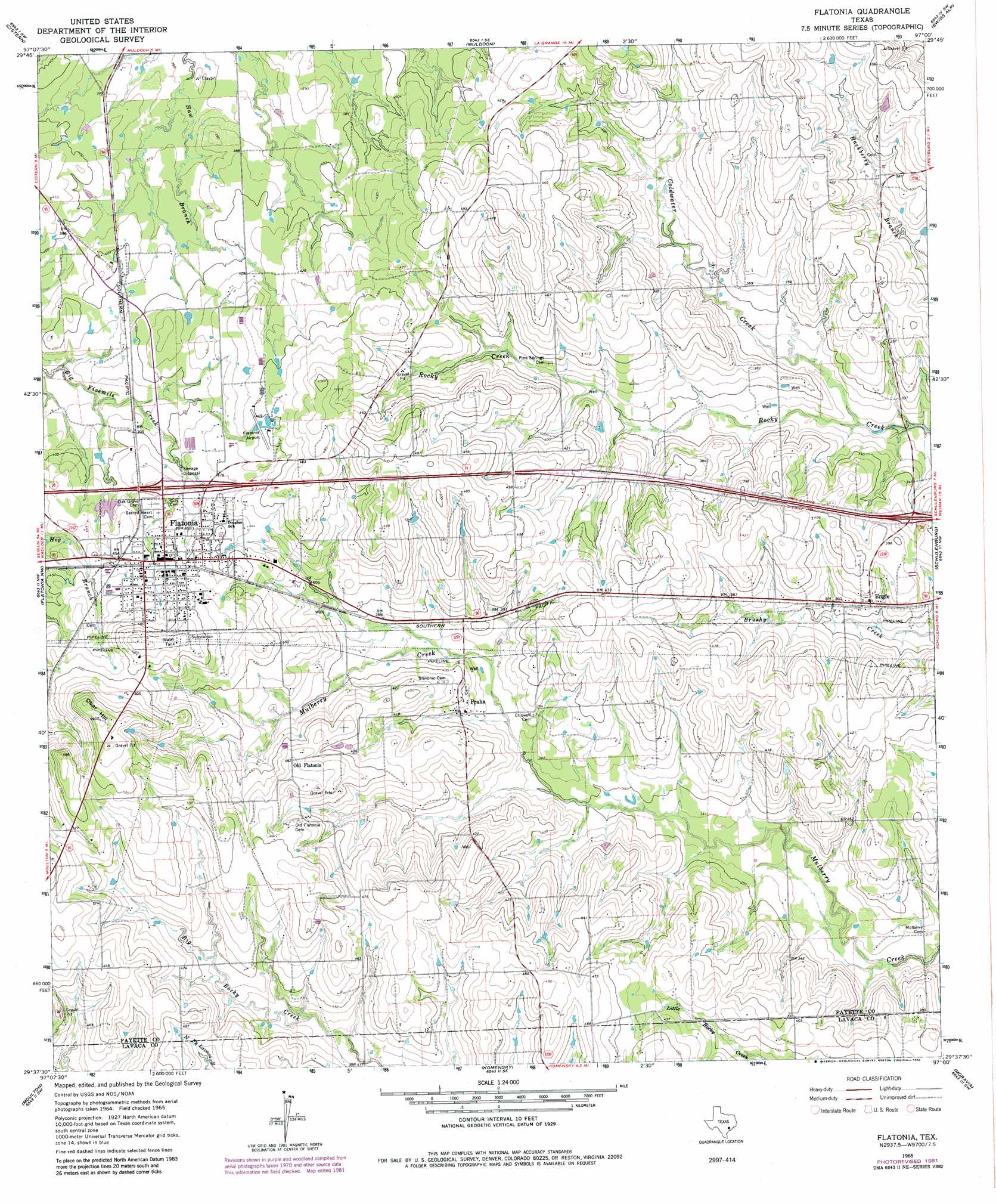
USGS Topo Quad 29097f1 - 1:24,000 scale
| Topo Map Name: | Flatonia |
| USGS Topo Quad ID: | 29097f1 |
| Print Size: | ca. 21 1/4" wide x 27" high |
| Southeast Coordinates: | 29.625° N latitude / 97° W longitude |
| Map Center Coordinates: | 29.6875° N latitude / 97.0625° W longitude |
| U.S. State: | TX |
| Filename: | o29097f1.jpg |
| Download Map JPG Image: | Flatonia topo map 1:24,000 scale |
| Map Type: | Topographic |
| Topo Series: | 7.5´ |
| Map Scale: | 1:24,000 |
| Source of Map Images: | United States Geological Survey (USGS) |
| Alternate Map Versions: |
Flatonia TX 1965, updated 1967 Download PDF Buy paper map Flatonia TX 1965, updated 1982 Download PDF Buy paper map Flatonia TX 2010 Download PDF Buy paper map Flatonia TX 2013 Download PDF Buy paper map Flatonia TX 2016 Download PDF Buy paper map |
1:24,000 Topo Quads surrounding Flatonia
Rosanky |
Togo |
West Point |
La Grange West |
La Grange East |
Jeddo |
Cistern |
Muldoon |
Swiss Alp |
Ammannsville |
Waelder |
Flatonia Nw |
Flatonia |
Schulenburg |
Weimar |
Dilworth |
Moulton |
Komensky |
Moravia |
Oakland |
Hamon |
Shiner |
Wied |
Hallettsville |
Sublime |
> Back to 29097e1 at 1:100,000 scale
> Back to 29096a1 at 1:250,000 scale
> Back to U.S. Topo Maps home
Flatonia topo map: Gazetteer
Flatonia: Dams
Ring Lake Dam elevation 127m 416′Flatonia: Populated Places
Engle elevation 113m 370′Flatonia elevation 139m 456′
Old Flatonia elevation 147m 482′
Praha elevation 116m 380′
Flatonia: Reservoirs
Ring Lake elevation 127m 416′Flatonia: Streams
Coldwater Creek elevation 94m 308′Flatonia: Summits
Obar Hill elevation 181m 593′Flatonia digital topo map on disk
Buy this Flatonia topo map showing relief, roads, GPS coordinates and other geographical features, as a high-resolution digital map file on DVD: