Dale Topo Map Texas
To zoom in, hover over the map of Dale
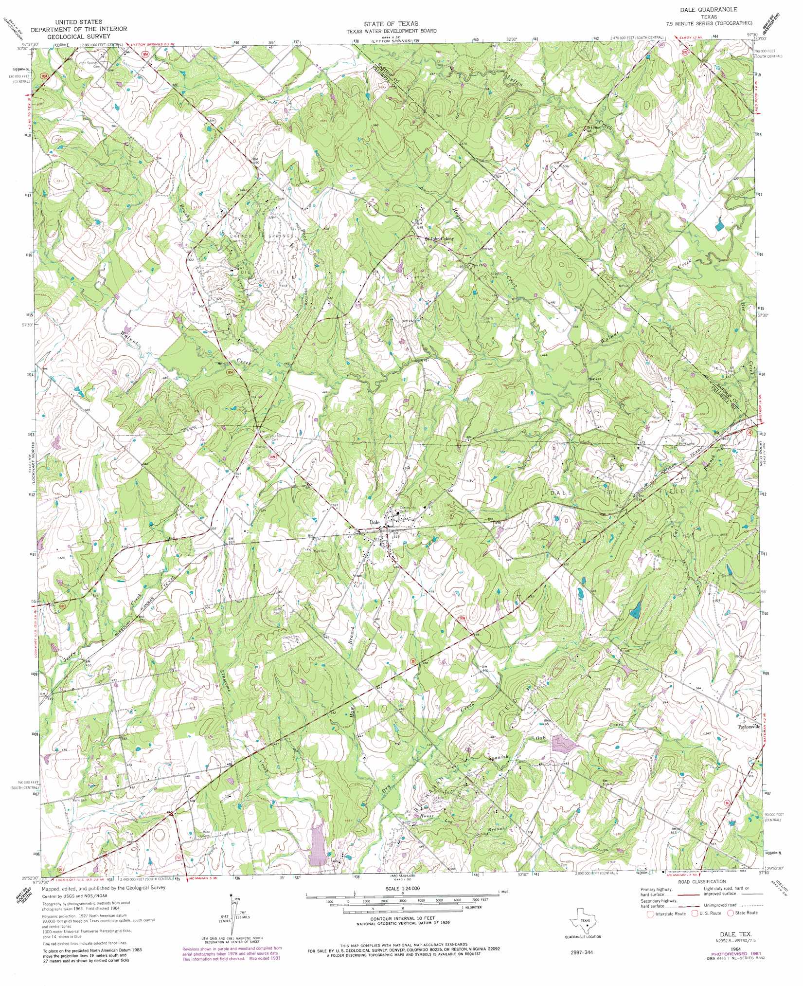
USGS Topo Quad 29097h5 - 1:24,000 scale
| Topo Map Name: | Dale |
| USGS Topo Quad ID: | 29097h5 |
| Print Size: | ca. 21 1/4" wide x 27" high |
| Southeast Coordinates: | 29.875° N latitude / 97.5° W longitude |
| Map Center Coordinates: | 29.9375° N latitude / 97.5625° W longitude |
| U.S. State: | TX |
| Filename: | o29097h5.jpg |
| Download Map JPG Image: | Dale topo map 1:24,000 scale |
| Map Type: | Topographic |
| Topo Series: | 7.5´ |
| Map Scale: | 1:24,000 |
| Source of Map Images: | United States Geological Survey (USGS) |
| Alternate Map Versions: |
Dale TX 1964, updated 1966 Download PDF Buy paper map Dale TX 1964, updated 1975 Download PDF Buy paper map Dale TX 1964, updated 1982 Download PDF Buy paper map Dale TX 2010 Download PDF Buy paper map Dale TX 2013 Download PDF Buy paper map Dale TX 2016 Download PDF Buy paper map |
1:24,000 Topo Quads surrounding Dale
Oak Hill |
Montopolis |
Webberville |
Utley |
Lake Bastrop |
Buda |
Creedmoor |
Lytton Springs |
Bastrop Sw |
Bastrap |
Uhland |
Lockhart North |
Dale |
Red Rock |
Rosanky |
Martindale |
Lockhart South |
Mcmahan |
Delhi |
Jeddo |
Kingsbury |
Luling |
Harwood |
Sandy Fork |
Waelder |
> Back to 29097e1 at 1:100,000 scale
> Back to 29096a1 at 1:250,000 scale
> Back to U.S. Topo Maps home
Dale topo map: Gazetteer
Dale: Dams
Soil Conservation Service Site 24 Dam elevation 144m 472′Soil Conservation Service Site 26 Dam elevation 130m 426′
Dale: Oilfields
Buchanan Oil Field elevation 149m 488′Dale Oil Field elevation 153m 501′
Lytton Springs Oil Field elevation 155m 508′
Dale: Populated Places
Dale elevation 159m 521′Saint Johns Colony elevation 166m 544′
Dale: Reservoirs
Soil Conservation Service Site 24 Reservoir elevation 144m 472′Soil Conservation Service Site 26 Reservoir elevation 130m 426′
Dale: Streams
Bee Creek elevation 122m 400′Brushy Creek elevation 140m 459′
Cat Branch elevation 168m 551′
Haggai Creek elevation 131m 429′
Haw Branch elevation 129m 423′
House Log Branch elevation 128m 419′
Lytton Creek elevation 122m 400′
Spanish Oak Creek elevation 131m 429′
Dale: Valleys
Pool Hollow elevation 141m 462′Dale digital topo map on disk
Buy this Dale topo map showing relief, roads, GPS coordinates and other geographical features, as a high-resolution digital map file on DVD: