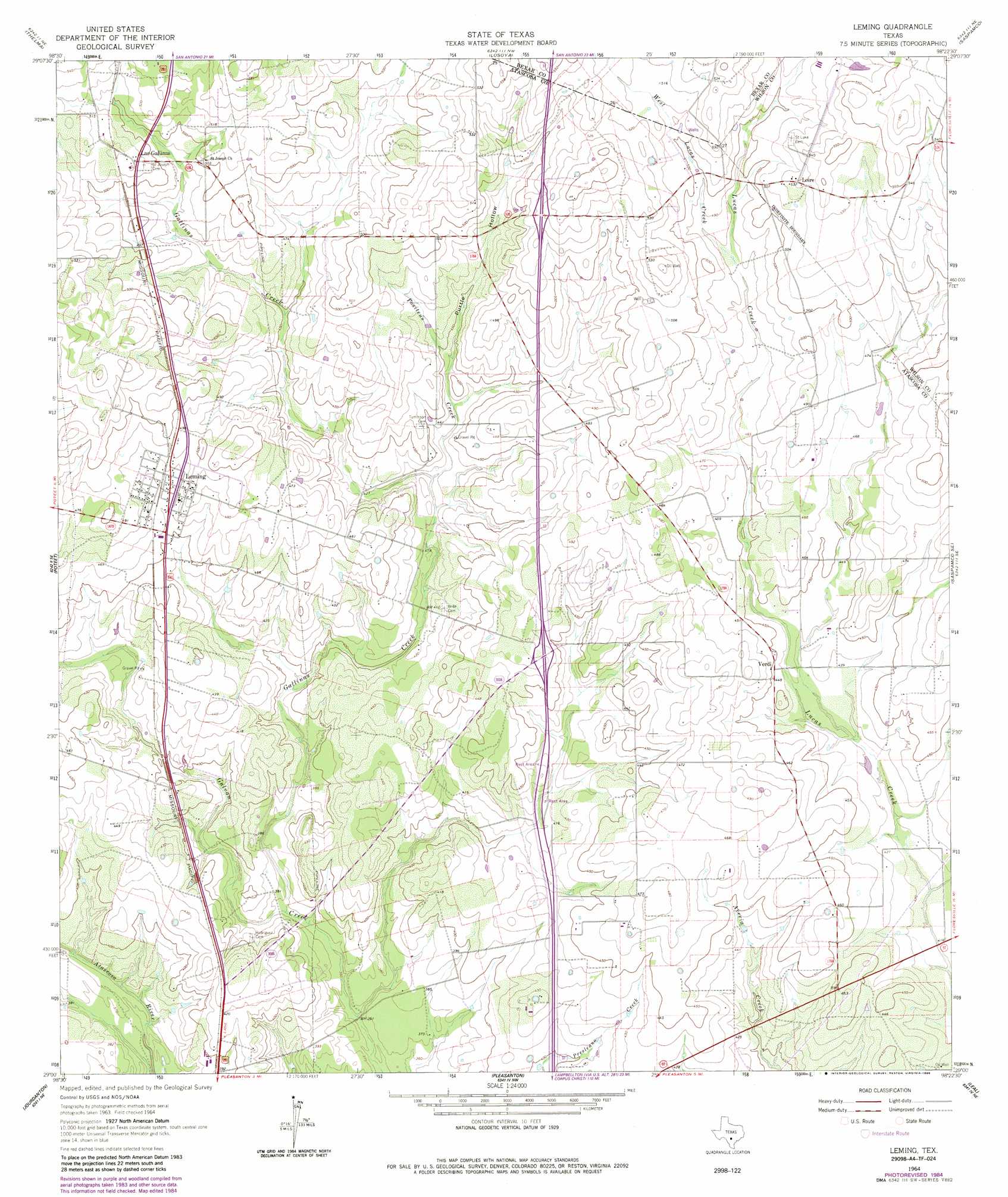
Leming Topo Map Texas
To zoom in, hover over the map of Leming
USGS Topo Quad 29098a4 - 1:24,000 scale
| Topo Map Name: | Leming |
| USGS Topo Quad ID: | 29098a4 |
| Print Size: | ca. 21 1/4" wide x 27" high |
| Southeast Coordinates: | 29° N latitude / 98.375° W longitude |
| Map Center Coordinates: | 29.0625° N latitude / 98.4375° W longitude |
| U.S. State: | TX |
| Filename: | o29098a4.jpg |
| Download Map JPG Image: | Leming topo map 1:24,000 scale |
| Map Type: | Topographic |
| Topo Series: | 7.5´ |
| Map Scale: | 1:24,000 |
| Source of Map Images: | United States Geological Survey (USGS) |
| Alternate Map Versions: |
Leming TX 1964, updated 1966 Download PDF Buy paper map Leming TX 1964, updated 1986 Download PDF Buy paper map Leming TX 2010 Download PDF Buy paper map Leming TX 2013 Download PDF Buy paper map Leming TX 2016 Download PDF Buy paper map |
1:24,000 Topo Quads surrounding Leming
Macdona |
Terrell Wells |
Southton |
Elmendorf |
La Vernia Sw |
Somerset |
Thelma |
Losoya |
Saspamco |
Floresville |
Rossville |
Poteet |
Leming |
Saspamco Se |
Dewees |
Dobrowolski |
Jourdanton |
Pleasanton |
Leal |
Three Oaks |
Charlotte |
Christine West |
Christine East |
Mccoy |
Fashing |
> Back to 29098a1 at 1:100,000 scale
> Back to 29098a1 at 1:250,000 scale
> Back to U.S. Topo Maps home
Leming topo map: Gazetteer
Leming: Airports
Longs Farm Airport elevation 139m 456′Ten Oaks Airport elevation 151m 495′
Leming: Populated Places
Espey elevation 157m 515′Las Gallinas elevation 157m 515′
Leming elevation 144m 472′
Loire elevation 162m 531′
Verdi elevation 135m 442′
Leming: Streams
Gallinas Creek elevation 112m 367′Positeus Creek elevation 132m 433′
West Lucas Creek elevation 146m 479′
Leming: Valleys
Purtle Hollow elevation 141m 462′Leming digital topo map on disk
Buy this Leming topo map showing relief, roads, GPS coordinates and other geographical features, as a high-resolution digital map file on DVD: