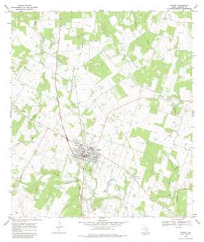
Poteet Topo Map Texas
To zoom in, hover over the map of Poteet
USGS Topo Quad 29098a5 - 1:24,000 scale
| Topo Map Name: | Poteet |
| USGS Topo Quad ID: | 29098a5 |
| Print Size: | ca. 21 1/4" wide x 27" high |
| Southeast Coordinates: | 29° N latitude / 98.5° W longitude |
| Map Center Coordinates: | 29.0625° N latitude / 98.5625° W longitude |
| U.S. State: | TX |
| Filename: | o29098a5.jpg |
| Download Map JPG Image: | Poteet topo map 1:24,000 scale |
| Map Type: | Topographic |
| Topo Series: | 7.5´ |
| Map Scale: | 1:24,000 |
| Source of Map Images: | United States Geological Survey (USGS) |
| Alternate Map Versions: |
Poteet TX 1968, updated 1971 Download PDF Buy paper map Poteet TX 1968, updated 1981 Download PDF Buy paper map Poteet TX 2010 Download PDF Buy paper map Poteet TX 2013 Download PDF Buy paper map Poteet TX 2016 Download PDF Buy paper map |
1:24,000 Topo Quads surrounding Poteet
> Back to 29098a1 at 1:100,000 scale
> Back to 29098a1 at 1:250,000 scale
> Back to U.S. Topo Maps home
Poteet topo map: Gazetteer
Poteet: Airports
Maurice Dauwe Farm Airport elevation 140m 459′Poteet: Populated Places
Poteet elevation 136m 446′Poteet: Streams
Agua Negra Creek elevation 142m 465′Elm Creek elevation 110m 360′
Poteet: Valleys
Rutledge Hollow elevation 122m 400′Poteet digital topo map on disk
Buy this Poteet topo map showing relief, roads, GPS coordinates and other geographical features, as a high-resolution digital map file on DVD:


