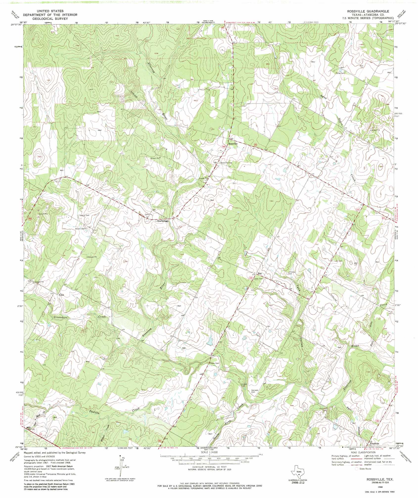
Rossville Topo Map Texas
To zoom in, hover over the map of Rossville
USGS Topo Quad 29098a6 - 1:24,000 scale
| Topo Map Name: | Rossville |
| USGS Topo Quad ID: | 29098a6 |
| Print Size: | ca. 21 1/4" wide x 27" high |
| Southeast Coordinates: | 29° N latitude / 98.625° W longitude |
| Map Center Coordinates: | 29.0625° N latitude / 98.6875° W longitude |
| U.S. State: | TX |
| Filename: | o29098a6.jpg |
| Download Map JPG Image: | Rossville topo map 1:24,000 scale |
| Map Type: | Topographic |
| Topo Series: | 7.5´ |
| Map Scale: | 1:24,000 |
| Source of Map Images: | United States Geological Survey (USGS) |
| Alternate Map Versions: |
Rossville TX 1968, updated 1971 Download PDF Buy paper map Rossville TX 1968, updated 1984 Download PDF Buy paper map Rossville TX 2010 Download PDF Buy paper map Rossville TX 2013 Download PDF Buy paper map Rossville TX 2016 Download PDF Buy paper map |
1:24,000 Topo Quads surrounding Rossville
Castroville |
Lacoste |
Macdona |
Terrell Wells |
Southton |
Devine |
Lytle |
Somerset |
Thelma |
Losoya |
Ghost Hill |
Bigfoot |
Rossville |
Poteet |
Leming |
Schattel Nw |
Schattel |
Dobrowolski |
Jourdanton |
Pleasanton |
Keystone Ranch |
Goldfinch |
Charlotte |
Christine West |
Christine East |
> Back to 29098a1 at 1:100,000 scale
> Back to 29098a1 at 1:250,000 scale
> Back to U.S. Topo Maps home
Rossville topo map: Gazetteer
Rossville: Populated Places
Anchorage elevation 167m 547′Iuka elevation 157m 515′
Rossville elevation 171m 561′
Rossville: Streams
Mile and a Half Creek elevation 152m 498′Padilla Creek elevation 137m 449′
Palo Alto Creek elevation 128m 419′
Santa Anna Creek elevation 134m 439′
Siestedero Creek elevation 140m 459′
Willow Creek elevation 146m 479′
Rossville: Valleys
Fern Hollow elevation 129m 423′Tank Hollow elevation 131m 429′
Rossville digital topo map on disk
Buy this Rossville topo map showing relief, roads, GPS coordinates and other geographical features, as a high-resolution digital map file on DVD: