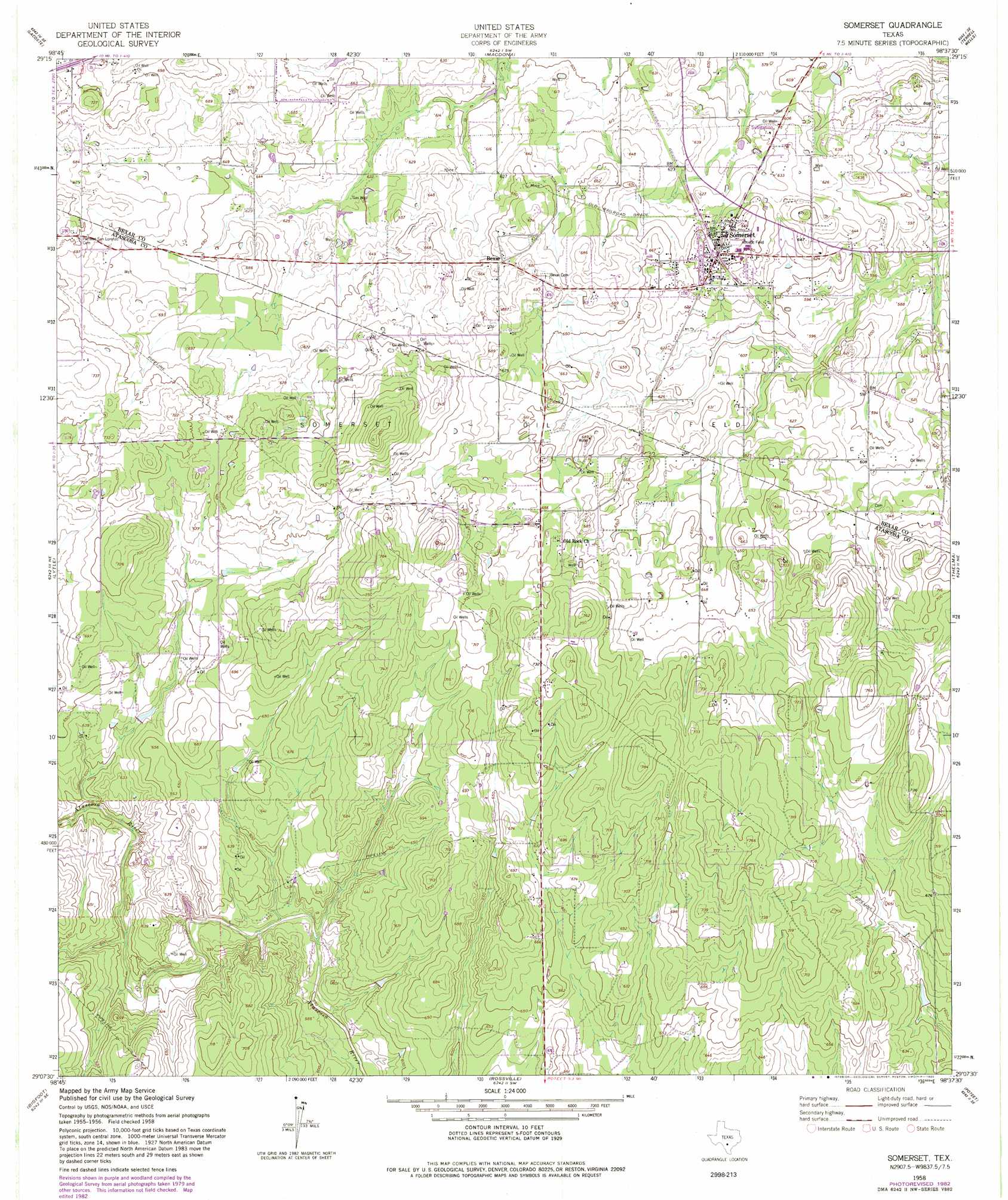
Somerset Topo Map Texas
To zoom in, hover over the map of Somerset
USGS Topo Quad 29098b6 - 1:24,000 scale
| Topo Map Name: | Somerset |
| USGS Topo Quad ID: | 29098b6 |
| Print Size: | ca. 21 1/4" wide x 27" high |
| Southeast Coordinates: | 29.125° N latitude / 98.625° W longitude |
| Map Center Coordinates: | 29.1875° N latitude / 98.6875° W longitude |
| U.S. State: | TX |
| Filename: | o29098b6.jpg |
| Download Map JPG Image: | Somerset topo map 1:24,000 scale |
| Map Type: | Topographic |
| Topo Series: | 7.5´ |
| Map Scale: | 1:24,000 |
| Source of Map Images: | United States Geological Survey (USGS) |
| Alternate Map Versions: |
Somerset TX 1958, updated 1961 Download PDF Buy paper map Somerset TX 1958, updated 1975 Download PDF Buy paper map Somerset TX 1958, updated 1982 Download PDF Buy paper map Somerset TX 2010 Download PDF Buy paper map Somerset TX 2013 Download PDF Buy paper map Somerset TX 2016 Download PDF Buy paper map |
1:24,000 Topo Quads surrounding Somerset
Riomedina |
Lacoste Ne |
Culebra Hill |
San Antonio West |
San Antonio East |
Castroville |
Lacoste |
Macdona |
Terrell Wells |
Southton |
Devine |
Lytle |
Somerset |
Thelma |
Losoya |
Ghost Hill |
Bigfoot |
Rossville |
Poteet |
Leming |
Schattel Nw |
Schattel |
Dobrowolski |
Jourdanton |
Pleasanton |
> Back to 29098a1 at 1:100,000 scale
> Back to 29098a1 at 1:250,000 scale
> Back to U.S. Topo Maps home
Somerset topo map: Gazetteer
Somerset: Oilfields
Somerset Oil Field elevation 203m 666′Somerset: Parks
Somerset Stadium elevation 200m 656′Somerset: Populated Places
Bexar elevation 200m 656′Somerset elevation 197m 646′
Somerset digital topo map on disk
Buy this Somerset topo map showing relief, roads, GPS coordinates and other geographical features, as a high-resolution digital map file on DVD: