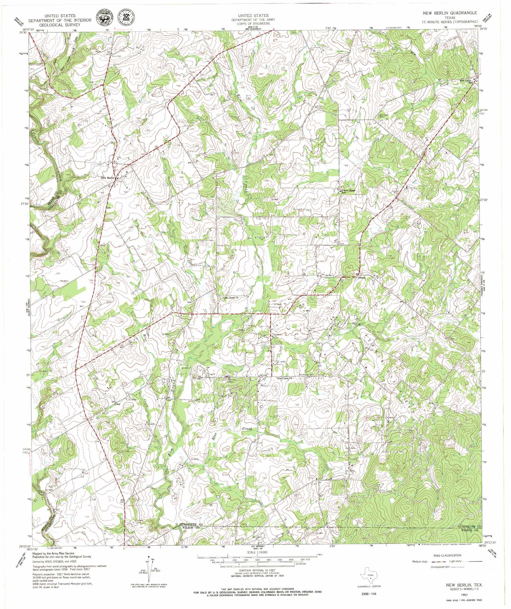
New Berlin Topo Map Texas
To zoom in, hover over the map of New Berlin
USGS Topo Quad 29098d1 - 1:24,000 scale
| Topo Map Name: | New Berlin |
| USGS Topo Quad ID: | 29098d1 |
| Print Size: | ca. 21 1/4" wide x 27" high |
| Southeast Coordinates: | 29.375° N latitude / 98° W longitude |
| Map Center Coordinates: | 29.4375° N latitude / 98.0625° W longitude |
| U.S. State: | TX |
| Filename: | o29098d1.jpg |
| Download Map JPG Image: | New Berlin topo map 1:24,000 scale |
| Map Type: | Topographic |
| Topo Series: | 7.5´ |
| Map Scale: | 1:24,000 |
| Source of Map Images: | United States Geological Survey (USGS) |
| Alternate Map Versions: |
New Berlin TX 1957, updated 1961 Download PDF Buy paper map New Berlin TX 1957, updated 1979 Download PDF Buy paper map New Berlin TX 2010 Download PDF Buy paper map New Berlin TX 2013 Download PDF Buy paper map New Berlin TX 2016 Download PDF Buy paper map |
1:24,000 Topo Quads surrounding New Berlin
Bat Cave |
New Braunfels West |
New Braunfels East |
Geronimo |
Kingsbury |
Schertz |
Marion |
Mcqueeney |
Seguin |
Darst Creek |
Martinez |
Saint Hedwig |
New Berlin |
Thomas Springs |
Dewville |
Elmendorf |
La Vernia Sw |
La Vernia |
Alum |
Nixon |
Saspamco |
Floresville |
Marcelinas Hills |
Stockdale |
Gillett |
> Back to 29098a1 at 1:100,000 scale
> Back to 29098a1 at 1:250,000 scale
> Back to U.S. Topo Maps home
New Berlin topo map: Gazetteer
New Berlin: Oilfields
La Vernia Oil Field elevation 165m 541′New Berlin: Populated Places
New Berlin elevation 174m 570′Olmos elevation 167m 547′
Sweet Home elevation 170m 557′
New Berlin: Streams
Blue Creek elevation 140m 459′Dry Santa Clara Creek elevation 164m 538′
New Berlin digital topo map on disk
Buy this New Berlin topo map showing relief, roads, GPS coordinates and other geographical features, as a high-resolution digital map file on DVD: