Hunter Topo Map Texas
To zoom in, hover over the map of Hunter
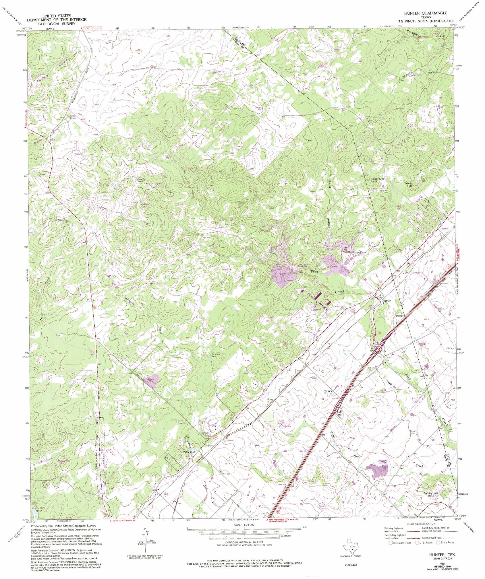
USGS Topo Quad 29098g1 - 1:24,000 scale
| Topo Map Name: | Hunter |
| USGS Topo Quad ID: | 29098g1 |
| Print Size: | ca. 21 1/4" wide x 27" high |
| Southeast Coordinates: | 29.75° N latitude / 98° W longitude |
| Map Center Coordinates: | 29.8125° N latitude / 98.0625° W longitude |
| U.S. State: | TX |
| Filename: | o29098g1.jpg |
| Download Map JPG Image: | Hunter topo map 1:24,000 scale |
| Map Type: | Topographic |
| Topo Series: | 7.5´ |
| Map Scale: | 1:24,000 |
| Source of Map Images: | United States Geological Survey (USGS) |
| Alternate Map Versions: |
Hunter TX 1964, updated 1965 Download PDF Buy paper map Hunter TX 1964, updated 1974 Download PDF Buy paper map Hunter TX 1964, updated 1975 Download PDF Buy paper map Hunter TX 1964, updated 1994 Download PDF Buy paper map Hunter TX 1964, updated 1994 Download PDF Buy paper map Hunter TX 2010 Download PDF Buy paper map Hunter TX 2013 Download PDF Buy paper map Hunter TX 2016 Download PDF Buy paper map |
1:24,000 Topo Quads surrounding Hunter
Payton |
Rough Hollow |
Driftwood |
Mountain City |
Buda |
Fischer |
Devils Backbone |
Wimberley |
San Marcos North |
Uhland |
Smithson Valley |
Sattler |
Hunter |
San Marcos South |
Martindale |
Bat Cave |
New Braunfels West |
New Braunfels East |
Geronimo |
Kingsbury |
Schertz |
Marion |
Mcqueeney |
Seguin |
Darst Creek |
> Back to 29098e1 at 1:100,000 scale
> Back to 29098a1 at 1:250,000 scale
> Back to U.S. Topo Maps home
Hunter topo map: Gazetteer
Hunter: Dams
Soil Conservation Service Site 1 Dam elevation 225m 738′Soil Conservation Service Site 2 Dam elevation 219m 718′
Soil Conservation Service Site 3 Dam elevation 179m 587′
Hunter: Populated Places
Hunter elevation 191m 626′Royal Forest elevation 309m 1013′
Hunter: Reservoirs
Haley Tank elevation 212m 695′Soil Conservation Service Site 1 Reservoir elevation 225m 738′
Soil Conservation Service Site 2 Reservoir elevation 219m 718′
Soil Conservation Service Site 3 Reservoir elevation 179m 587′
Hunter: Streams
Caney Creek elevation 171m 561′Hunter: Summits
Bading Hill elevation 203m 666′Coal Kiln Hill elevation 281m 921′
Nail Hill elevation 215m 705′
Trunk Hill elevation 263m 862′
Hunter: Valleys
Bullhead Hollow elevation 197m 646′Hunter digital topo map on disk
Buy this Hunter topo map showing relief, roads, GPS coordinates and other geographical features, as a high-resolution digital map file on DVD: