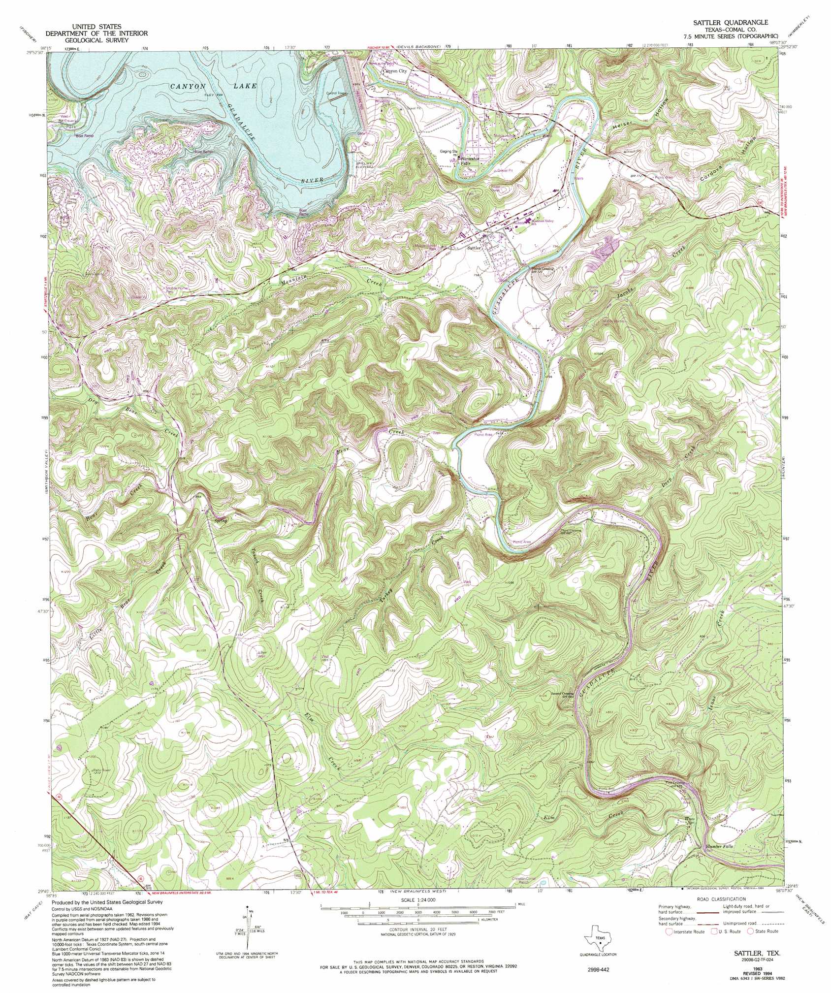
Sattler Topo Map Texas
To zoom in, hover over the map of Sattler
USGS Topo Quad 29098g2 - 1:24,000 scale
| Topo Map Name: | Sattler |
| USGS Topo Quad ID: | 29098g2 |
| Print Size: | ca. 21 1/4" wide x 27" high |
| Southeast Coordinates: | 29.75° N latitude / 98.125° W longitude |
| Map Center Coordinates: | 29.8125° N latitude / 98.1875° W longitude |
| U.S. State: | TX |
| Filename: | o29098g2.jpg |
| Download Map JPG Image: | Sattler topo map 1:24,000 scale |
| Map Type: | Topographic |
| Topo Series: | 7.5´ |
| Map Scale: | 1:24,000 |
| Source of Map Images: | United States Geological Survey (USGS) |
| Alternate Map Versions: |
Sattler TX 1963, updated 1965 Download PDF Buy paper map Sattler TX 1963, updated 1975 Download PDF Buy paper map Sattler TX 1963, updated 1984 Download PDF Buy paper map Sattler TX 1963, updated 1994 Download PDF Buy paper map Sattler TX 2010 Download PDF Buy paper map Sattler TX 2013 Download PDF Buy paper map Sattler TX 2016 Download PDF Buy paper map |
1:24,000 Topo Quads surrounding Sattler
Blanco |
Payton |
Rough Hollow |
Driftwood |
Mountain City |
Spring Branch |
Fischer |
Devils Backbone |
Wimberley |
San Marcos North |
Anhalt |
Smithson Valley |
Sattler |
Hunter |
San Marcos South |
Bulverde |
Bat Cave |
New Braunfels West |
New Braunfels East |
Geronimo |
Longhorn |
Schertz |
Marion |
Mcqueeney |
Seguin |
> Back to 29098e1 at 1:100,000 scale
> Back to 29098a1 at 1:250,000 scale
> Back to U.S. Topo Maps home
Sattler topo map: Gazetteer
Sattler: Dams
Canyon Dam elevation 277m 908′Sattler: Falls
Horseshoe Falls elevation 233m 764′Slumber Falls elevation 194m 636′
Sattler: Parks
Comal Park elevation 300m 984′North Park elevation 300m 984′
Overlook Park elevation 293m 961′
Sattler: Populated Places
Buffalo Springs (historical) elevation 214m 702′Canyon City elevation 258m 846′
First Crossing elevation 195m 639′
Fourth Crossing elevation 219m 718′
Sattler elevation 239m 784′
Second Crossing elevation 203m 666′
Third Crossing elevation 212m 695′
Sattler: Post Offices
Canyon Lake Post Office elevation 242m 793′Sattler: Reservoirs
Canyon Lake elevation 280m 918′Sattler: Springs
Bear Springs elevation 262m 859′Hueco Springs elevation 199m 652′
Waco Spring elevation 198m 649′
Sattler: Streams
Bear Creek elevation 214m 702′Deep Creek elevation 209m 685′
Dry Bear Creek elevation 270m 885′
Elm Creek elevation 195m 639′
Isaac Creek elevation 203m 666′
Jacobs Creek elevation 222m 728′
Little Bear Creek elevation 261m 856′
Mountain Creek elevation 219m 718′
Tausch Creek elevation 245m 803′
Turkey Creek elevation 213m 698′
Sattler: Trails
Guadalupe Park Trail elevation 247m 810′Sattler: Valleys
Cordova Hollow elevation 227m 744′Heiser Hollow elevation 225m 738′
Sattler digital topo map on disk
Buy this Sattler topo map showing relief, roads, GPS coordinates and other geographical features, as a high-resolution digital map file on DVD: