Turkey Knob Topo Map Texas
To zoom in, hover over the map of Turkey Knob
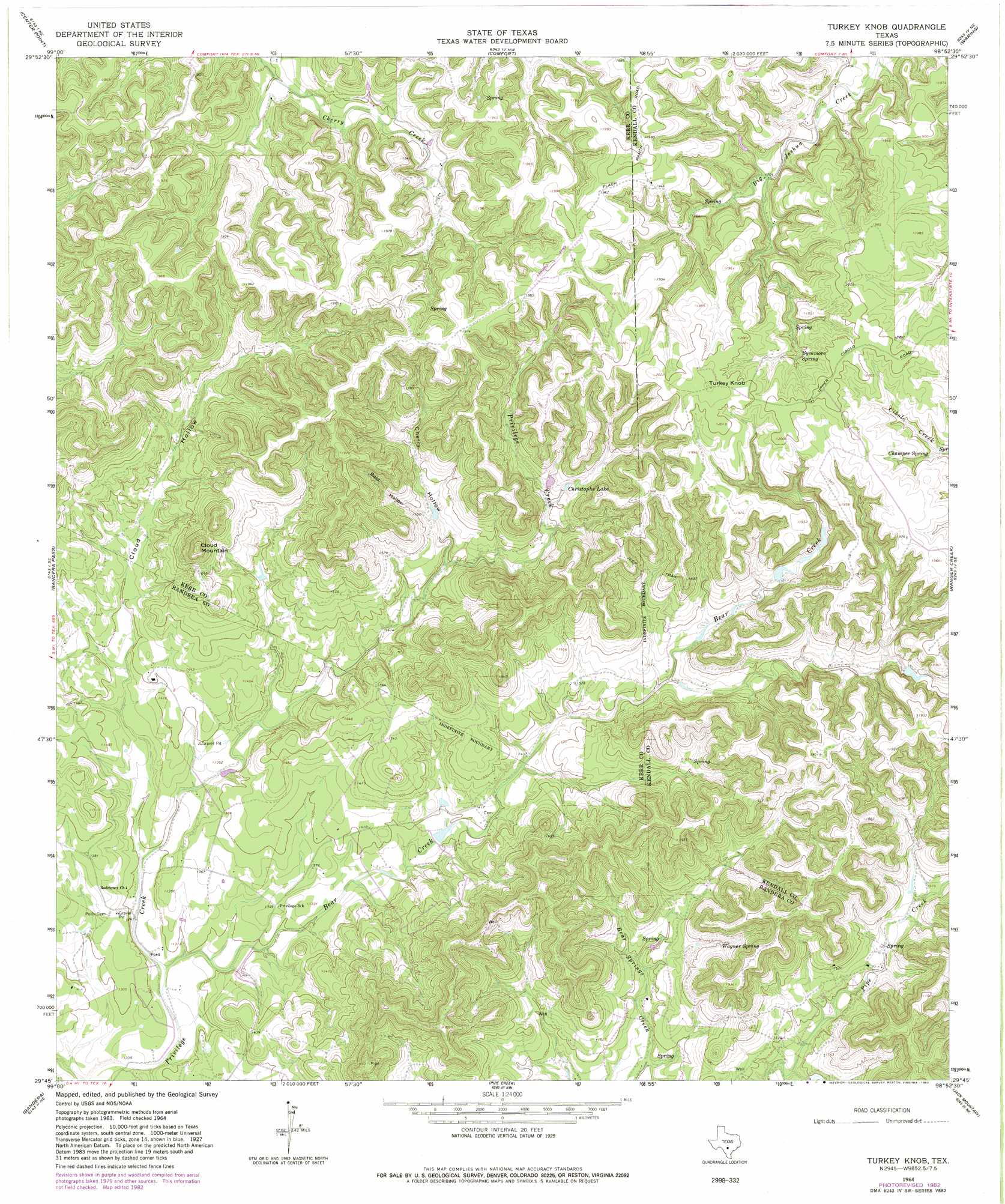
USGS Topo Quad 29098g8 - 1:24,000 scale
| Topo Map Name: | Turkey Knob |
| USGS Topo Quad ID: | 29098g8 |
| Print Size: | ca. 21 1/4" wide x 27" high |
| Southeast Coordinates: | 29.75° N latitude / 98.875° W longitude |
| Map Center Coordinates: | 29.8125° N latitude / 98.9375° W longitude |
| U.S. State: | TX |
| Filename: | o29098g8.jpg |
| Download Map JPG Image: | Turkey Knob topo map 1:24,000 scale |
| Map Type: | Topographic |
| Topo Series: | 7.5´ |
| Map Scale: | 1:24,000 |
| Source of Map Images: | United States Geological Survey (USGS) |
| Alternate Map Versions: |
Turkey Knob TX 1964, updated 1968 Download PDF Buy paper map Turkey Knob TX 1964, updated 1982 Download PDF Buy paper map Turkey Knob TX 2010 Download PDF Buy paper map Turkey Knob TX 2013 Download PDF Buy paper map Turkey Knob TX 2016 Download PDF Buy paper map |
1:24,000 Topo Quads surrounding Turkey Knob
Kerrville |
Legion |
Cypress Creek |
Rafter Hollow |
Whitworth Ranch |
Fall Creek |
Center Point |
Comfort |
Waring |
Sisterdale |
Rock Cliff Reservoir |
Bandera Pass |
Turkey Knob |
Ranger Creek |
Boerne |
Tarpley Pass |
Bandera |
Pipe Creek |
Jack Mountain |
Van Raub |
Twin Hollow |
Timber Creek |
Medina Lake |
San Geronimo |
Helotes |
> Back to 29098e1 at 1:100,000 scale
> Back to 29098a1 at 1:250,000 scale
> Back to U.S. Topo Maps home
Turkey Knob topo map: Gazetteer
Turkey Knob: Dams
Berry Lake Dam elevation 403m 1322′Castle Lake Dam elevation 418m 1371′
Youngblood Lake Dam elevation 418m 1371′
Turkey Knob: Parks
Bear Springs Blossom Nature Preserve elevation 557m 1827′Turkey Knob: Reservoirs
Berry Lake elevation 403m 1322′Castle Lake elevation 418m 1371′
Christophs Lake elevation 492m 1614′
Youngblood Lake elevation 418m 1371′
Turkey Knob: Springs
Brown Spring elevation 572m 1876′Champee Spring elevation 568m 1863′
Sycamore Spring elevation 571m 1873′
Wagner Spring elevation 485m 1591′
Turkey Knob: Streams
Bear Creek elevation 381m 1250′Turkey Knob: Summits
Cloud Mountain elevation 586m 1922′Turkey Knob elevation 623m 2043′
Turkey Knob: Valleys
Bald Hollow elevation 465m 1525′Cherry Hollow elevation 444m 1456′
Cloud Hollow elevation 390m 1279′
Turkey Knob digital topo map on disk
Buy this Turkey Knob topo map showing relief, roads, GPS coordinates and other geographical features, as a high-resolution digital map file on DVD: