Lone Tree Hill Topo Map Texas
To zoom in, hover over the map of Lone Tree Hill
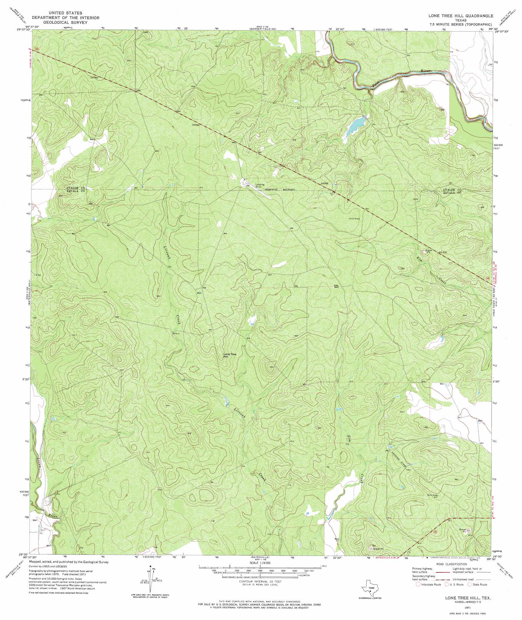
USGS Topo Quad 29099a5 - 1:24,000 scale
| Topo Map Name: | Lone Tree Hill |
| USGS Topo Quad ID: | 29099a5 |
| Print Size: | ca. 21 1/4" wide x 27" high |
| Southeast Coordinates: | 29° N latitude / 99.5° W longitude |
| Map Center Coordinates: | 29.0625° N latitude / 99.5625° W longitude |
| U.S. State: | TX |
| Filename: | o29099a5.jpg |
| Download Map JPG Image: | Lone Tree Hill topo map 1:24,000 scale |
| Map Type: | Topographic |
| Topo Series: | 7.5´ |
| Map Scale: | 1:24,000 |
| Source of Map Images: | United States Geological Survey (USGS) |
| Alternate Map Versions: |
Lone Tree Hill TX 1971, updated 1974 Download PDF Buy paper map Lone Tree Hill TX 2010 Download PDF Buy paper map Lone Tree Hill TX 2012 Download PDF Buy paper map Lone Tree Hill TX 2016 Download PDF Buy paper map |
1:24,000 Topo Quads surrounding Lone Tree Hill
Sevenmile Hill |
Knippa |
Blanco Lake |
Sabinal |
D'Hanis |
Uvalde |
Garner Field |
Garner Field Ne |
Irishman Hill |
Frio Town Ne |
Pulliam Ranch |
Batesville Hill |
Lone Tree Hill |
Gross Tank |
Frio Town |
La Pryor |
Batesville Nw |
Batesville |
Johnnie Little Hill |
Holcomb Reservoir |
La Pryor Se |
Batesville Sw |
Loma Vista |
West Ranch |
Divot |
> Back to 29099a1 at 1:100,000 scale
> Back to 29098a1 at 1:250,000 scale
> Back to U.S. Topo Maps home
Lone Tree Hill topo map: Gazetteer
Lone Tree Hill: Airports
R and J Livestock Company Airport elevation 241m 790′Lone Tree Hill: Dams
Garwood Lake Dam elevation 238m 780′Lone Tree Hill: Reservoirs
Garwood Lake elevation 238m 780′Lone Tree Hill: Streams
Camp Lake Slough elevation 222m 728′Lone Tree Hill: Summits
Lone Tree Hill elevation 264m 866′Lone Tree Hill digital topo map on disk
Buy this Lone Tree Hill topo map showing relief, roads, GPS coordinates and other geographical features, as a high-resolution digital map file on DVD: