Sevenmile Hill Topo Map Texas
To zoom in, hover over the map of Sevenmile Hill
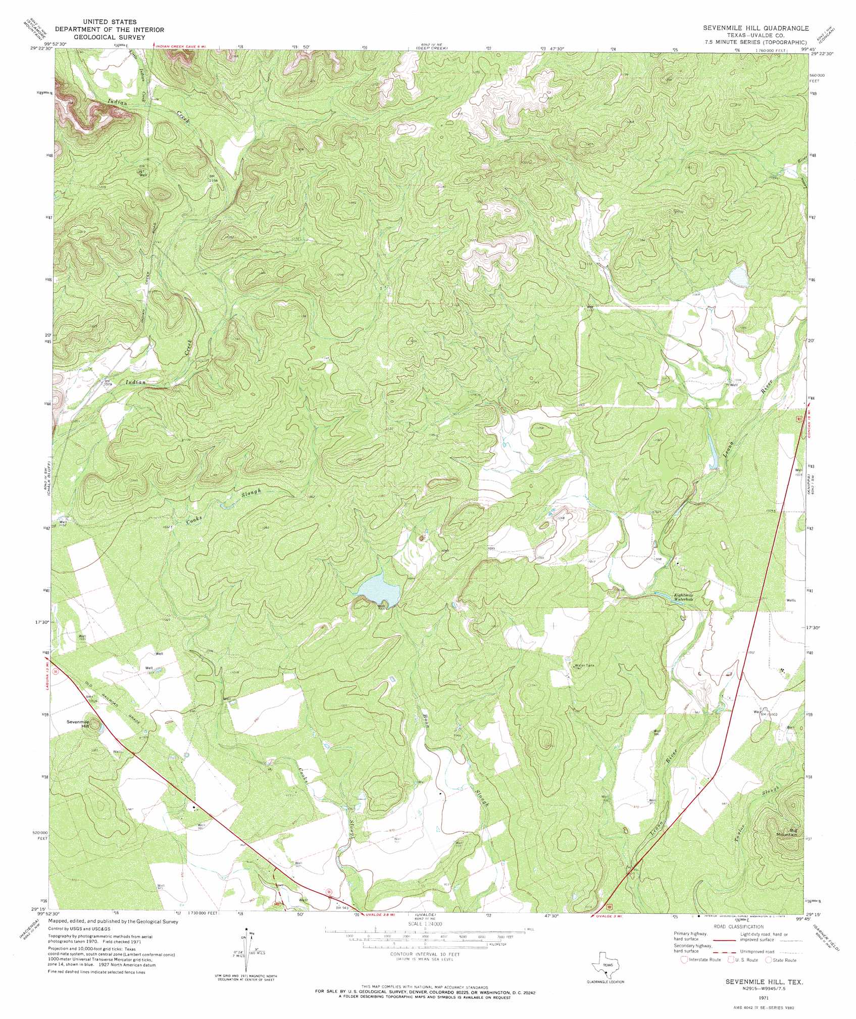
USGS Topo Quad 29099c7 - 1:24,000 scale
| Topo Map Name: | Sevenmile Hill |
| USGS Topo Quad ID: | 29099c7 |
| Print Size: | ca. 21 1/4" wide x 27" high |
| Southeast Coordinates: | 29.25° N latitude / 99.75° W longitude |
| Map Center Coordinates: | 29.3125° N latitude / 99.8125° W longitude |
| U.S. State: | TX |
| Filename: | o29099c7.jpg |
| Download Map JPG Image: | Sevenmile Hill topo map 1:24,000 scale |
| Map Type: | Topographic |
| Topo Series: | 7.5´ |
| Map Scale: | 1:24,000 |
| Source of Map Images: | United States Geological Survey (USGS) |
| Alternate Map Versions: |
Sevenmile Hill TX 1971, updated 1973 Download PDF Buy paper map Sevenmile Hill TX 2010 Download PDF Buy paper map Sevenmile Hill TX 2012 Download PDF Buy paper map Sevenmile Hill TX 2016 Download PDF Buy paper map |
1:24,000 Topo Quads surrounding Sevenmile Hill
Montell |
Lake Creek |
Reagan Wells |
Magers Crossing |
Utopia |
Laguna |
Sycamore Mountain |
Deep Creek |
Concan |
Trio |
Mustang Waterhole |
Chalk Bluff |
Sevenmile Hill |
Knippa |
Blanco Lake |
Cline |
Hacienda |
Uvalde |
Garner Field |
Garner Field Ne |
Olmos Creek |
Sand Mountain |
Pulliam Ranch |
Batesville Hill |
Lone Tree Hill |
> Back to 29099a1 at 1:100,000 scale
> Back to 29098a1 at 1:250,000 scale
> Back to U.S. Topo Maps home
Sevenmile Hill topo map: Gazetteer
Sevenmile Hill: Dams
Willingham Lake Dam elevation 303m 994′Sevenmile Hill: Lakes
Eightmile Waterhole elevation 302m 990′Sevenmile Hill: Reservoirs
Willingham Lake elevation 303m 994′Sevenmile Hill: Streams
Little Indian Creek elevation 355m 1164′Sevenmile Hill: Summits
Sevenmile Hill elevation 325m 1066′Sevenmile Hill digital topo map on disk
Buy this Sevenmile Hill topo map showing relief, roads, GPS coordinates and other geographical features, as a high-resolution digital map file on DVD: