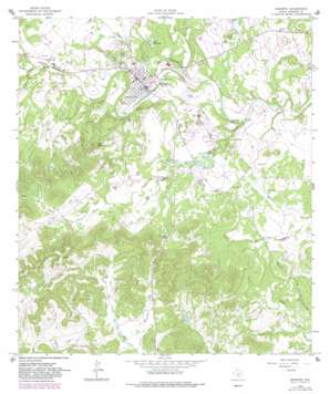
Bandera Topo Map Texas
To zoom in, hover over the map of Bandera
USGS Topo Quad 29099f1 - 1:24,000 scale
| Topo Map Name: | Bandera |
| USGS Topo Quad ID: | 29099f1 |
| Print Size: | ca. 21 1/4" wide x 27" high |
| Southeast Coordinates: | 29.625° N latitude / 99° W longitude |
| Map Center Coordinates: | 29.6875° N latitude / 99.0625° W longitude |
| U.S. State: | TX |
| Filename: | o29099f1.jpg |
| Download Map JPG Image: | Bandera topo map 1:24,000 scale |
| Map Type: | Topographic |
| Topo Series: | 7.5´ |
| Map Scale: | 1:24,000 |
| Source of Map Images: | United States Geological Survey (USGS) |
| Alternate Map Versions: |
Bandera TX 1964, updated 1967 Download PDF Buy paper map Bandera TX 1964, updated 1983 Download PDF Buy paper map Bandera TX 2010 Download PDF Buy paper map Bandera TX 2013 Download PDF Buy paper map Bandera TX 2016 Download PDF Buy paper map |
1:24,000 Topo Quads surrounding Bandera
> Back to 29099e1 at 1:100,000 scale
> Back to 29098a1 at 1:250,000 scale
> Back to U.S. Topo Maps home
Bandera topo map: Gazetteer
Bandera: Airports
Flying L Ranch Airport (historical) elevation 386m 1266′Lobo Mountain Ranch Airport elevation 460m 1509′
Bandera: Dams
Alkek Lake Number 1 Dam elevation 372m 1220′Alkek Lake Number 2 Dam elevation 379m 1243′
Conoco Lake Dam Number 1 elevation 397m 1302′
Old Langford Lake Dam elevation 415m 1361′
Bandera: Flats
Potato Flats elevation 446m 1463′Bandera: Populated Places
Bandera elevation 379m 1243′Bandera: Reservoirs
Alkek Lake Number 1 elevation 372m 1220′Alkek Lake Number 2 elevation 379m 1243′
Conoco Lake Number 1 elevation 397m 1302′
Lake Hiawatha elevation 381m 1250′
Old Langford Lake elevation 415m 1361′
Bandera: Springs
Dripping Springs elevation 370m 1213′Kindla Spring elevation 384m 1259′
Mansfield Spring elevation 433m 1420′
Bandera: Streams
Bandera Creek elevation 359m 1177′Doe Creek elevation 360m 1181′
Indian Creek elevation 384m 1259′
Mason Creek elevation 365m 1197′
Mud Creek elevation 365m 1197′
San Julian Creek elevation 353m 1158′
Bandera: Summits
Rugh Hill elevation 385m 1263′Town Mountain elevation 532m 1745′
Bandera: Valleys
Clark Hollow elevation 461m 1512′Gate Hollow elevation 456m 1496′
Mule Hollow elevation 461m 1512′
Stove Hollow elevation 459m 1505′
Bandera digital topo map on disk
Buy this Bandera topo map showing relief, roads, GPS coordinates and other geographical features, as a high-resolution digital map file on DVD:


