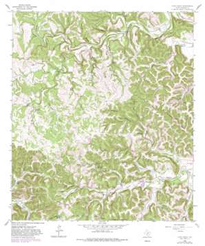
Love Creek Topo Map Texas
To zoom in, hover over the map of Love Creek
USGS Topo Quad 29099g4 - 1:24,000 scale
| Topo Map Name: | Love Creek |
| USGS Topo Quad ID: | 29099g4 |
| Print Size: | ca. 21 1/4" wide x 27" high |
| Southeast Coordinates: | 29.75° N latitude / 99.375° W longitude |
| Map Center Coordinates: | 29.8125° N latitude / 99.4375° W longitude |
| U.S. State: | TX |
| Filename: | o29099g4.jpg |
| Download Map JPG Image: | Love Creek topo map 1:24,000 scale |
| Map Type: | Topographic |
| Topo Series: | 7.5´ |
| Map Scale: | 1:24,000 |
| Source of Map Images: | United States Geological Survey (USGS) |
| Alternate Map Versions: |
Love Creek TX 1964, updated 1967 Download PDF Buy paper map Love Creek TX 1964, updated 1982 Download PDF Buy paper map Love Creek TX 2010 Download PDF Buy paper map Love Creek TX 2012 Download PDF Buy paper map Love Creek TX 2016 Download PDF Buy paper map |
1:24,000 Topo Quads surrounding Love Creek
> Back to 29099e1 at 1:100,000 scale
> Back to 29098a1 at 1:250,000 scale
> Back to U.S. Topo Maps home
Love Creek topo map: Gazetteer
Love Creek: Airports
Johnson Ranch Airport elevation 651m 2135′Love Creek: Dams
Johnson Lake Dam elevation 557m 1827′Tatum Lake Dam elevation 532m 1745′
Love Creek: Populated Places
Tuff elevation 536m 1758′Love Creek: Reservoirs
Johnson Lake elevation 557m 1827′Tatum Lake elevation 532m 1745′
Love Creek: Springs
Bluff Spring elevation 626m 2053′Devils Bathtub Spring elevation 590m 1935′
Dripping Spring elevation 594m 1948′
Duncan Spring elevation 626m 2053′
Main Spring elevation 624m 2047′
Muskhog Spring elevation 616m 2020′
Walnut Spring elevation 628m 2060′
Willow Spring elevation 635m 2083′
Love Creek: Streams
Big Armidge Creek elevation 580m 1902′Bottle Springs Creek elevation 615m 2017′
Buckelew Creek elevation 595m 1952′
Clark Creek elevation 545m 1788′
Coal Creek elevation 601m 1971′
Dockery Creek elevation 553m 1814′
Dryden Creek elevation 633m 2076′
Duncan Creek elevation 553m 1814′
Elam Creek elevation 504m 1653′
Honey Creek elevation 545m 1788′
Jackson Creek elevation 507m 1663′
Left Hand Duncan Creek elevation 576m 1889′
Left Hand Horse Creek elevation 549m 1801′
Light Creek elevation 535m 1755′
Little Armidge Creek elevation 584m 1916′
Little Shephard Creek elevation 549m 1801′
Love Creek elevation 512m 1679′
Ranger Creek elevation 557m 1827′
Right Hand Duncan Creek elevation 576m 1889′
Right Hand Horse Creek elevation 549m 1801′
Shephard Creek elevation 557m 1827′
South Fork North Prong Medina River elevation 590m 1935′
Ubanks Creek elevation 535m 1755′
Wyatt Creek elevation 601m 1971′
Love Creek: Valleys
Anderson Hollow elevation 545m 1788′Board Tree Hollow elevation 564m 1850′
Chimney Hollow elevation 577m 1893′
Cold Hollow elevation 575m 1886′
Copperhead Hollow elevation 564m 1850′
Covy Hollow elevation 595m 1952′
Indian Hollow elevation 505m 1656′
Lin Hollow elevation 548m 1797′
Negro Hollow elevation 561m 1840′
Raven Roost Hollow elevation 573m 1879′
Slaughter Hollow elevation 557m 1827′
Love Creek digital topo map on disk
Buy this Love Creek topo map showing relief, roads, GPS coordinates and other geographical features, as a high-resolution digital map file on DVD:


