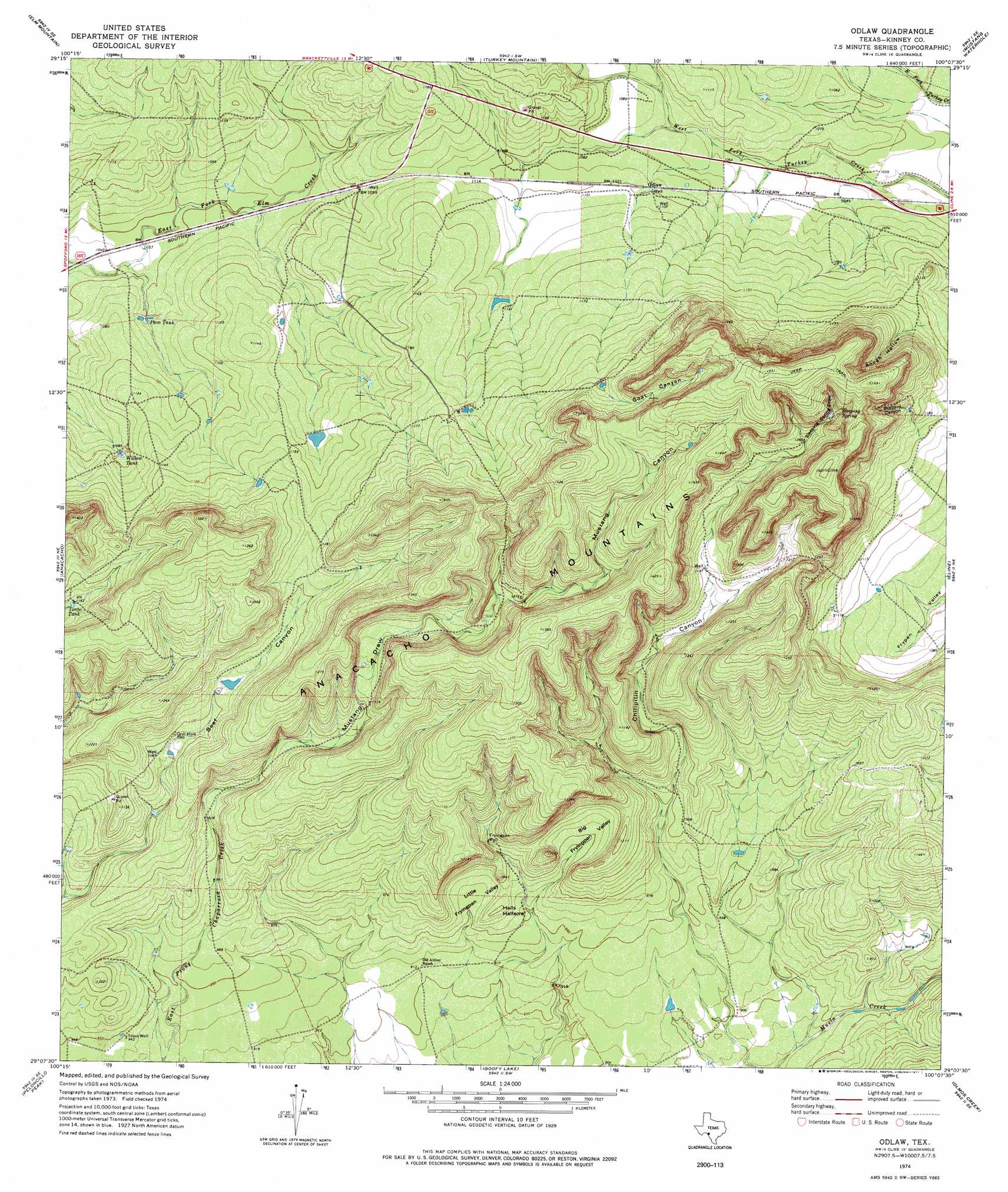
Odlaw Topo Map Texas
To zoom in, hover over the map of Odlaw
USGS Topo Quad 29100b2 - 1:24,000 scale
| Topo Map Name: | Odlaw |
| USGS Topo Quad ID: | 29100b2 |
| Print Size: | ca. 21 1/4" wide x 27" high |
| Southeast Coordinates: | 29.125° N latitude / 100.125° W longitude |
| Map Center Coordinates: | 29.1875° N latitude / 100.1875° W longitude |
| U.S. State: | TX |
| Filename: | o29100b2.jpg |
| Download Map JPG Image: | Odlaw topo map 1:24,000 scale |
| Map Type: | Topographic |
| Topo Series: | 7.5´ |
| Map Scale: | 1:24,000 |
| Source of Map Images: | United States Geological Survey (USGS) |
| Alternate Map Versions: |
Odlaw TX 1974, updated 1977 Download PDF Buy paper map Odlaw TX 2010 Download PDF Buy paper map Odlaw TX 2012 Download PDF Buy paper map Odlaw TX 2016 Download PDF Buy paper map |
1:24,000 Topo Quads surrounding Odlaw
Pinto Mountain |
Brackettville Ne |
Salmon Peak |
Laguna |
Sycamore Mountain |
Brackettville |
Elm Mountain |
Turkey Mountain |
Mustang Waterhole |
Chalk Bluff |
Spofford |
Anacacho |
Odlaw |
Cline |
Hacienda |
Imperialist Tank |
Peloncillo Peak |
Goofy Lake |
Olmos Creek |
Sand Mountain |
Paloma |
Trosado Tank |
Chacon Creek Nw |
Chacon Creek Ne |
La Pryor Nw |
> Back to 29100a1 at 1:100,000 scale
> Back to 29100a1 at 1:250,000 scale
> Back to U.S. Topo Maps home
Odlaw topo map: Gazetteer
Odlaw: Basins
Big Fryingpan Valley elevation 305m 1000′Little Fryingpan Valley elevation 291m 954′
Odlaw: Populated Places
Odlaw elevation 334m 1095′Odlaw: Ranges
Anacacho Mountains elevation 401m 1315′Odlaw: Reservoirs
Pavo Tank elevation 323m 1059′Tonto Tank elevation 355m 1164′
Willow Tank elevation 335m 1099′
Odlaw: Springs
Sleeping Spring elevation 405m 1328′Odlaw: Summits
Hells Halfacre elevation 302m 990′Odlaw: Valleys
Buzzard Canyon elevation 364m 1194′Chilipitin Canyon elevation 304m 997′
Goat Canyon elevation 381m 1250′
Mustang Canyon elevation 366m 1200′
Mustang Draw elevation 316m 1036′
Rough Hollow elevation 352m 1154′
Sleeping Spring Draw elevation 386m 1266′
Odlaw: Wells
Fryingpan Well elevation 309m 1013′Odlaw digital topo map on disk
Buy this Odlaw topo map showing relief, roads, GPS coordinates and other geographical features, as a high-resolution digital map file on DVD: