Cow Creek Tank Topo Map Texas
To zoom in, hover over the map of Cow Creek Tank
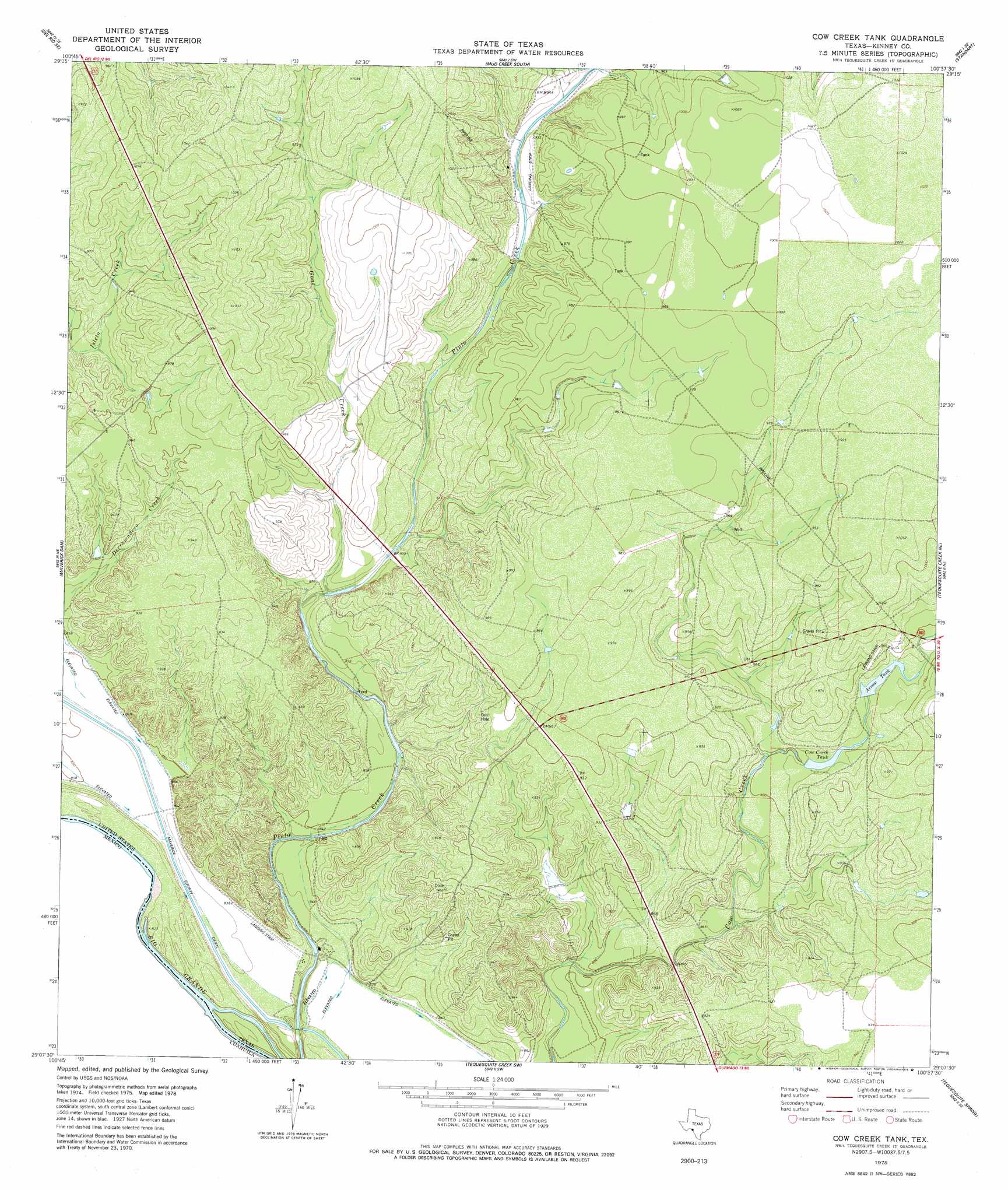
USGS Topo Quad 29100b6 - 1:24,000 scale
| Topo Map Name: | Cow Creek Tank |
| USGS Topo Quad ID: | 29100b6 |
| Print Size: | ca. 21 1/4" wide x 27" high |
| Southeast Coordinates: | 29.125° N latitude / 100.625° W longitude |
| Map Center Coordinates: | 29.1875° N latitude / 100.6875° W longitude |
| U.S. State: | TX |
| Filename: | o29100b6.jpg |
| Download Map JPG Image: | Cow Creek Tank topo map 1:24,000 scale |
| Map Type: | Topographic |
| Topo Series: | 7.5´ |
| Map Scale: | 1:24,000 |
| Source of Map Images: | United States Geological Survey (USGS) |
| Alternate Map Versions: |
Cow Creek Tank TX 2010 Download PDF Buy paper map Cow Creek Tank TX 2013 Download PDF Buy paper map Cow Creek Tank TX 2016 Download PDF Buy paper map |
1:24,000 Topo Quads surrounding Cow Creek Tank
Del Rio Nw |
Del Rio Ne |
Mud Creek North |
Mud Springs |
Pinto Mountain |
Del Rio Sw |
Del Rio Se |
Mud Creek South |
Standart |
Brackettville |
Maverick Dam |
Cow Creek Tank |
Tequesquite Creek Ne |
Spofford |
|
Tequesquite Creek Sw |
Tequesquite Spring |
Imperialist Tank |
||
Quemado West |
Quemado East |
Paloma |
> Back to 29100a1 at 1:100,000 scale
> Back to 29100a1 at 1:250,000 scale
> Back to U.S. Topo Maps home
Cow Creek Tank topo map: Gazetteer
Cow Creek Tank: Airports
Frerich Ranch Airport elevation 297m 974′Cow Creek Tank: Dams
Frerich Lake Number 1 Dam elevation 294m 964′Frerich Lake Number 2 Dam elevation 278m 912′
Cow Creek Tank: Reservoirs
Arrow Tank elevation 283m 928′Cow Creek Tank elevation 278m 912′
Frerich Lake Number 1 elevation 294m 964′
Frerich Lake Number 2 elevation 278m 912′
Cow Creek Tank: Streams
Derramadero Creek elevation 264m 866′Goat Creek elevation 261m 856′
Cow Creek Tank digital topo map on disk
Buy this Cow Creek Tank topo map showing relief, roads, GPS coordinates and other geographical features, as a high-resolution digital map file on DVD: