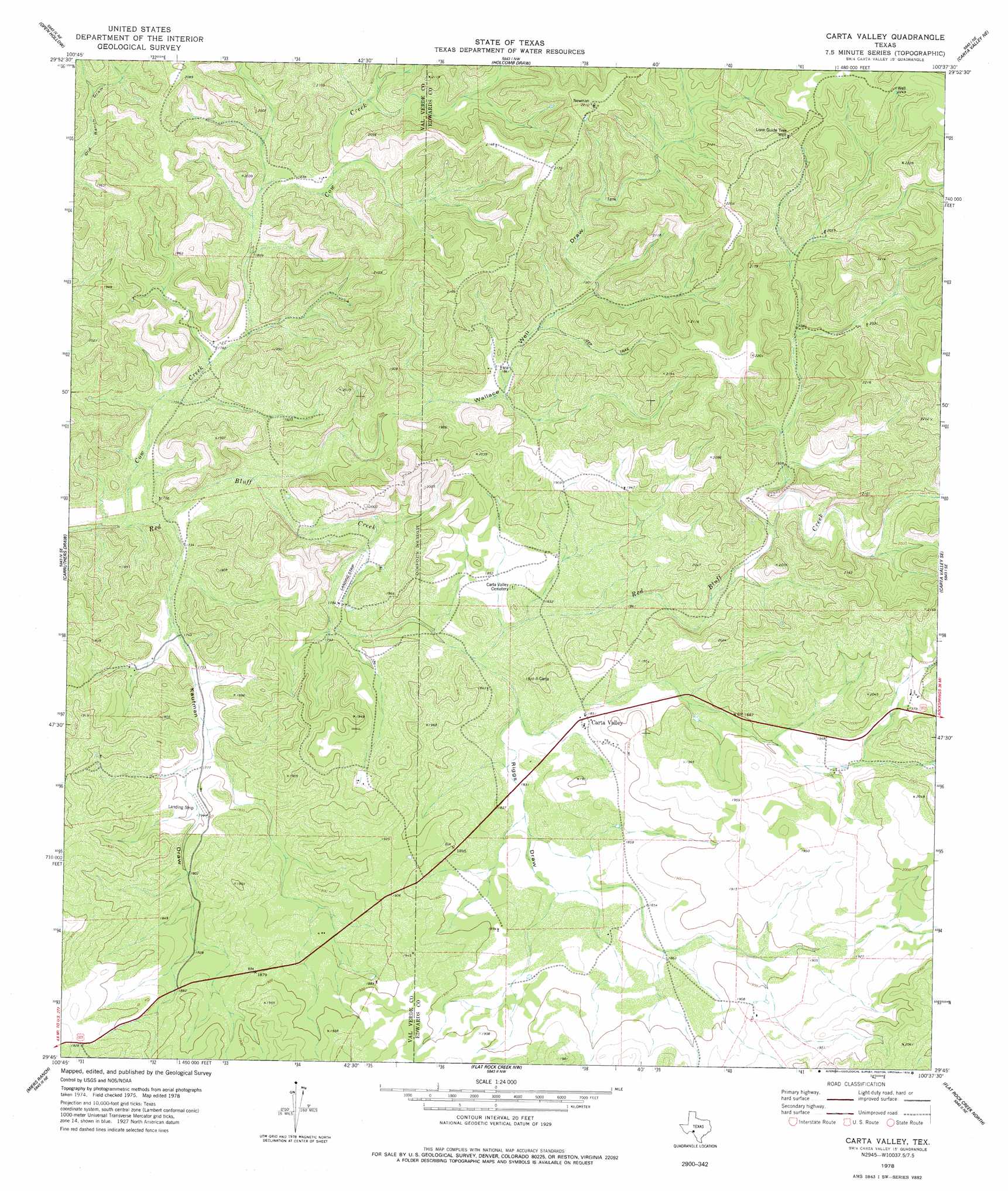
Carta Valley Topo Map Texas
To zoom in, hover over the map of Carta Valley
USGS Topo Quad 29100g6 - 1:24,000 scale
| Topo Map Name: | Carta Valley |
| USGS Topo Quad ID: | 29100g6 |
| Print Size: | ca. 21 1/4" wide x 27" high |
| Southeast Coordinates: | 29.75° N latitude / 100.625° W longitude |
| Map Center Coordinates: | 29.8125° N latitude / 100.6875° W longitude |
| U.S. State: | TX |
| Filename: | o29100g6.jpg |
| Download Map JPG Image: | Carta Valley topo map 1:24,000 scale |
| Map Type: | Topographic |
| Topo Series: | 7.5´ |
| Map Scale: | 1:24,000 |
| Source of Map Images: | United States Geological Survey (USGS) |
| Alternate Map Versions: |
Carta Valley TX 1978, updated 1978 Download PDF Buy paper map Carta Valley TX 2010 Download PDF Buy paper map Carta Valley TX 2012 Download PDF Buy paper map Carta Valley TX 2016 Download PDF Buy paper map |
1:24,000 Topo Quads surrounding Carta Valley
White Draw |
Robinson Draw |
Four Mills |
Turney Draw Se |
Ray Lake Sw |
Dolan Springs |
Open Hollow |
Holcomb Draw |
Carta Valley Ne |
Black Waterhole |
Clark Waterhole |
Carruthers Draw |
Carta Valley |
Carta Valley Se |
Twomile Draw |
Satan Canyon |
Miers Ranch |
Flat Rock Creek Nw |
Flat Rock Creek North |
Wiley Waterhole |
Rough Canyon |
Rough Canyon Se |
Flat Rock Creek Sw |
Flat Rock Creek South |
Kickapoo Caverns |
> Back to 29100e1 at 1:100,000 scale
> Back to 29100a1 at 1:250,000 scale
> Back to U.S. Topo Maps home
Carta Valley topo map: Gazetteer
Carta Valley: Populated Places
Carta Valley elevation 568m 1863′Carta Valley: Streams
Cow Creek elevation 518m 1699′Carta Valley: Valleys
Kaufman Draw elevation 524m 1719′Riggs Draw elevation 552m 1811′
Wallace Well Draw elevation 535m 1755′
Carta Valley: Wells
Lone Guide Tree Well elevation 670m 2198′Carta Valley digital topo map on disk
Buy this Carta Valley topo map showing relief, roads, GPS coordinates and other geographical features, as a high-resolution digital map file on DVD: