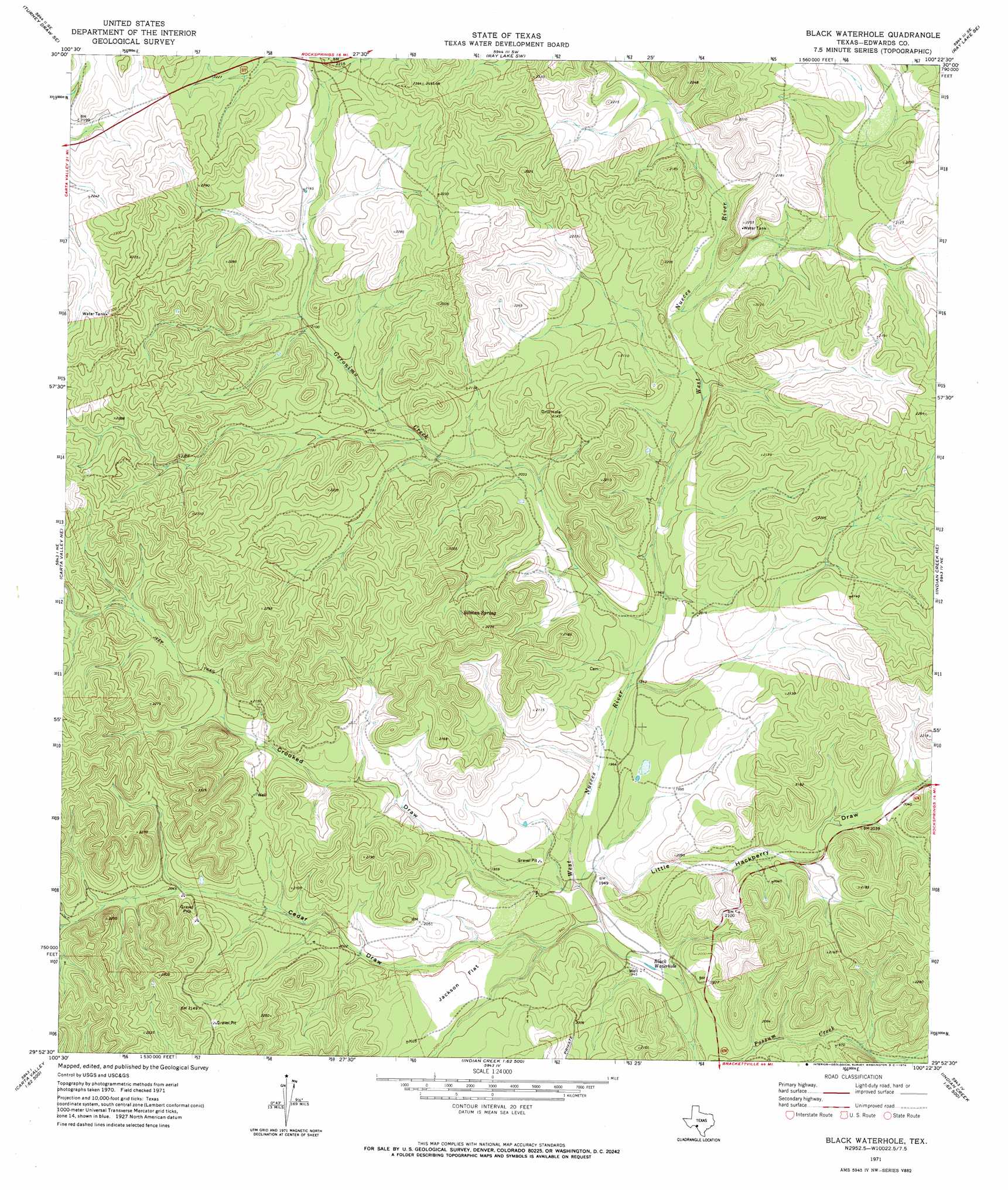
Black Waterhole Topo Map Texas
To zoom in, hover over the map of Black Waterhole
USGS Topo Quad 29100h4 - 1:24,000 scale
| Topo Map Name: | Black Waterhole |
| USGS Topo Quad ID: | 29100h4 |
| Print Size: | ca. 21 1/4" wide x 27" high |
| Southeast Coordinates: | 29.875° N latitude / 100.375° W longitude |
| Map Center Coordinates: | 29.9375° N latitude / 100.4375° W longitude |
| U.S. State: | TX |
| Filename: | o29100h4.jpg |
| Download Map JPG Image: | Black Waterhole topo map 1:24,000 scale |
| Map Type: | Topographic |
| Topo Series: | 7.5´ |
| Map Scale: | 1:24,000 |
| Source of Map Images: | United States Geological Survey (USGS) |
| Alternate Map Versions: |
Black Waterhole TX 1971, updated 1974 Download PDF Buy paper map Black Waterhole TX 2010 Download PDF Buy paper map Black Waterhole TX 2013 Download PDF Buy paper map Black Waterhole TX 2016 Download PDF Buy paper map |
1:24,000 Topo Quads surrounding Black Waterhole
Turney Draw Nw |
Turney Draw Ne |
Ray Lake Nw |
Ray Lake |
Elbow Lake |
Four Mills |
Turney Draw Se |
Ray Lake Sw |
Ray Lake Se |
Rocksprings |
Holcomb Draw |
Carta Valley Ne |
Black Waterhole |
Indian Creek Ne |
Cub Lake |
Carta Valley |
Carta Valley Se |
Twomile Draw |
Cutting Pen Draw |
Half Moon Prairie |
Flat Rock Creek Nw |
Flat Rock Creek North |
Wiley Waterhole |
Indian Mountain |
Kelley Peak |
> Back to 29100e1 at 1:100,000 scale
> Back to 29100a1 at 1:250,000 scale
> Back to U.S. Topo Maps home
Black Waterhole topo map: Gazetteer
Black Waterhole: Flats
Jackson Flat elevation 610m 2001′Black Waterhole: Lakes
Black Waterhole elevation 574m 1883′Black Waterhole: Springs
Silman Spring elevation 651m 2135′Silman Springs elevation 643m 2109′
Black Waterhole: Streams
Geronimo Creek elevation 603m 1978′Black Waterhole: Valleys
Cedar Draw elevation 577m 1893′Crooked Draw elevation 581m 1906′
Little Hackberry Draw elevation 581m 1906′
Black Waterhole digital topo map on disk
Buy this Black Waterhole topo map showing relief, roads, GPS coordinates and other geographical features, as a high-resolution digital map file on DVD: