Amistad Dam Topo Map Texas
To zoom in, hover over the map of Amistad Dam
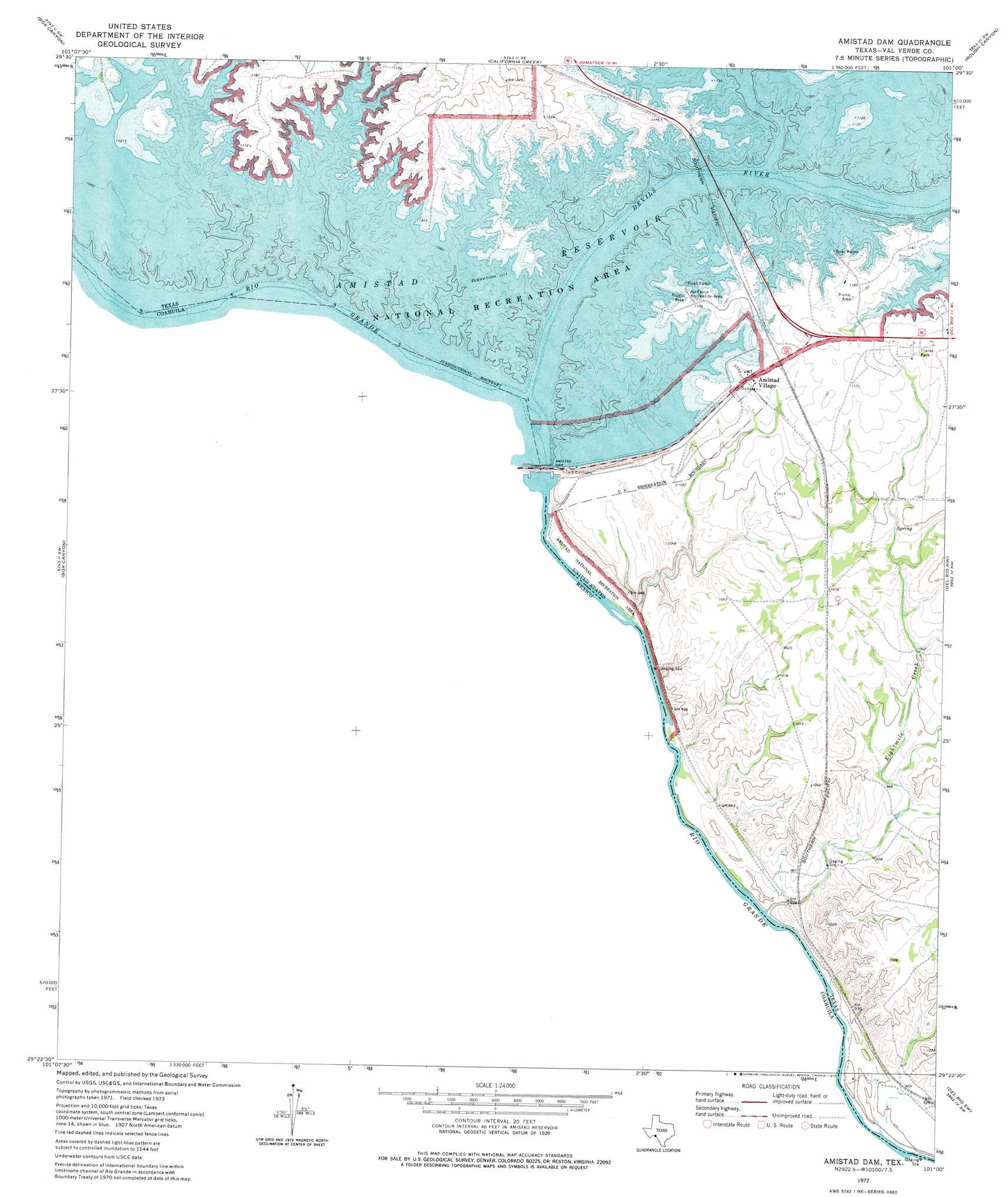
USGS Topo Quad 29101d1 - 1:24,000 scale
| Topo Map Name: | Amistad Dam |
| USGS Topo Quad ID: | 29101d1 |
| Print Size: | ca. 21 1/4" wide x 27" high |
| Southeast Coordinates: | 29.375° N latitude / 101° W longitude |
| Map Center Coordinates: | 29.4375° N latitude / 101.0625° W longitude |
| U.S. State: | TX |
| Filename: | o29101d1.jpg |
| Download Map JPG Image: | Amistad Dam topo map 1:24,000 scale |
| Map Type: | Topographic |
| Topo Series: | 7.5´ |
| Map Scale: | 1:24,000 |
| Source of Map Images: | United States Geological Survey (USGS) |
| Alternate Map Versions: |
Amistad Dam TX 1972, updated 1975 Download PDF Buy paper map Amistad Dam TX 2010 Download PDF Buy paper map Amistad Dam TX 2013 Download PDF Buy paper map Amistad Dam TX 2016 Download PDF Buy paper map |
1:24,000 Topo Quads surrounding Amistad Dam
Seminole Canyon |
Comstock |
Gillis Ranch |
Satan Canyon |
Miers Ranch |
Zuberbueler Bend |
Box Canyon |
California Creek |
Rough Canyon |
Rough Canyon Se |
Amistad Dam |
Del Rio Nw |
Del Rio Ne |
||
Del Rio Sw |
Del Rio Se |
|||
Maverick Dam |
> Back to 29101a1 at 1:100,000 scale
> Back to 29100a1 at 1:250,000 scale
> Back to U.S. Topo Maps home
Amistad Dam topo map: Gazetteer
Amistad Dam: Capes
Salems Point elevation 354m 1161′Amistad Dam: Dams
Amistad Dam elevation 340m 1115′Amistad Dam: Parks
Amistad National Recreation Area elevation 277m 908′Amistad Dam: Populated Places
Amistad Village elevation 353m 1158′Amistad Dam: Reservoirs
Amistad Reservoir elevation 337m 1105′Amistad Dam: Springs
McKee Springs elevation 282m 925′Amistad Dam: Streams
Devils River elevation 340m 1115′McKees Creek elevation 273m 895′
Amistad Dam digital topo map on disk
Buy this Amistad Dam topo map showing relief, roads, GPS coordinates and other geographical features, as a high-resolution digital map file on DVD: