Harkell Canyon Topo Map Texas
To zoom in, hover over the map of Harkell Canyon
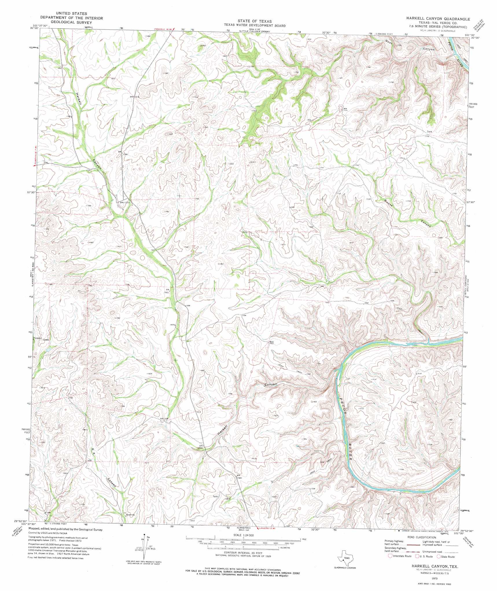
USGS Topo Quad 29101h5 - 1:24,000 scale
| Topo Map Name: | Harkell Canyon |
| USGS Topo Quad ID: | 29101h5 |
| Print Size: | ca. 21 1/4" wide x 27" high |
| Southeast Coordinates: | 29.875° N latitude / 101.5° W longitude |
| Map Center Coordinates: | 29.9375° N latitude / 101.5625° W longitude |
| U.S. State: | TX |
| Filename: | o29101h5.jpg |
| Download Map JPG Image: | Harkell Canyon topo map 1:24,000 scale |
| Map Type: | Topographic |
| Topo Series: | 7.5´ |
| Map Scale: | 1:24,000 |
| Source of Map Images: | United States Geological Survey (USGS) |
| Alternate Map Versions: |
Harkell Canyon TX 1973, updated 1976 Download PDF Buy paper map Harkell Canyon TX 2010 Download PDF Buy paper map Harkell Canyon TX 2013 Download PDF Buy paper map Harkell Canyon TX 2016 Download PDF Buy paper map |
1:24,000 Topo Quads surrounding Harkell Canyon
Meyers Canyon Ne |
Hackberry Crossing |
Pandale |
Divide Well Draw |
Steel Star Draw |
Sevenmile Canyon |
Roundhill Ranch |
Little Fielder Draw |
Everett Canyon |
Blue Hills |
Lozier Canyon North |
Pumpville |
Harkell Canyon |
Still Canyon |
Mayfield Canyon |
Lozier Canyon South |
Ramsey Canyon |
Langtry |
Shumla |
Pecos High Bridge |
Zuberbueler Bend Nw |
Seminole Canyon |
> Back to 29101e1 at 1:100,000 scale
> Back to 29100a1 at 1:250,000 scale
> Back to U.S. Topo Maps home
Harkell Canyon topo map: Gazetteer
Harkell Canyon: Valleys
Goat Canyon elevation 426m 1397′Harkell Canyon elevation 398m 1305′
Harkell Canyon digital topo map on disk
Buy this Harkell Canyon topo map showing relief, roads, GPS coordinates and other geographical features, as a high-resolution digital map file on DVD: