Stillwell Crossing Topo Map Texas
To zoom in, hover over the map of Stillwell Crossing
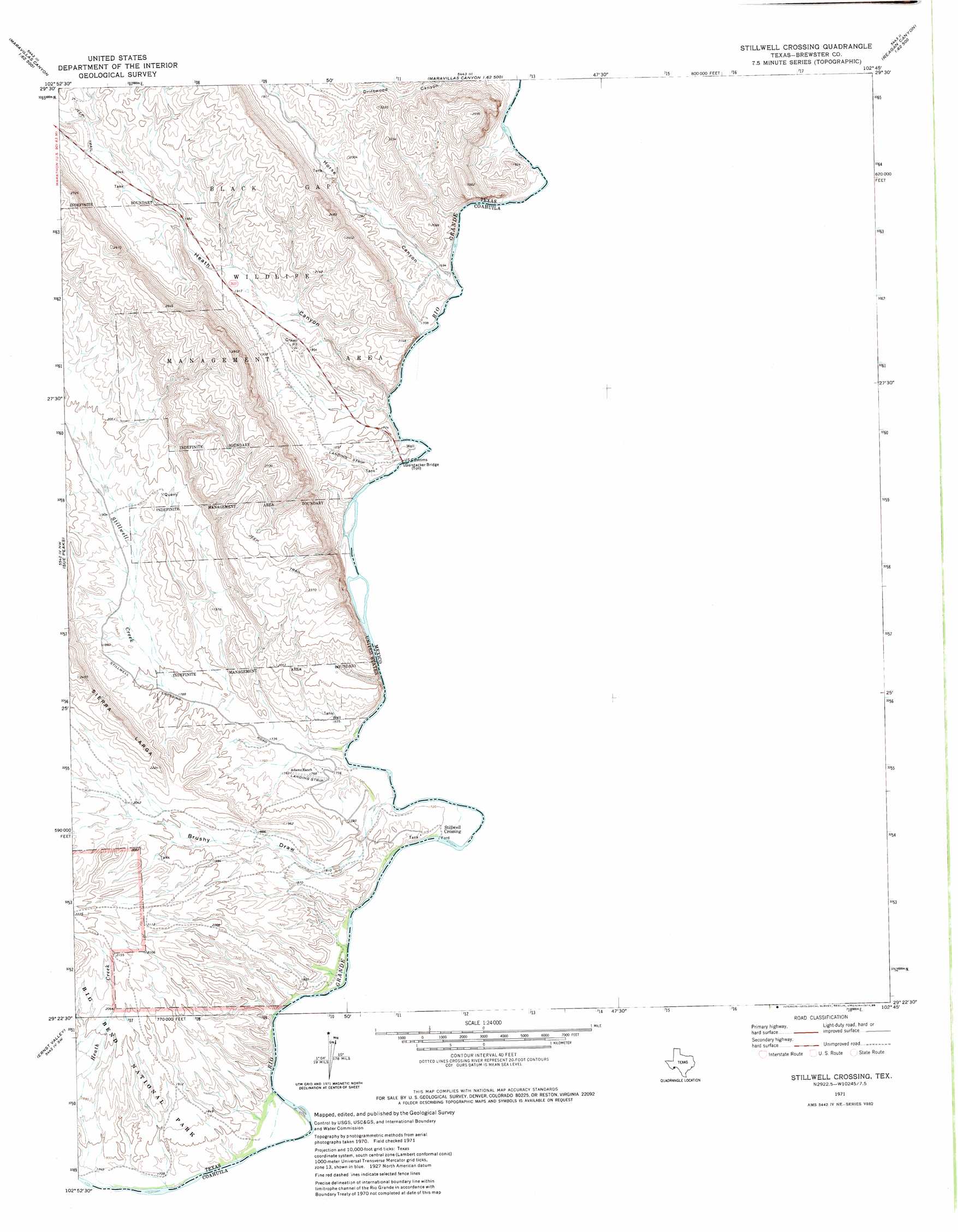
USGS Topo Quad 29102d7 - 1:24,000 scale
| Topo Map Name: | Stillwell Crossing |
| USGS Topo Quad ID: | 29102d7 |
| Print Size: | ca. 21 1/4" wide x 27" high |
| Southeast Coordinates: | 29.375° N latitude / 102.75° W longitude |
| Map Center Coordinates: | 29.4375° N latitude / 102.8125° W longitude |
| U.S. State: | TX |
| Filename: | o29102d7.jpg |
| Download Map JPG Image: | Stillwell Crossing topo map 1:24,000 scale |
| Map Type: | Topographic |
| Topo Series: | 7.5´ |
| Map Scale: | 1:24,000 |
| Source of Map Images: | United States Geological Survey (USGS) |
| Alternate Map Versions: |
Stillwell Crossing TX 1971, updated 1974 Download PDF Buy paper map Stillwell Crossing TX 1971, updated 1988 Download PDF Buy paper map Stillwell Crossing TX 2010 Download PDF Buy paper map Stillwell Crossing TX 2013 Download PDF Buy paper map Stillwell Crossing TX 2016 Download PDF Buy paper map |
1:24,000 Topo Quads surrounding Stillwell Crossing
Bone Spring Ne |
Stillwell Mountain |
Cupola Mountain |
Las Vegas De Los Ladrones |
San Rosendo |
Dagger Flat |
Black Gap |
Bourland Canyon |
Las Vegas De Los Ladrones Sw |
|
Mckinney Springs |
Sue Peaks |
Stillwell Crossing |
||
Roys Peak |
Ernst Valley |
|||
San Vincente |
Boquillas |
> Back to 29102a1 at 1:100,000 scale
> Back to 29102a1 at 1:250,000 scale
> Back to U.S. Topo Maps home
Stillwell Crossing topo map: Gazetteer
Stillwell Crossing: Airports
Heath Canyon Airport elevation 550m 1804′Stillwell Crossing: Bridges
Gerstacker Bridge elevation 518m 1699′Stillwell Crossing: Populated Places
Stillwell Crossing elevation 521m 1709′Stillwell Crossing: Streams
Stillwell Creek elevation 547m 1794′Stillwell Crossing: Valleys
Brushy Draw elevation 523m 1715′Heath Canyon elevation 513m 1683′
Horse Canyon elevation 513m 1683′
Telephone Canyon elevation 627m 2057′
Stillwell Crossing digital topo map on disk
Buy this Stillwell Crossing topo map showing relief, roads, GPS coordinates and other geographical features, as a high-resolution digital map file on DVD: