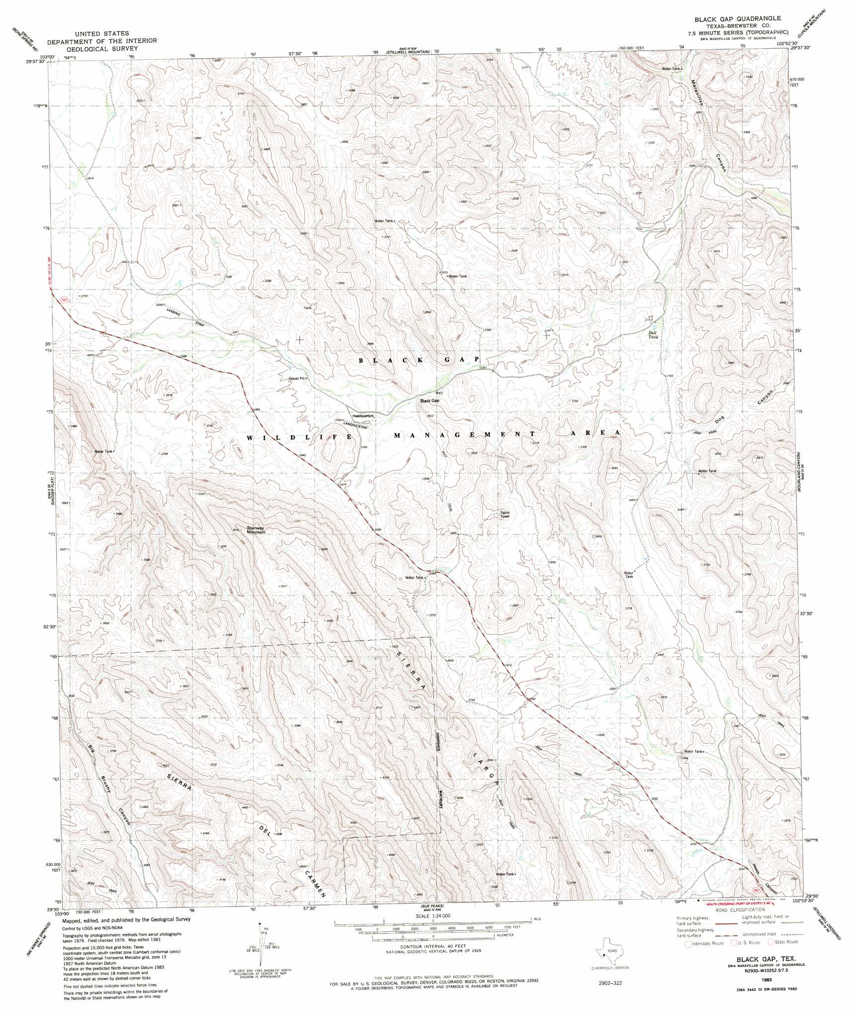
Black Gap Topo Map Texas
To zoom in, hover over the map of Black Gap
USGS Topo Quad 29102e8 - 1:24,000 scale
| Topo Map Name: | Black Gap |
| USGS Topo Quad ID: | 29102e8 |
| Print Size: | ca. 21 1/4" wide x 27" high |
| Southeast Coordinates: | 29.5° N latitude / 102.875° W longitude |
| Map Center Coordinates: | 29.5625° N latitude / 102.9375° W longitude |
| U.S. State: | TX |
| Filename: | o29102e8.jpg |
| Download Map JPG Image: | Black Gap topo map 1:24,000 scale |
| Map Type: | Topographic |
| Topo Series: | 7.5´ |
| Map Scale: | 1:24,000 |
| Source of Map Images: | United States Geological Survey (USGS) |
| Alternate Map Versions: |
Black Gap TX 1983, updated 1984 Download PDF Buy paper map Black Gap TX 2010 Download PDF Buy paper map Black Gap TX 2013 Download PDF Buy paper map Black Gap TX 2016 Download PDF Buy paper map |
1:24,000 Topo Quads surrounding Black Gap
Sosa Peak |
Hood Spring Se |
Yellow House Peak |
Dove Mountain |
Beef Gap |
Persimmon Gap |
Bone Spring Ne |
Stillwell Mountain |
Cupola Mountain |
Las Vegas De Los Ladrones |
Bone Spring |
Dagger Flat |
Black Gap |
Bourland Canyon |
Las Vegas De Los Ladrones Sw |
Grapevine Hills |
Mckinney Springs |
Sue Peaks |
Stillwell Crossing |
|
Panther Junction |
Roys Peak |
Ernst Valley |
> Back to 29102e1 at 1:100,000 scale
> Back to 29102a1 at 1:250,000 scale
> Back to U.S. Topo Maps home
Black Gap topo map: Gazetteer
Black Gap: Gaps
Black Gap elevation 689m 2260′Black Gap: Parks
Black Gap Wildlife Management Area elevation 678m 2224′Black Gap: Reservoirs
Bee Cove Tank elevation 766m 2513′Dett Tank elevation 632m 2073′
Hole in the Ground Tank elevation 769m 2522′
Redhouse Tank elevation 691m 2267′
Rockhouse Tank elevation 694m 2276′
Black Gap: Summits
Stairway Mountain elevation 959m 3146′Black Gap: Trails
Black Gap WMA Trail elevation 689m 2260′Black Gap digital topo map on disk
Buy this Black Gap topo map showing relief, roads, GPS coordinates and other geographical features, as a high-resolution digital map file on DVD: