Taylor Canyon Topo Map Texas
To zoom in, hover over the map of Taylor Canyon
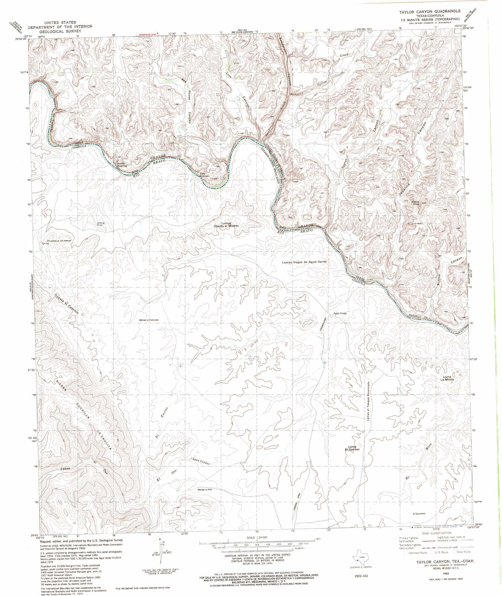
USGS Topo Quad 29102g2 - 1:24,000 scale
| Topo Map Name: | Taylor Canyon |
| USGS Topo Quad ID: | 29102g2 |
| Print Size: | ca. 21 1/4" wide x 27" high |
| Southeast Coordinates: | 29.75° N latitude / 102.125° W longitude |
| Map Center Coordinates: | 29.8125° N latitude / 102.1875° W longitude |
| U.S. State: | TX |
| Filename: | o29102g2.jpg |
| Download Map JPG Image: | Taylor Canyon topo map 1:24,000 scale |
| Map Type: | Topographic |
| Topo Series: | 7.5´ |
| Map Scale: | 1:24,000 |
| Source of Map Images: | United States Geological Survey (USGS) |
| Alternate Map Versions: |
Taylor Canyon TX 1983, updated 1984 Download PDF Buy paper map Taylor Canyon TX 2010 Download PDF Buy paper map Taylor Canyon TX 2013 Download PDF Buy paper map Taylor Canyon TX 2016 Download PDF Buy paper map |
1:24,000 Topo Quads surrounding Taylor Canyon
Hagler Canyon |
Sanderson Se |
Mofeta |
Dryden |
Meyers Canyon |
Candilla Canyon West |
Candilla Canyon East |
Mcclain Canyon |
Balcon Creek |
Cook Creek North |
Panther Gulch West |
Panther Gulch East |
Taylor Canyon |
Shafter Canyon |
Cook Creek South |
> Back to 29102e1 at 1:100,000 scale
> Back to 29102a1 at 1:250,000 scale
> Back to U.S. Topo Maps home
Taylor Canyon topo map: Gazetteer
Taylor Canyon: Areas
Middle Watering elevation 433m 1420′Taylor Canyon: Populated Places
Dryden Crossing elevation 407m 1335′Taylor Canyon: Streams
Garcia Creek elevation 477m 1564′Sanderson Creek elevation 441m 1446′
Taylor Canyon: Summits
Cable Hills elevation 526m 1725′Taylor Canyon: Valleys
Britton Canyon elevation 414m 1358′Jabalina Canyon elevation 403m 1322′
Sanderson Canyon elevation 449m 1473′
Taylor Canyon elevation 431m 1414′
Taylor Canyon digital topo map on disk
Buy this Taylor Canyon topo map showing relief, roads, GPS coordinates and other geographical features, as a high-resolution digital map file on DVD: