Bullis Gap Topo Map Texas
To zoom in, hover over the map of Bullis Gap
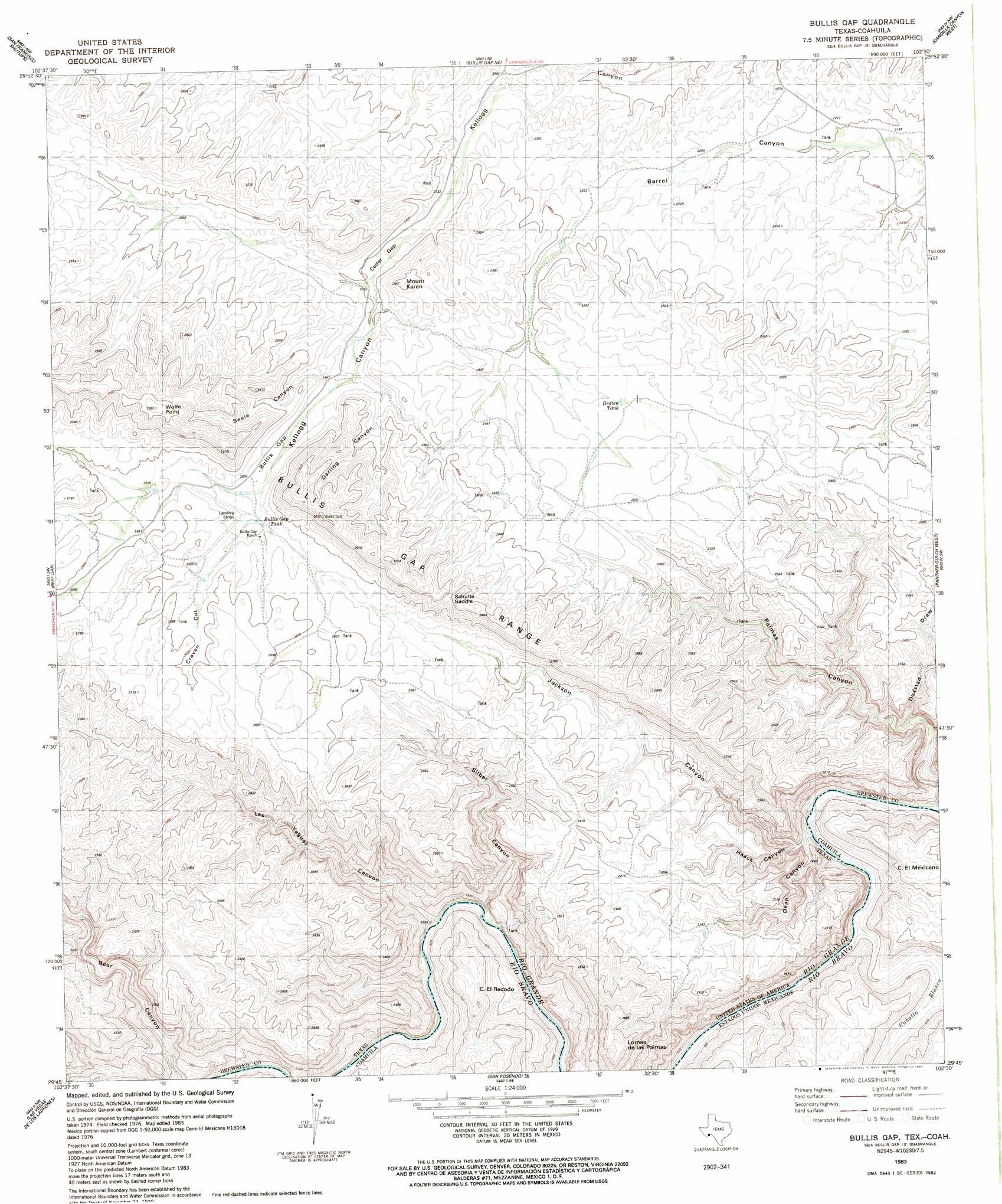
USGS Topo Quad 29102g5 - 1:24,000 scale
| Topo Map Name: | Bullis Gap |
| USGS Topo Quad ID: | 29102g5 |
| Print Size: | ca. 21 1/4" wide x 27" high |
| Southeast Coordinates: | 29.75° N latitude / 102.5° W longitude |
| Map Center Coordinates: | 29.8125° N latitude / 102.5625° W longitude |
| U.S. State: | TX |
| Filename: | o29102g5.jpg |
| Download Map JPG Image: | Bullis Gap topo map 1:24,000 scale |
| Map Type: | Topographic |
| Topo Series: | 7.5´ |
| Map Scale: | 1:24,000 |
| Source of Map Images: | United States Geological Survey (USGS) |
| Alternate Map Versions: |
Bullis Gap TX 1983, updated 1984 Download PDF Buy paper map Bullis Gap TX 2010 Download PDF Buy paper map Bullis Gap TX 2013 Download PDF Buy paper map Bullis Gap TX 2016 Download PDF Buy paper map |
1:24,000 Topo Quads surrounding Bullis Gap
Tesnus Se |
Fresno Creek |
Big Brindle Canyon |
Hagler Canyon |
Sanderson Se |
Pine Mountain East |
San Francisco Shutups |
Bullis Gap Ne |
Candilla Canyon West |
Candilla Canyon East |
Dove Mountain |
Beef Gap |
Bullis Gap |
Panther Gulch West |
Panther Gulch East |
Cupola Mountain |
Las Vegas De Los Ladrones |
San Rosendo |
||
Bourland Canyon |
Las Vegas De Los Ladrones Sw |
> Back to 29102e1 at 1:100,000 scale
> Back to 29102a1 at 1:250,000 scale
> Back to U.S. Topo Maps home
Bullis Gap topo map: Gazetteer
Bullis Gap: Gaps
Cedar Gap elevation 729m 2391′Bullis Gap: Ranges
Bullis Gap Range elevation 926m 3038′Bullis Gap: Reservoirs
Britton Tank elevation 749m 2457′Bullis Gap Tank elevation 763m 2503′
Bullis Gap: Summits
Loma de las Palmas elevation 882m 2893′Bullis Gap: Valleys
Jackson Canyon elevation 473m 1551′Palmas Canyon elevation 471m 1545′
Bullis Gap digital topo map on disk
Buy this Bullis Gap topo map showing relief, roads, GPS coordinates and other geographical features, as a high-resolution digital map file on DVD: