Pine Mountain West Topo Map Texas
To zoom in, hover over the map of Pine Mountain West
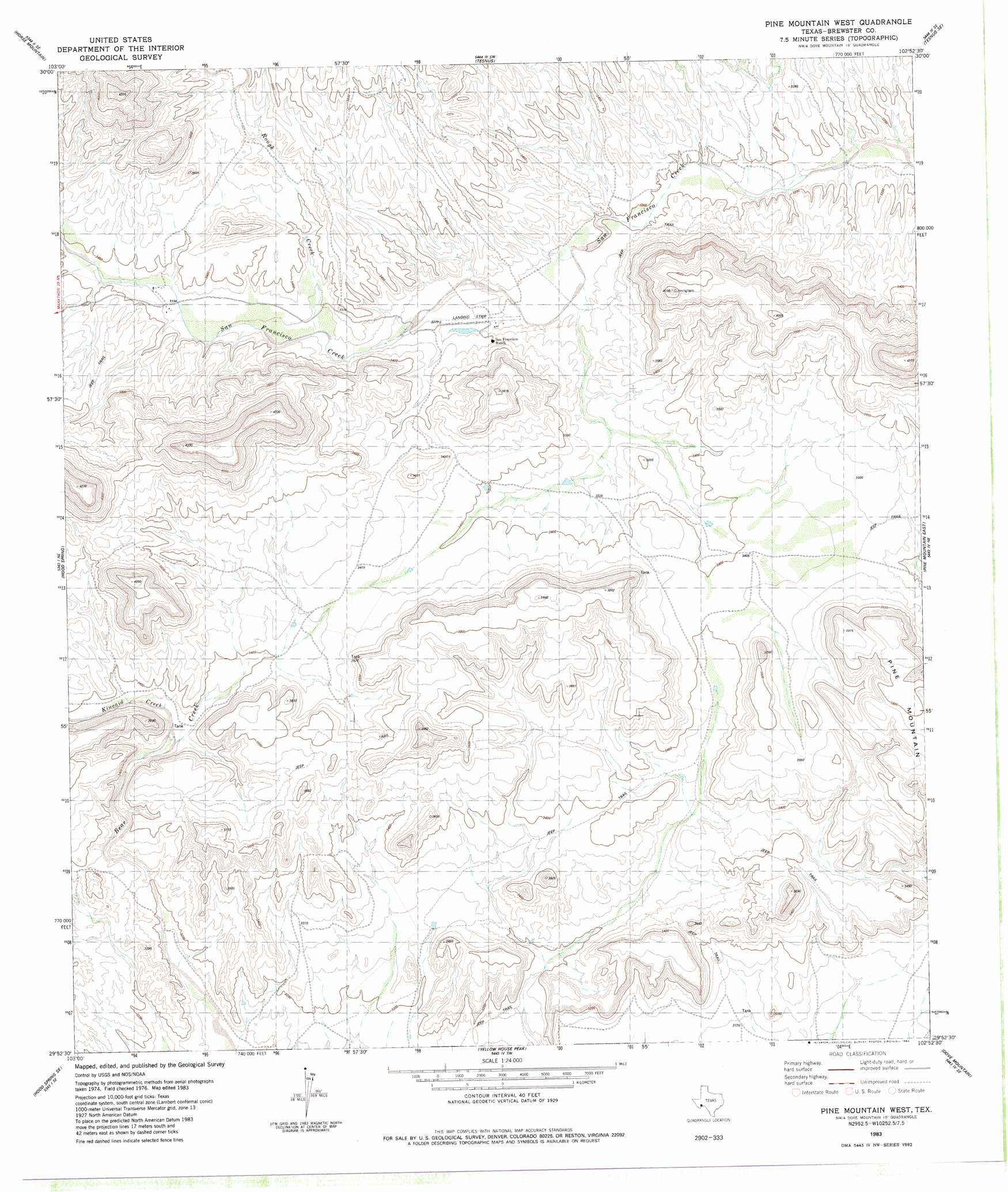
USGS Topo Quad 29102h8 - 1:24,000 scale
| Topo Map Name: | Pine Mountain West |
| USGS Topo Quad ID: | 29102h8 |
| Print Size: | ca. 21 1/4" wide x 27" high |
| Southeast Coordinates: | 29.875° N latitude / 102.875° W longitude |
| Map Center Coordinates: | 29.9375° N latitude / 102.9375° W longitude |
| U.S. State: | TX |
| Filename: | o29102h8.jpg |
| Download Map JPG Image: | Pine Mountain West topo map 1:24,000 scale |
| Map Type: | Topographic |
| Topo Series: | 7.5´ |
| Map Scale: | 1:24,000 |
| Source of Map Images: | United States Geological Survey (USGS) |
| Alternate Map Versions: |
Pine Mountain West TX 1983, updated 1984 Download PDF Buy paper map Pine Mountain West TX 2010 Download PDF Buy paper map Pine Mountain West TX 2013 Download PDF Buy paper map Pine Mountain West TX 2016 Download PDF Buy paper map |
1:24,000 Topo Quads surrounding Pine Mountain West
Marathon |
Lightening Hills |
Housetop Mountains |
Tesnus Ne |
Longfellow |
Pena Blanca Mountains |
Horse Mountain |
Tesnus |
Tesnus Se |
Fresno Creek |
Heart Mountain |
Hood Spring |
Pine Mountain West |
Pine Mountain East |
San Francisco Shutups |
Sosa Peak |
Hood Spring Se |
Yellow House Peak |
Dove Mountain |
Beef Gap |
Persimmon Gap |
Bone Spring Ne |
Stillwell Mountain |
Cupola Mountain |
Las Vegas De Los Ladrones |
> Back to 29102e1 at 1:100,000 scale
> Back to 29102a1 at 1:250,000 scale
> Back to U.S. Topo Maps home
Pine Mountain West topo map: Gazetteer
Pine Mountain West: Airports
Chaney San Francisco Ranch Airport elevation 987m 3238′Pine Mountain West: Streams
Kincaid Creek elevation 1012m 3320′Rough Creek elevation 1006m 3300′
Pine Mountain West digital topo map on disk
Buy this Pine Mountain West topo map showing relief, roads, GPS coordinates and other geographical features, as a high-resolution digital map file on DVD: