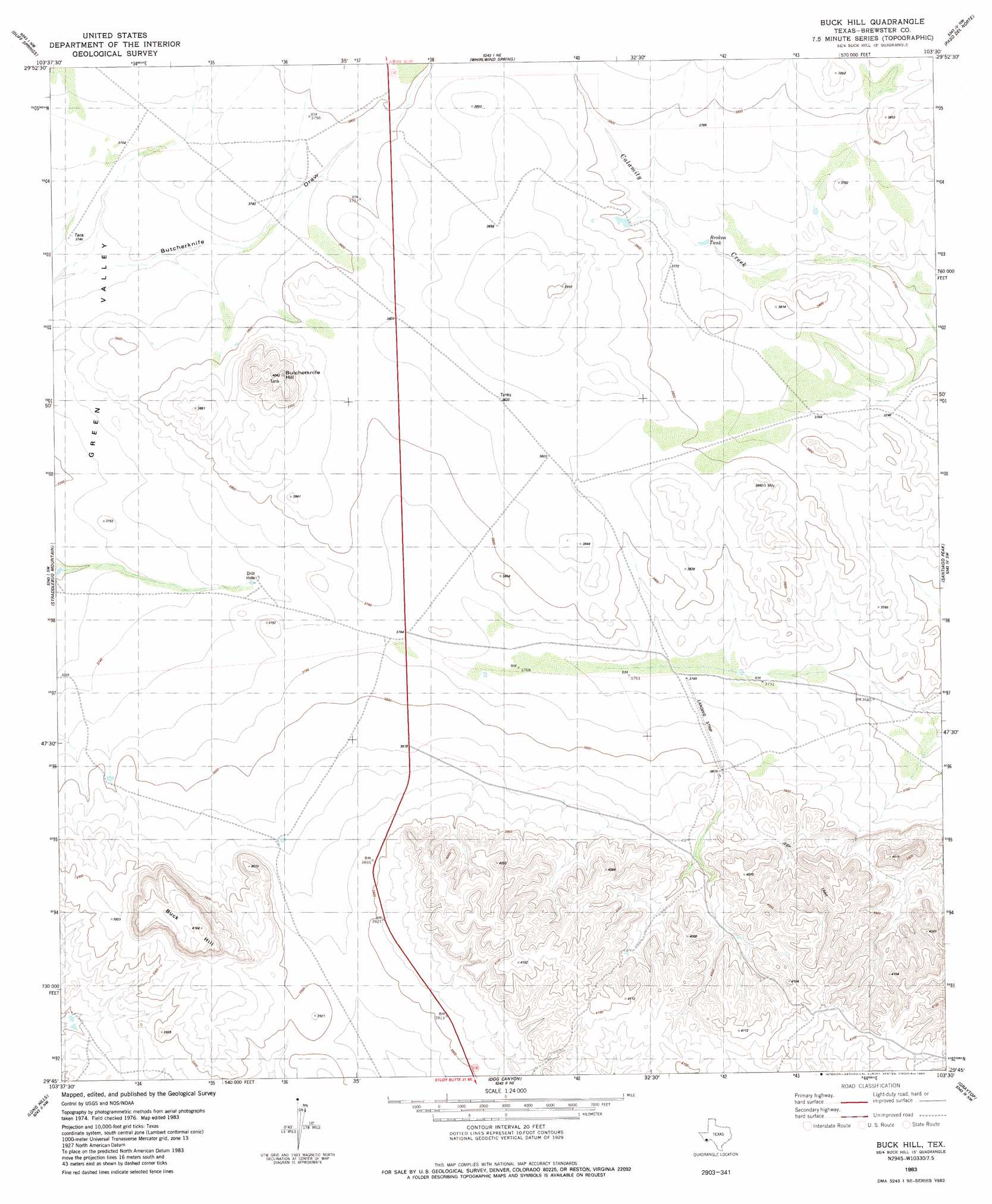
Buck Hill Topo Map Texas
To zoom in, hover over the map of Buck Hill
USGS Topo Quad 29103g5 - 1:24,000 scale
| Topo Map Name: | Buck Hill |
| USGS Topo Quad ID: | 29103g5 |
| Print Size: | ca. 21 1/4" wide x 27" high |
| Southeast Coordinates: | 29.75° N latitude / 103.5° W longitude |
| Map Center Coordinates: | 29.8125° N latitude / 103.5625° W longitude |
| U.S. State: | TX |
| Filename: | o29103g5.jpg |
| Download Map JPG Image: | Buck Hill topo map 1:24,000 scale |
| Map Type: | Topographic |
| Topo Series: | 7.5´ |
| Map Scale: | 1:24,000 |
| Source of Map Images: | United States Geological Survey (USGS) |
| Alternate Map Versions: |
Buck Hill TX 1983, updated 1984 Download PDF Buy paper map Buck Hill TX 2010 Download PDF Buy paper map Buck Hill TX 2012 Download PDF Buy paper map Buck Hill TX 2016 Download PDF Buy paper map |
1:24,000 Topo Quads surrounding Buck Hill
Cactus Flat |
Goat Mountain |
Elephant Mountain |
Rock House Gap |
Simpson Springs Mountain |
Paradise Draw |
Duff Springs |
Whirlwind Spring |
Paso Del Norte |
Maravillas Gap |
Mckinney Mountain |
Straddlebug Mountain |
Buck Hill |
Santiago Peak |
Ye Mesa |
Bandera Mesa North |
Long Hills |
Dog Canyon |
Graytop |
Butterbowl |
Bandero Mesa South |
Agua Fria Mountain |
Packsaddle Mountain |
White Hills |
Twin Peaks |
> Back to 29103e1 at 1:100,000 scale
> Back to 29102a1 at 1:250,000 scale
> Back to U.S. Topo Maps home
Buck Hill topo map: Gazetteer
Buck Hill: Reservoirs
Broken Tank elevation 1143m 3750′Stone Tank elevation 1187m 3894′
Buck Hill: Summits
Buck Hill elevation 1275m 4183′Butcherknife Hill elevation 1229m 4032′
Buck Hill digital topo map on disk
Buy this Buck Hill topo map showing relief, roads, GPS coordinates and other geographical features, as a high-resolution digital map file on DVD: