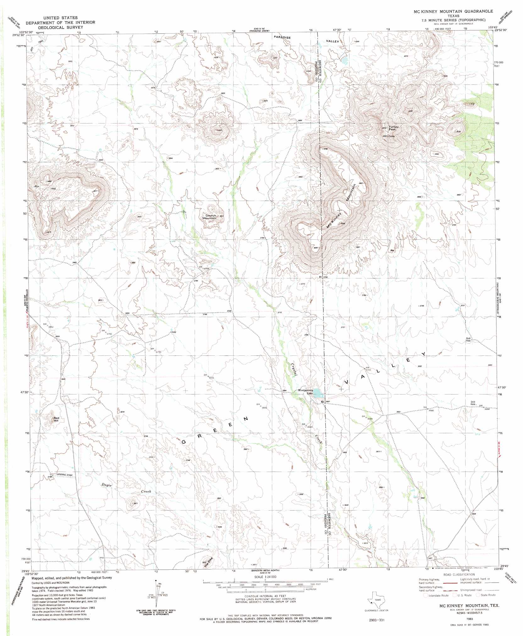
Mckinney Mountain Topo Map Texas
To zoom in, hover over the map of Mckinney Mountain
USGS Topo Quad 29103g7 - 1:24,000 scale
| Topo Map Name: | Mckinney Mountain |
| USGS Topo Quad ID: | 29103g7 |
| Print Size: | ca. 21 1/4" wide x 27" high |
| Southeast Coordinates: | 29.75° N latitude / 103.75° W longitude |
| Map Center Coordinates: | 29.8125° N latitude / 103.8125° W longitude |
| U.S. State: | TX |
| Filename: | o29103g7.jpg |
| Download Map JPG Image: | Mckinney Mountain topo map 1:24,000 scale |
| Map Type: | Topographic |
| Topo Series: | 7.5´ |
| Map Scale: | 1:24,000 |
| Source of Map Images: | United States Geological Survey (USGS) |
| Alternate Map Versions: |
McKinney Mountain TX 1983, updated 1984 Download PDF Buy paper map McKinney Mountain TX 2010 Download PDF Buy paper map McKinney Mountain TX 2012 Download PDF Buy paper map McKinney Mountain TX 2016 Download PDF Buy paper map |
1:24,000 Topo Quads surrounding Mckinney Mountain
Frenchman Hills |
Devils Den |
Cactus Flat |
Goat Mountain |
Elephant Mountain |
Plata Ne |
Jordan Gap |
Paradise Draw |
Duff Springs |
Whirlwind Spring |
Plata |
Puerto Potrillo |
Mckinney Mountain |
Straddlebug Mountain |
Buck Hill |
Casa Piedra |
Horseshoe Mountain |
Bandera Mesa North |
Long Hills |
Dog Canyon |
Manzanillo Canyon |
La Mota Mountain |
Bandero Mesa South |
Agua Fria Mountain |
Packsaddle Mountain |
> Back to 29103e1 at 1:100,000 scale
> Back to 29102a1 at 1:250,000 scale
> Back to U.S. Topo Maps home
Mckinney Mountain topo map: Gazetteer
Mckinney Mountain: Summits
Church Mountain elevation 1207m 3959′McKinney Mountain elevation 1523m 4996′
Red Hill elevation 1217m 3992′
Turney Peak elevation 1464m 4803′
Mckinney Mountain: Valleys
Paradise Valley elevation 1146m 3759′Mckinney Mountain digital topo map on disk
Buy this Mckinney Mountain topo map showing relief, roads, GPS coordinates and other geographical features, as a high-resolution digital map file on DVD: