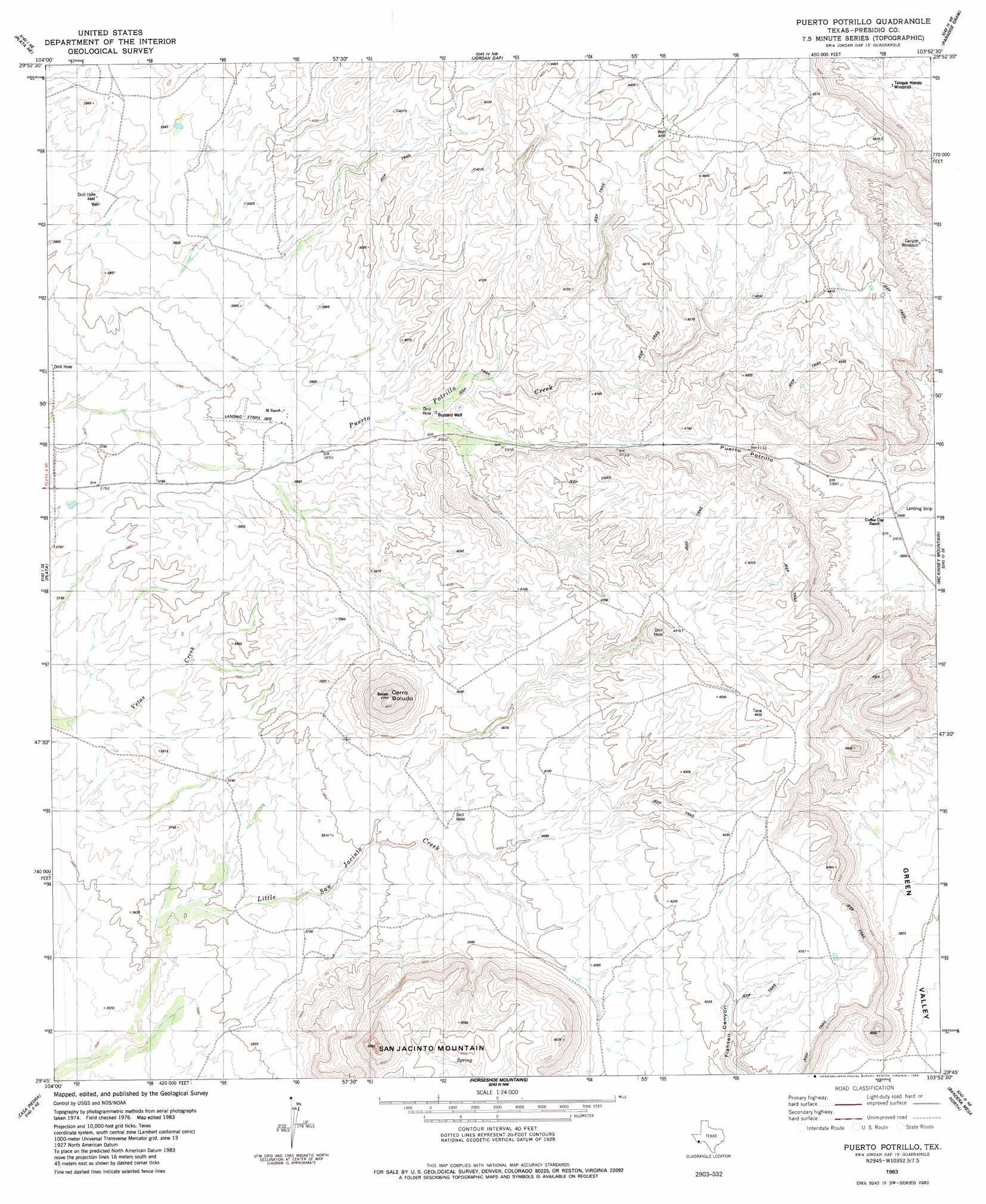
Puerto Potrillo Topo Map Texas
To zoom in, hover over the map of Puerto Potrillo
USGS Topo Quad 29103g8 - 1:24,000 scale
| Topo Map Name: | Puerto Potrillo |
| USGS Topo Quad ID: | 29103g8 |
| Print Size: | ca. 21 1/4" wide x 27" high |
| Southeast Coordinates: | 29.75° N latitude / 103.875° W longitude |
| Map Center Coordinates: | 29.8125° N latitude / 103.9375° W longitude |
| U.S. State: | TX |
| Filename: | o29103g8.jpg |
| Download Map JPG Image: | Puerto Potrillo topo map 1:24,000 scale |
| Map Type: | Topographic |
| Topo Series: | 7.5´ |
| Map Scale: | 1:24,000 |
| Source of Map Images: | United States Geological Survey (USGS) |
| Alternate Map Versions: |
Puerto Potrillo TX 1983, updated 1984 Download PDF Buy paper map Puerto Potrillo TX 2010 Download PDF Buy paper map Puerto Potrillo TX 2012 Download PDF Buy paper map Puerto Potrillo TX 2016 Download PDF Buy paper map |
1:24,000 Topo Quads surrounding Puerto Potrillo
San Estaban Lake Sw |
Frenchman Hills |
Devils Den |
Cactus Flat |
Goat Mountain |
Cerros Priestos |
Plata Ne |
Jordan Gap |
Paradise Draw |
Duff Springs |
Cienaga Mountains |
Plata |
Puerto Potrillo |
Mckinney Mountain |
Straddlebug Mountain |
Alamo Spring |
Casa Piedra |
Horseshoe Mountain |
Bandera Mesa North |
Long Hills |
Cerro Redondo |
Manzanillo Canyon |
La Mota Mountain |
Bandero Mesa South |
Agua Fria Mountain |
> Back to 29103e1 at 1:100,000 scale
> Back to 29102a1 at 1:250,000 scale
> Back to U.S. Topo Maps home
Puerto Potrillo topo map: Gazetteer
Puerto Potrillo: Gaps
Puerto Potrillo elevation 1244m 4081′Puerto Potrillo: Summits
Cerro Boludo elevation 1443m 4734′San Jacinto Mountain elevation 1493m 4898′
Puerto Potrillo digital topo map on disk
Buy this Puerto Potrillo topo map showing relief, roads, GPS coordinates and other geographical features, as a high-resolution digital map file on DVD: