Heart Mountain Topo Map Texas
To zoom in, hover over the map of Heart Mountain
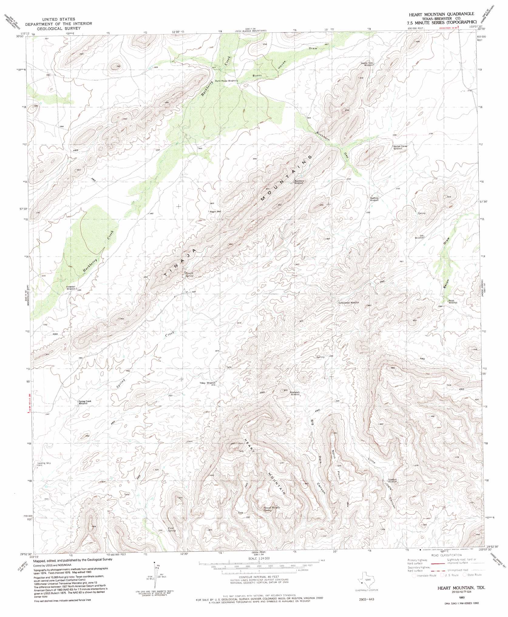
USGS Topo Quad 29103h2 - 1:24,000 scale
| Topo Map Name: | Heart Mountain |
| USGS Topo Quad ID: | 29103h2 |
| Print Size: | ca. 21 1/4" wide x 27" high |
| Southeast Coordinates: | 29.875° N latitude / 103.125° W longitude |
| Map Center Coordinates: | 29.9375° N latitude / 103.1875° W longitude |
| U.S. State: | TX |
| Filename: | o29103h2.jpg |
| Download Map JPG Image: | Heart Mountain topo map 1:24,000 scale |
| Map Type: | Topographic |
| Topo Series: | 7.5´ |
| Map Scale: | 1:24,000 |
| Source of Map Images: | United States Geological Survey (USGS) |
| Alternate Map Versions: |
Heart Mountain TX 1983, updated 1984 Download PDF Buy paper map Heart Mountain TX 1983, updated 1991 Download PDF Buy paper map Heart Mountain TX 2010 Download PDF Buy paper map Heart Mountain TX 2013 Download PDF Buy paper map Heart Mountain TX 2016 Download PDF Buy paper map |
1:24,000 Topo Quads surrounding Heart Mountain
Dugout Mountain |
Beckwith Hills |
Marathon |
Lightening Hills |
Housetop Mountains |
Rock House Gap |
Simpson Springs Mountain |
Pena Blanca Mountains |
Horse Mountain |
Tesnus |
Paso Del Norte |
Maravillas Gap |
Heart Mountain |
Hood Spring |
Pine Mountain West |
Santiago Peak |
Ye Mesa |
Sosa Peak |
Hood Spring Se |
Yellow House Peak |
Graytop |
Butterbowl |
Persimmon Gap |
Bone Spring Ne |
Stillwell Mountain |
> Back to 29103e1 at 1:100,000 scale
> Back to 29102a1 at 1:250,000 scale
> Back to U.S. Topo Maps home
Heart Mountain topo map: Gazetteer
Heart Mountain: Springs
Tinaja Spring elevation 1141m 3743′Tinaja Springs elevation 1047m 3435′
Heart Mountain: Summits
Tinaja Mountains elevation 1187m 3894′Heart Mountain digital topo map on disk
Buy this Heart Mountain topo map showing relief, roads, GPS coordinates and other geographical features, as a high-resolution digital map file on DVD: