Paradise Draw Topo Map Texas
To zoom in, hover over the map of Paradise Draw
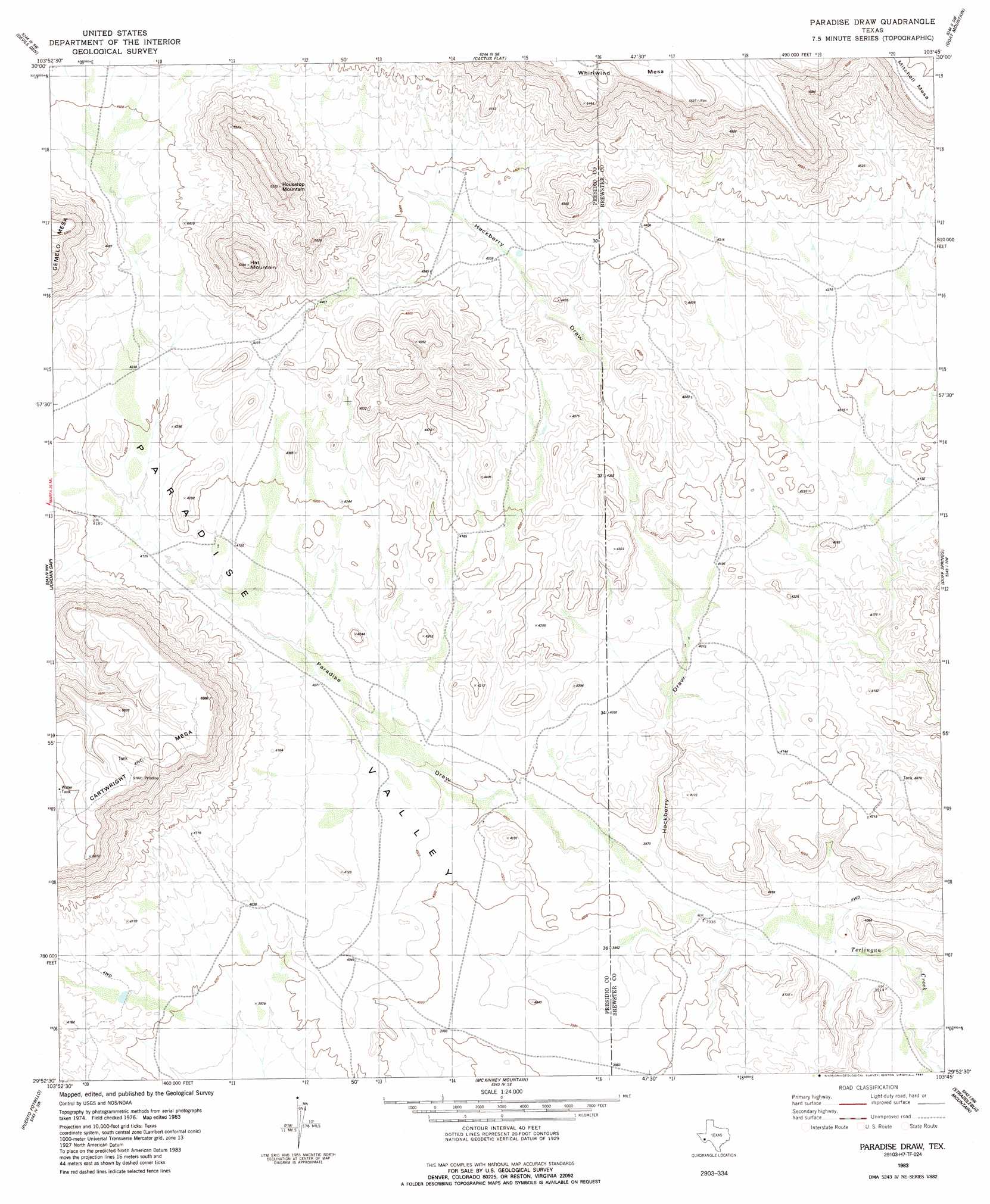
USGS Topo Quad 29103h7 - 1:24,000 scale
| Topo Map Name: | Paradise Draw |
| USGS Topo Quad ID: | 29103h7 |
| Print Size: | ca. 21 1/4" wide x 27" high |
| Southeast Coordinates: | 29.875° N latitude / 103.75° W longitude |
| Map Center Coordinates: | 29.9375° N latitude / 103.8125° W longitude |
| U.S. State: | TX |
| Filename: | o29103h7.jpg |
| Download Map JPG Image: | Paradise Draw topo map 1:24,000 scale |
| Map Type: | Topographic |
| Topo Series: | 7.5´ |
| Map Scale: | 1:24,000 |
| Source of Map Images: | United States Geological Survey (USGS) |
| Alternate Map Versions: |
Paradise Draw TX 1983, updated 1984 Download PDF Buy paper map Paradise Draw TX 1983, updated 1991 Download PDF Buy paper map Paradise Draw TX 2010 Download PDF Buy paper map Paradise Draw TX 2012 Download PDF Buy paper map Paradise Draw TX 2016 Download PDF Buy paper map |
1:24,000 Topo Quads surrounding Paradise Draw
San Estaban Lake |
Tinaja |
Tinaja Ne |
Cathedral Mountain |
Mount Ord |
Frenchman Hills |
Devils Den |
Cactus Flat |
Goat Mountain |
Elephant Mountain |
Plata Ne |
Jordan Gap |
Paradise Draw |
Duff Springs |
Whirlwind Spring |
Plata |
Puerto Potrillo |
Mckinney Mountain |
Straddlebug Mountain |
Buck Hill |
Casa Piedra |
Horseshoe Mountain |
Bandera Mesa North |
Long Hills |
Dog Canyon |
> Back to 29103e1 at 1:100,000 scale
> Back to 29102a1 at 1:250,000 scale
> Back to U.S. Topo Maps home
Paradise Draw topo map: Gazetteer
Paradise Draw: Summits
Gemelo Mesa elevation 1536m 5039′Hat Mountain elevation 1596m 5236′
Housetop Mountain elevation 1620m 5314′
Whirlwind Mesa elevation 1692m 5551′
Paradise Draw: Valleys
Hackberry Draw elevation 1215m 3986′Paradise Draw elevation 1210m 3969′
Paradise Draw digital topo map on disk
Buy this Paradise Draw topo map showing relief, roads, GPS coordinates and other geographical features, as a high-resolution digital map file on DVD: