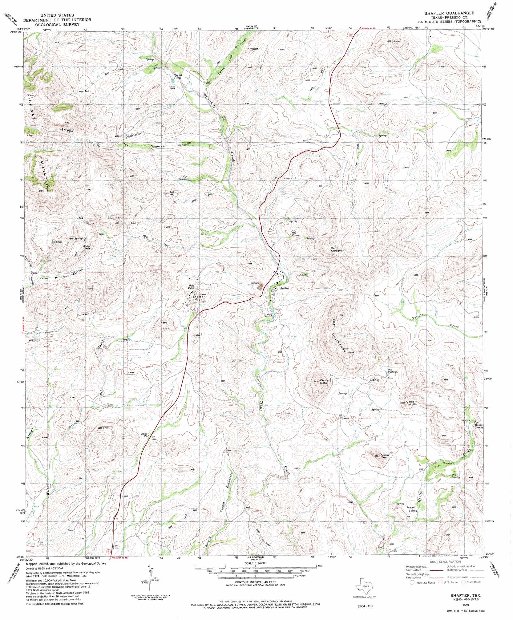
Shafter Topo Map Texas
To zoom in, hover over the map of Shafter
USGS Topo Quad 29104g3 - 1:24,000 scale
| Topo Map Name: | Shafter |
| USGS Topo Quad ID: | 29104g3 |
| Print Size: | ca. 21 1/4" wide x 27" high |
| Southeast Coordinates: | 29.75° N latitude / 104.25° W longitude |
| Map Center Coordinates: | 29.8125° N latitude / 104.3125° W longitude |
| U.S. State: | TX |
| Filename: | o29104g3.jpg |
| Download Map JPG Image: | Shafter topo map 1:24,000 scale |
| Map Type: | Topographic |
| Topo Series: | 7.5´ |
| Map Scale: | 1:24,000 |
| Source of Map Images: | United States Geological Survey (USGS) |
| Alternate Map Versions: |
Shafter TX 1983, updated 1983 Download PDF Buy paper map Shafter TX 2010 Download PDF Buy paper map Shafter TX 2012 Download PDF Buy paper map Shafter TX 2016 Download PDF Buy paper map |
1:24,000 Topo Quads surrounding Shafter
Ruidosa Hot Springs |
Cuesta Del Burro West |
Cuesta Del Burro East |
San Estaban Lake Sw |
Frenchman Hills |
Sierra Parda |
Chinati Peak |
Cieneguita |
Cerros Priestos |
Plata Ne |
Adobes |
Cerro Orona |
Shafter |
Cienaga Mountains |
Plata |
Indio |
Arroyo Melado |
La Boquilla |
Alamo Spring |
Casa Piedra |
Presidio West |
Presidio East |
Cerro Redondo |
Manzanillo Canyon |
> Back to 29104e1 at 1:100,000 scale
> Back to 29104a1 at 1:250,000 scale
> Back to U.S. Topo Maps home
Shafter topo map: Gazetteer
Shafter: Mines
Shafter Mine elevation 1240m 4068′Shafter: Populated Places
Shafter elevation 1189m 3900′Shafter: Summits
Cerro Tren elevation 1298m 4258′Shafter digital topo map on disk
Buy this Shafter topo map showing relief, roads, GPS coordinates and other geographical features, as a high-resolution digital map file on DVD: