Vado De Piedra Topo Map Texas
To zoom in, hover over the map of Vado De Piedra
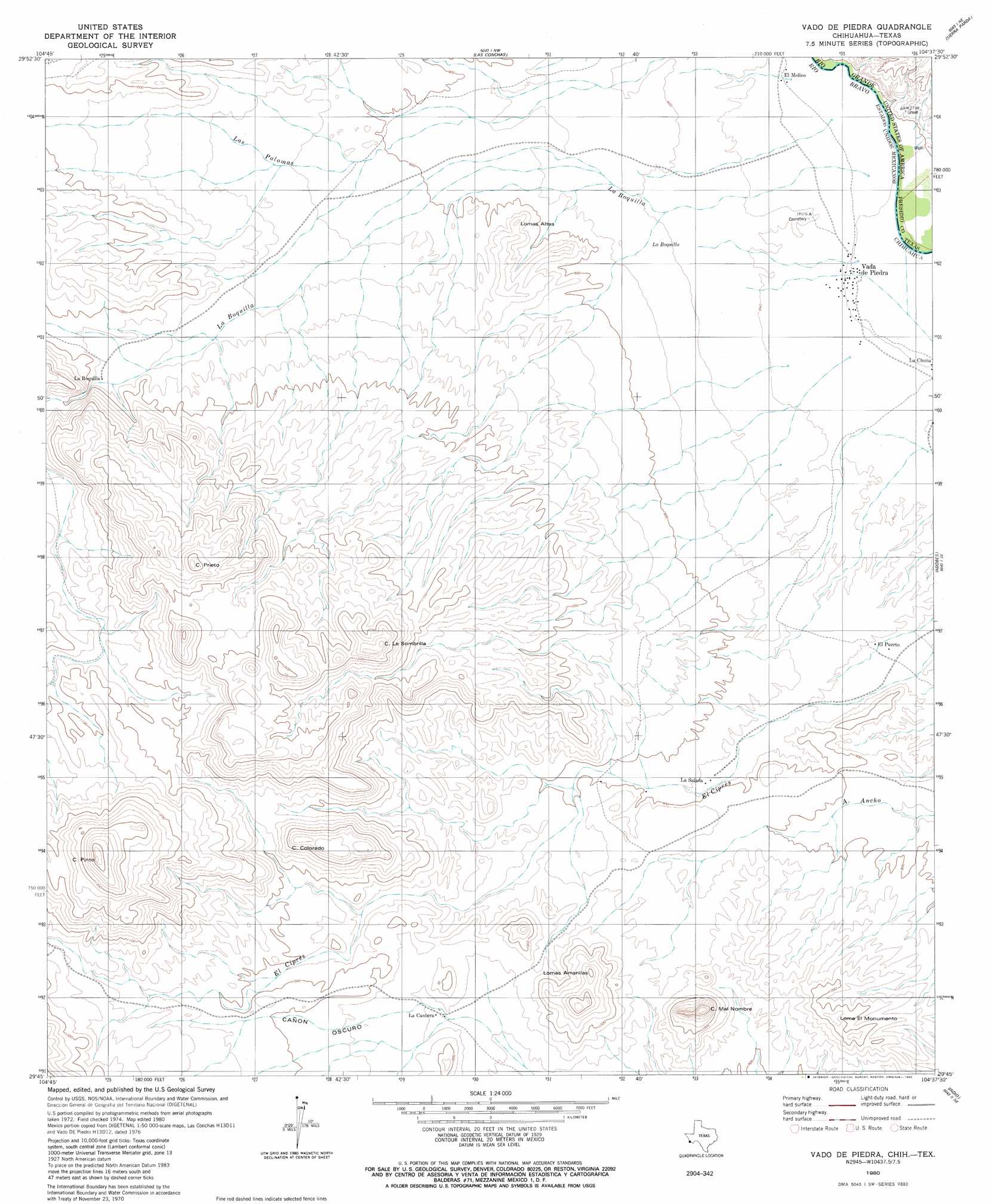
USGS Topo Quad 29104g6 - 1:24,000 scale
| Topo Map Name: | Vado De Piedra |
| USGS Topo Quad ID: | 29104g6 |
| Print Size: | ca. 21 1/4" wide x 27" high |
| Southeast Coordinates: | 29.75° N latitude / 104.625° W longitude |
| Map Center Coordinates: | 29.8125° N latitude / 104.6875° W longitude |
| U.S. State: | TX |
| Filename: | o29104g6.jpg |
| Download Map JPG Image: | Vado De Piedra topo map 1:24,000 scale |
| Map Type: | Topographic |
| Topo Series: | 7.5´ |
| Map Scale: | 1:24,000 |
| Source of Map Images: | United States Geological Survey (USGS) |
| Alternate Map Versions: |
Vado De Piedra TX 2010 Download PDF Buy paper map Vado De Piedra TX 2012 Download PDF Buy paper map Vado De Piedra TX 2016 Download PDF Buy paper map |
1:24,000 Topo Quads surrounding Vado De Piedra
Pueblo Nuevo |
Ruidosa Hot Springs |
Cuesta Del Burro West |
||
Las Conchas |
Sierra Parda |
Chinati Peak |
||
Vado De Piedra |
Adobes |
Cerro Orona |
||
Indio |
Arroyo Melado |
|||
Presidio West |
> Back to 29104e1 at 1:100,000 scale
> Back to 29104a1 at 1:250,000 scale
> Back to U.S. Topo Maps home
No gazetteer data is available for the Vado De Piedra topo map sheet.
Vado De Piedra digital topo map on disk
Buy this Vado De Piedra topo map showing relief, roads, GPS coordinates and other geographical features, as a high-resolution digital map file on DVD: