Hilliard Ne Topo Map Florida
To zoom in, hover over the map of Hilliard Ne
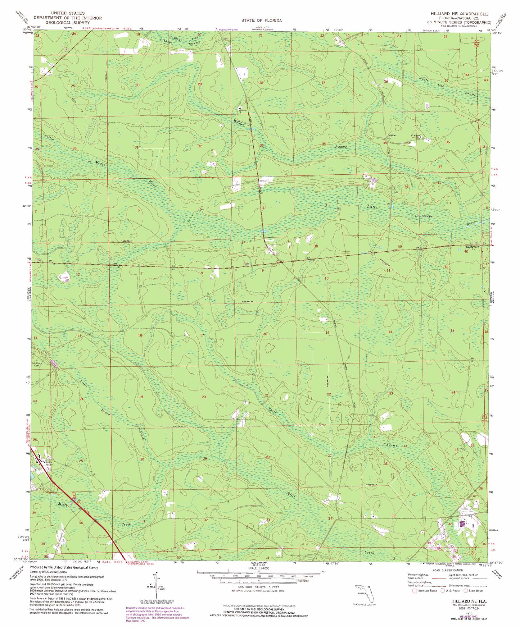
USGS Topo Quad 30081f7 - 1:24,000 scale
| Topo Map Name: | Hilliard Ne |
| USGS Topo Quad ID: | 30081f7 |
| Print Size: | ca. 21 1/4" wide x 27" high |
| Southeast Coordinates: | 30.625° N latitude / 81.75° W longitude |
| Map Center Coordinates: | 30.6875° N latitude / 81.8125° W longitude |
| U.S. State: | FL |
| Filename: | O30081F7.jpg |
| Download Map JPG Image: | Hilliard Ne topo map 1:24,000 scale |
| Map Type: | Topographic |
| Topo Series: | 7.5´ |
| Map Scale: | 1:24,000 |
| Source of Map Images: | United States Geological Survey (USGS) |
| Alternate Map Versions: |
Hilliard NE FL 1970, updated 1973 Download PDF Buy paper map Hilliard NE FL 1970, updated 1990 Download PDF Buy paper map Hilliard NE FL 1970, updated 1992 Download PDF Buy paper map Hilliard NE FL 2012 Download PDF Buy paper map Hilliard NE FL 2015 Download PDF Buy paper map |
1:24,000 Topo Quads surrounding Hilliard Ne
Newell |
Burnt Fort |
Jerusalem |
Woodbine |
Kingsland Ne |
Folkston |
Boulogne |
Kings Ferry |
Kingsland |
Harrietts Bluff |
Toledo |
Hilliard |
Hilliard Ne |
Gross |
Saint Marys |
Saint George |
Hilliard Sw |
Callahan |
Italia |
Hedges |
Macclenny Ne |
Bryceville |
Dinsmore |
Trout River |
Eastport |
> Back to 30081e1 at 1:100,000 scale
> Back to 30080a1 at 1:250,000 scale
> Back to U.S. Topo Maps home
Hilliard Ne topo map: Gazetteer
Hilliard Ne: Parks
Nassau Wildlife Management Area elevation 5m 16′Hilliard Ne: Populated Places
Evergreen elevation 3m 9′Lessie elevation 6m 19′
Hilliard Ne: Streams
Little Boggy Creek elevation 2m 6′Hilliard Ne: Swamps
Spell Swamp elevation 0m 0′White Oak Swamp elevation 2m 6′
Wilder Swamp elevation 3m 9′
Hilliard Ne digital topo map on disk
Buy this Hilliard Ne topo map showing relief, roads, GPS coordinates and other geographical features, as a high-resolution digital map file on DVD: