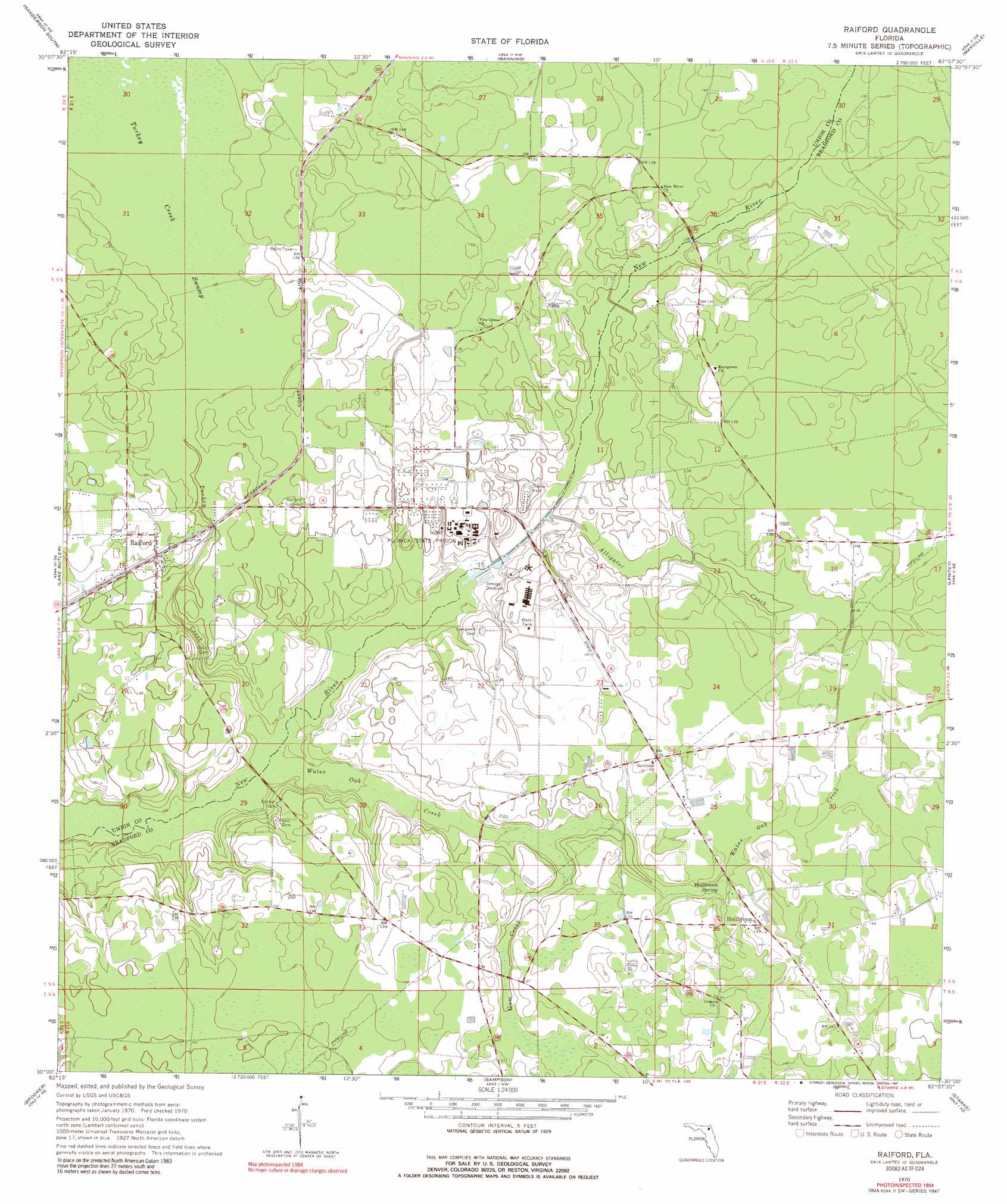
Raiford Topo Map Florida
To zoom in, hover over the map of Raiford
USGS Topo Quad 30082a2 - 1:24,000 scale
| Topo Map Name: | Raiford |
| USGS Topo Quad ID: | 30082a2 |
| Print Size: | ca. 21 1/4" wide x 27" high |
| Southeast Coordinates: | 30° N latitude / 82.125° W longitude |
| Map Center Coordinates: | 30.0625° N latitude / 82.1875° W longitude |
| U.S. State: | FL |
| Filename: | O30082A2.jpg |
| Download Map JPG Image: | Raiford topo map 1:24,000 scale |
| Map Type: | Topographic |
| Topo Series: | 7.5´ |
| Map Scale: | 1:24,000 |
| Source of Map Images: | United States Geological Survey (USGS) |
| Alternate Map Versions: |
Raiford FL 1970, updated 1973 Download PDF Buy paper map Raiford FL 1970, updated 1991 Download PDF Buy paper map Raiford FL 2012 Download PDF Buy paper map Raiford FL 2015 Download PDF Buy paper map |
1:24,000 Topo Quads surrounding Raiford
Big Gum Swamp |
Sanderson North |
Macclenny West |
Macclenny East |
Baldwin |
Olustee |
Sanderson South |
Manning |
Maxville |
Fiftone |
Lulu |
Lake Butler |
Raiford |
Lawtey |
Middleburg Sw |
Worthington Springs |
Brooker |
Sampson |
Starke |
Kingsley |
Alachua |
Monteocha |
Waldo |
Keystone Heights |
Gold Head Branch |
> Back to 30082a1 at 1:100,000 scale
> Back to 30082a1 at 1:250,000 scale
> Back to U.S. Topo Maps home
Raiford topo map: Gazetteer
Raiford: Airports
State Prison Field elevation 41m 134′Raiford: Parks
Lake Butler Wildlife Management Area Raiford Tract elevation 40m 131′Raiford: Populated Places
Ellerbee elevation 41m 134′Heilbronn elevation 42m 137′
Raiford elevation 40m 131′
Raiford: Springs
Heilbronn Spring elevation 39m 127′Raiford: Streams
Alligator Creek elevation 33m 108′Gum Creek elevation 36m 118′
Olustee Creek elevation 38m 124′
Turkey Creek elevation 32m 104′
Water Oak Creek elevation 31m 101′
Raiford: Swamps
Cattail Swamp elevation 41m 134′Turkey Creek Swamp elevation 41m 134′
Raiford digital topo map on disk
Buy this Raiford topo map showing relief, roads, GPS coordinates and other geographical features, as a high-resolution digital map file on DVD: