Columbia Topo Map Florida
To zoom in, hover over the map of Columbia
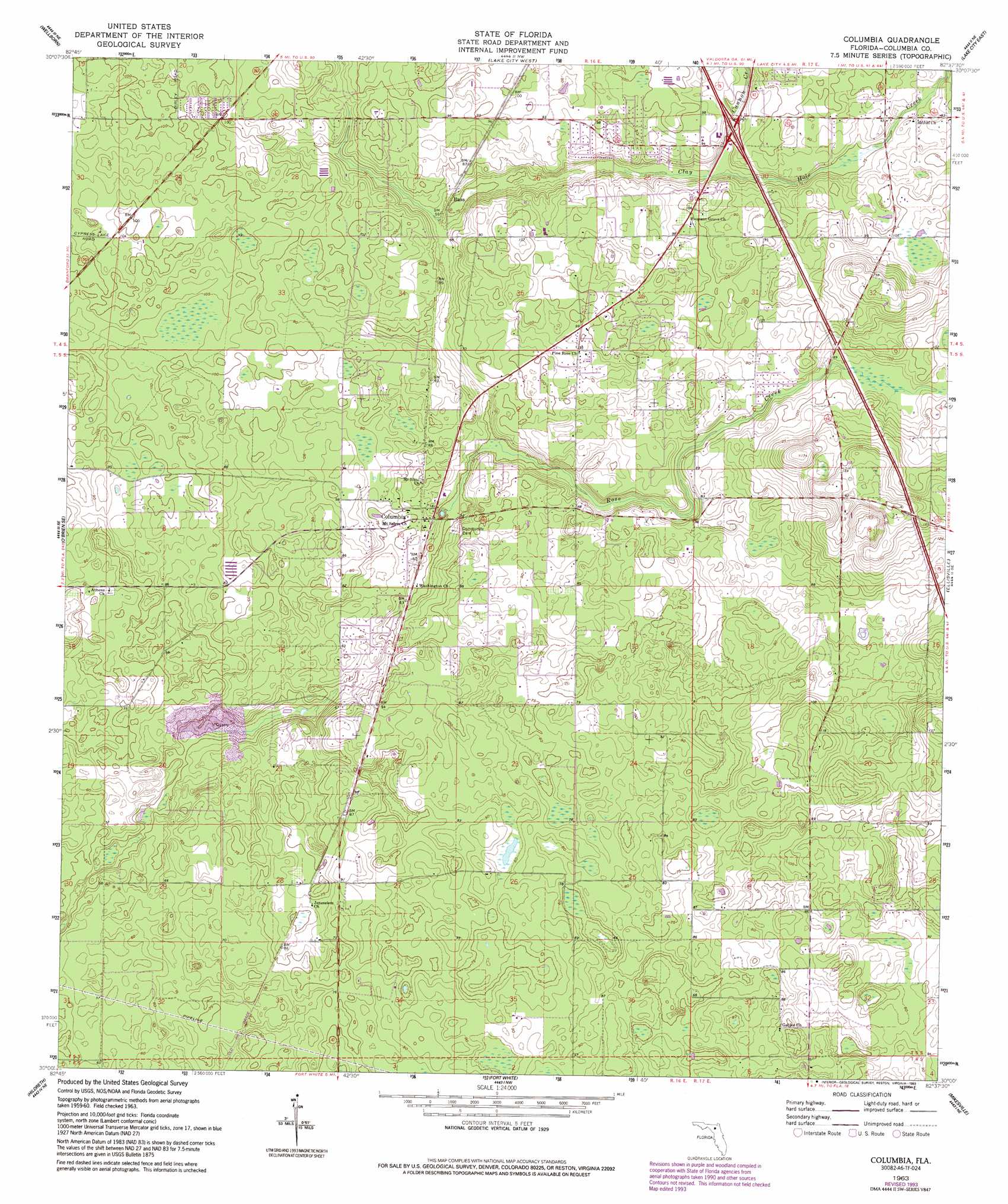
USGS Topo Quad 30082a6 - 1:24,000 scale
| Topo Map Name: | Columbia |
| USGS Topo Quad ID: | 30082a6 |
| Print Size: | ca. 21 1/4" wide x 27" high |
| Southeast Coordinates: | 30° N latitude / 82.625° W longitude |
| Map Center Coordinates: | 30.0625° N latitude / 82.6875° W longitude |
| U.S. State: | FL |
| Filename: | O30082A6.jpg |
| Download Map JPG Image: | Columbia topo map 1:24,000 scale |
| Map Type: | Topographic |
| Topo Series: | 7.5´ |
| Map Scale: | 1:24,000 |
| Source of Map Images: | United States Geological Survey (USGS) |
| Alternate Map Versions: |
Columbia FL 1963, updated 1965 Download PDF Buy paper map Columbia FL 1963, updated 1993 Download PDF Buy paper map Columbia FL 2012 Download PDF Buy paper map Columbia FL 2015 Download PDF Buy paper map |
1:24,000 Topo Quads surrounding Columbia
Live Oak East |
White Springs West |
White Springs East |
Deep Creek |
Big Gum Swamp |
Mcalpin |
Wellborn |
Lake City West |
Lake City East |
Olustee |
O'Brien |
O'Brien Se |
Columbia |
Ellisville |
Lulu |
Branford |
Hildreth |
Fort White |
Mikesville |
Worthington Springs |
Hatchbend |
Bell |
High Springs Sw |
High Springs |
Alachua |
> Back to 30082a1 at 1:100,000 scale
> Back to 30082a1 at 1:250,000 scale
> Back to U.S. Topo Maps home
Columbia topo map: Gazetteer
Columbia: Populated Places
Bass elevation 18m 59′Columbia elevation 20m 65′
Columbia: Streams
Cannon Creek elevation 19m 62′Clay Hole Creek elevation 17m 55′
Rose Creek elevation 10m 32′
Columbia digital topo map on disk
Buy this Columbia topo map showing relief, roads, GPS coordinates and other geographical features, as a high-resolution digital map file on DVD: