Mcalpin Topo Map Florida
To zoom in, hover over the map of Mcalpin
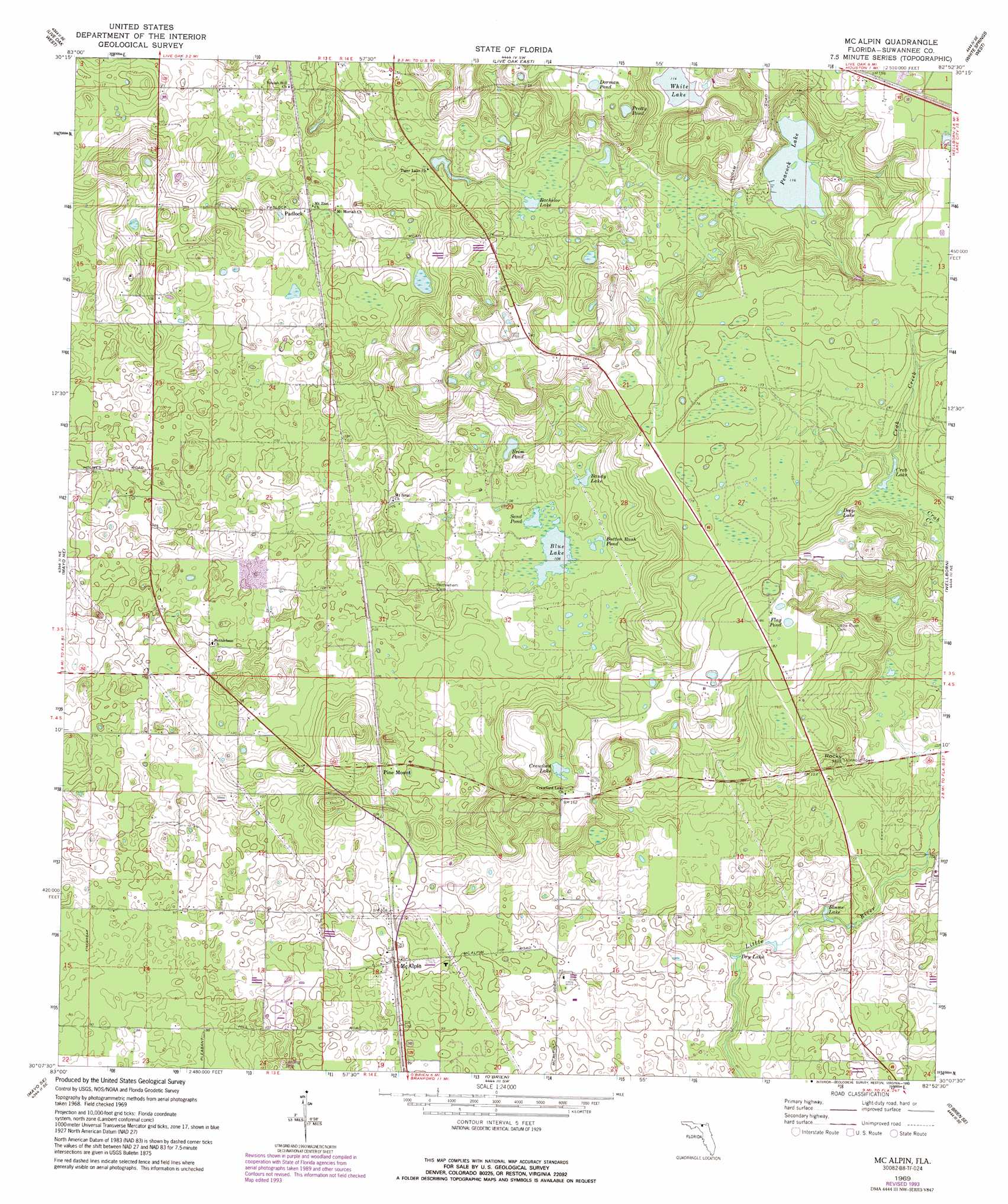
USGS Topo Quad 30082b8 - 1:24,000 scale
| Topo Map Name: | Mcalpin |
| USGS Topo Quad ID: | 30082b8 |
| Print Size: | ca. 21 1/4" wide x 27" high |
| Southeast Coordinates: | 30.125° N latitude / 82.875° W longitude |
| Map Center Coordinates: | 30.1875° N latitude / 82.9375° W longitude |
| U.S. State: | FL |
| Filename: | O30082B8.jpg |
| Download Map JPG Image: | Mcalpin topo map 1:24,000 scale |
| Map Type: | Topographic |
| Topo Series: | 7.5´ |
| Map Scale: | 1:24,000 |
| Source of Map Images: | United States Geological Survey (USGS) |
| Alternate Map Versions: |
McAlpin FL 1969, updated 1971 Download PDF Buy paper map McAlpin FL 1969, updated 1990 Download PDF Buy paper map McAlpin FL 1969, updated 1993 Download PDF Buy paper map McAlpin FL 2012 Download PDF Buy paper map McAlpin FL 2015 Download PDF Buy paper map |
1:24,000 Topo Quads surrounding Mcalpin
Ellaville |
Fort Union |
Hillcoat |
Genoa |
Benton |
Falmouth |
Live Oak West |
Live Oak East |
White Springs West |
White Springs East |
Dowling Park |
Mayo Ne |
Mcalpin |
Wellborn |
Lake City West |
Mayo |
Mayo Se |
O'Brien |
O'Brien Se |
Columbia |
Mallory Swamp Nw |
Mallory Swamp Ne |
Branford |
Hildreth |
Fort White |
> Back to 30082a1 at 1:100,000 scale
> Back to 30082a1 at 1:250,000 scale
> Back to U.S. Topo Maps home
Mcalpin topo map: Gazetteer
Mcalpin: Airports
Wright Farms Airport elevation 32m 104′Mcalpin: Lakes
Bachelor Lake elevation 33m 108′Bandy Lake elevation 33m 108′
Blue Lake elevation 32m 104′
Blume Lake elevation 27m 88′
Brim Pond elevation 33m 108′
Button Bush Pond elevation 33m 108′
Crab Lake elevation 42m 137′
Crawford Lake elevation 43m 141′
Deep Lake elevation 42m 137′
Dry Lake elevation 27m 88′
Flag Pond elevation 55m 180′
Peacock Lake elevation 35m 114′
White Lake elevation 35m 114′
Mcalpin: Populated Places
McAlpin elevation 31m 101′Padlock elevation 36m 118′
Pine Mount elevation 34m 111′
Mcalpin: Reservoirs
Dorman Pond elevation 52m 170′Pretty Pond elevation 46m 150′
Sand Pond elevation 32m 104′
Scott Pond elevation 47m 154′
Tiger Lake elevation 30m 98′
Mcalpin: Summits
Rocky Hill elevation 47m 154′Mcalpin digital topo map on disk
Buy this Mcalpin topo map showing relief, roads, GPS coordinates and other geographical features, as a high-resolution digital map file on DVD: