Benton Topo Map Florida
To zoom in, hover over the map of Benton
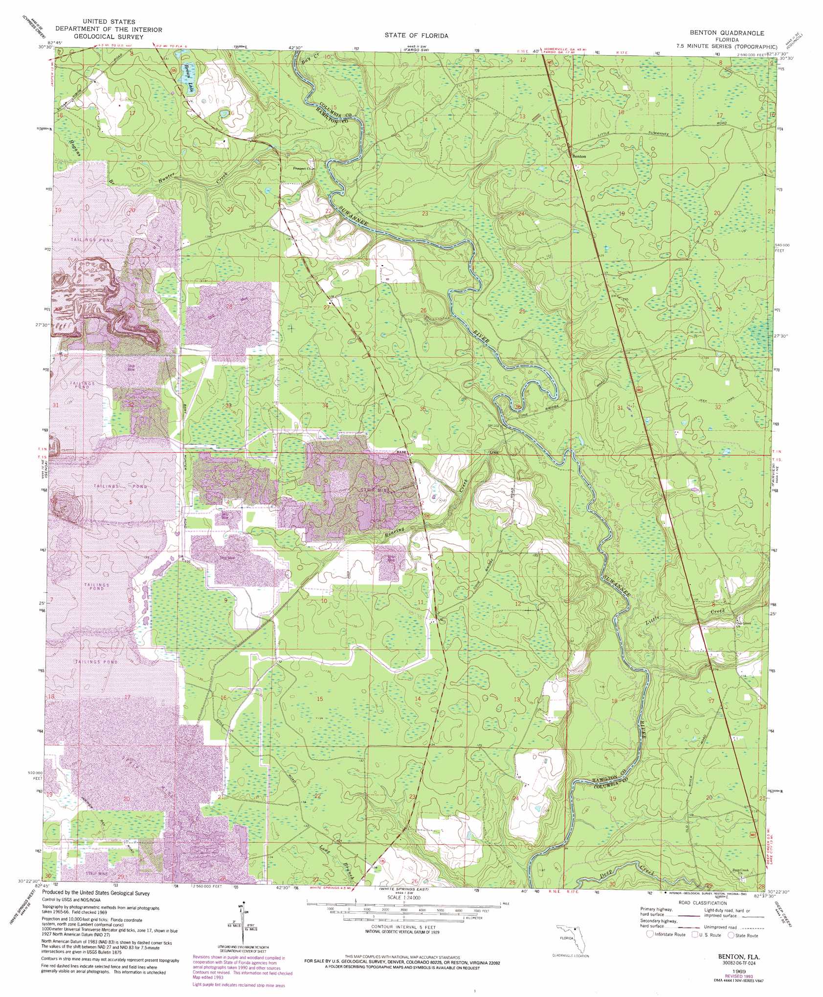
USGS Topo Quad 30082d6 - 1:24,000 scale
| Topo Map Name: | Benton |
| USGS Topo Quad ID: | 30082d6 |
| Print Size: | ca. 21 1/4" wide x 27" high |
| Southeast Coordinates: | 30.375° N latitude / 82.625° W longitude |
| Map Center Coordinates: | 30.4375° N latitude / 82.6875° W longitude |
| U.S. State: | FL |
| Filename: | O30082D6.jpg |
| Download Map JPG Image: | Benton topo map 1:24,000 scale |
| Map Type: | Topographic |
| Topo Series: | 7.5´ |
| Map Scale: | 1:24,000 |
| Source of Map Images: | United States Geological Survey (USGS) |
| Alternate Map Versions: |
Benton FL 1969, updated 1971 Download PDF Buy paper map Benton FL 1969, updated 1977 Download PDF Buy paper map Benton FL 1969, updated 1993 Download PDF Buy paper map Benton FL 2006, updated 2007 Download PDF Buy paper map Benton FL 2012 Download PDF Buy paper map Benton FL 2015 Download PDF Buy paper map |
| FStopo: | US Forest Service topo Benton is available: Download FStopo PDF Download FStopo TIF |
1:24,000 Topo Quads surrounding Benton
Tarver |
Pineland |
Needmore |
Fargo |
Strange Island |
Jasper |
Cypress Creek |
Fargo Sw |
Council |
Sargent |
Hillcoat |
Genoa |
Benton |
Fairview |
Sanderson Nw |
Live Oak East |
White Springs West |
White Springs East |
Deep Creek |
Big Gum Swamp |
Mcalpin |
Wellborn |
Lake City West |
Lake City East |
Olustee |
> Back to 30082a1 at 1:100,000 scale
> Back to 30082a1 at 1:250,000 scale
> Back to U.S. Topo Maps home
Benton topo map: Gazetteer
Benton: Lakes
Brown Lake elevation 37m 121′Benton: Populated Places
Benton elevation 38m 124′Benton: Streams
Bay Creek elevation 25m 82′Hogans Branch elevation 33m 108′
Hunter Creek elevation 24m 78′
Little Creek elevation 22m 72′
Roaring Creek elevation 23m 75′
Benton: Swamps
Hooker Bay elevation 40m 131′Benton digital topo map on disk
Buy this Benton topo map showing relief, roads, GPS coordinates and other geographical features, as a high-resolution digital map file on DVD: