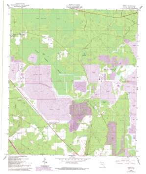
Genoa Topo Map Florida
To zoom in, hover over the map of Genoa
USGS Topo Quad 30082d7 - 1:24,000 scale
| Topo Map Name: | Genoa |
| USGS Topo Quad ID: | 30082d7 |
| Print Size: | ca. 21 1/4" wide x 27" high |
| Southeast Coordinates: | 30.375° N latitude / 82.75° W longitude |
| Map Center Coordinates: | 30.4375° N latitude / 82.8125° W longitude |
| U.S. State: | FL |
| Filename: | O30082D7.jpg |
| Download Map JPG Image: | Genoa topo map 1:24,000 scale |
| Map Type: | Topographic |
| Topo Series: | 7.5´ |
| Map Scale: | 1:24,000 |
| Source of Map Images: | United States Geological Survey (USGS) |
| Alternate Map Versions: |
Genoa FL 1962, updated 1963 Download PDF Buy paper map Genoa FL 1962, updated 1985 Download PDF Buy paper map Genoa FL 1962, updated 1993 Download PDF Buy paper map Genoa FL 2012 Download PDF Buy paper map Genoa FL 2015 Download PDF Buy paper map |
1:24,000 Topo Quads surrounding Genoa
> Back to 30082a1 at 1:100,000 scale
> Back to 30082a1 at 1:250,000 scale
> Back to U.S. Topo Maps home
Genoa topo map: Gazetteer
Genoa: Islands
Pine Island elevation 37m 121′Genoa: Lakes
Poole Pond elevation 39m 127′Genoa: Parks
Occidental Wildlife Management Area elevation 39m 127′Genoa: Populated Places
Belmont elevation 38m 124′Blacks Still elevation 40m 131′
Camps Still elevation 43m 141′
Genoa elevation 42m 137′
Purvis Still elevation 39m 127′
Genoa: Swamps
Altmans Bay elevation 36m 118′Cheshire Bay elevation 39m 127′
Hog Hammock elevation 39m 127′
Long Pond elevation 39m 127′
Swift Creek elevation 38m 124′
Swift Creek Swamp elevation 37m 121′
Genoa digital topo map on disk
Buy this Genoa topo map showing relief, roads, GPS coordinates and other geographical features, as a high-resolution digital map file on DVD:


