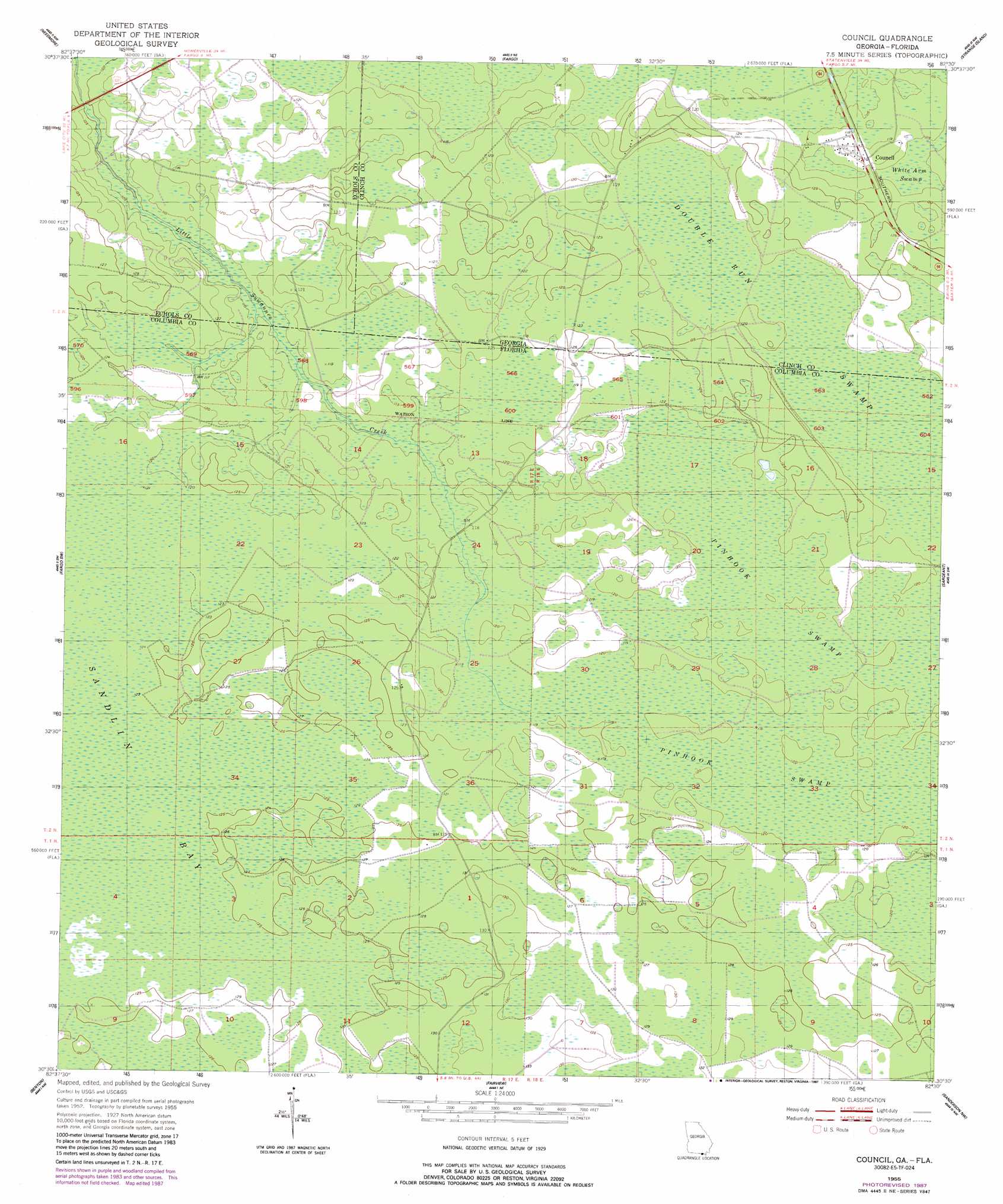
Council Topo Map Florida
To zoom in, hover over the map of Council
USGS Topo Quad 30082e5 - 1:24,000 scale
| Topo Map Name: | Council |
| USGS Topo Quad ID: | 30082e5 |
| Print Size: | ca. 21 1/4" wide x 27" high |
| Southeast Coordinates: | 30.5° N latitude / 82.5° W longitude |
| Map Center Coordinates: | 30.5625° N latitude / 82.5625° W longitude |
| U.S. States: | FL, GA |
| Filename: | O30082E5.jpg |
| Download Map JPG Image: | Council topo map 1:24,000 scale |
| Map Type: | Topographic |
| Topo Series: | 7.5´ |
| Map Scale: | 1:24,000 |
| Source of Map Images: | United States Geological Survey (USGS) |
| Alternate Map Versions: |
Council GA 1955, updated 1956 Download PDF Buy paper map Council GA 1955, updated 1956 Download PDF Buy paper map Council GA 1955, updated 1977 Download PDF Buy paper map Council GA 1955, updated 1987 Download PDF Buy paper map Council GA 1994, updated 1998 Download PDF Buy paper map Council GA 2006, updated 2007 Download PDF Buy paper map Council GA 2011 Download PDF Buy paper map Council GA 2014 Download PDF Buy paper map |
| FStopo: | US Forest Service topo Council is available: Download FStopo PDF Download FStopo TIF |
1:24,000 Topo Quads surrounding Council
Thelma |
Headlight |
Colon |
The Pocket |
Billys Island |
Pineland |
Needmore |
Fargo |
Strange Island |
Blackjack Island |
Cypress Creek |
Fargo Sw |
Council |
Sargent |
Eddy |
Genoa |
Benton |
Fairview |
Sanderson Nw |
Taylor |
White Springs West |
White Springs East |
Deep Creek |
Big Gum Swamp |
Sanderson North |
> Back to 30082e1 at 1:100,000 scale
> Back to 30082a1 at 1:250,000 scale
> Back to U.S. Topo Maps home
Council topo map: Gazetteer
Council: Populated Places
Council elevation 37m 121′Council: Swamps
Double Run Swamp elevation 36m 118′Double Run Swamp elevation 36m 118′
Council digital topo map on disk
Buy this Council topo map showing relief, roads, GPS coordinates and other geographical features, as a high-resolution digital map file on DVD: