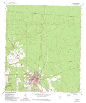
Jasper Topo Map Florida
To zoom in, hover over the map of Jasper
USGS Topo Quad 30082e8 - 1:24,000 scale
| Topo Map Name: | Jasper |
| USGS Topo Quad ID: | 30082e8 |
| Print Size: | ca. 21 1/4" wide x 27" high |
| Southeast Coordinates: | 30.5° N latitude / 82.875° W longitude |
| Map Center Coordinates: | 30.5625° N latitude / 82.9375° W longitude |
| U.S. States: | FL, GA |
| Filename: | O30082E8.jpg |
| Download Map JPG Image: | Jasper topo map 1:24,000 scale |
| Map Type: | Topographic |
| Topo Series: | 7.5´ |
| Map Scale: | 1:24,000 |
| Source of Map Images: | United States Geological Survey (USGS) |
| Alternate Map Versions: |
Jasper FL 1955, updated 1956 Download PDF Buy paper map Jasper FL 1955, updated 1977 Download PDF Buy paper map Jasper FL 1955, updated 1993 Download PDF Buy paper map Jasper FL 2011 Download PDF Buy paper map Jasper FL 2012 Download PDF Buy paper map Jasper FL 2015 Download PDF Buy paper map |
1:24,000 Topo Quads surrounding Jasper
> Back to 30082e1 at 1:100,000 scale
> Back to 30082a1 at 1:250,000 scale
> Back to U.S. Topo Maps home
Jasper topo map: Gazetteer
Jasper: Airports
Hamilton Helistop elevation 46m 150′Jasper: Lakes
Clardy Lakes elevation 21m 68′Jasper: Populated Places
Bakers Mill elevation 41m 134′Jasper elevation 46m 150′
Kennedy Still elevation 43m 141′
Rawls elevation 40m 131′
Jasper: Post Offices
Jasper Post Office elevation 46m 150′Jasper: Swamps
Bird Bay elevation 42m 137′Buzzard Bay elevation 41m 134′
Hires Bay elevation 43m 141′
Prairie Pond elevation 38m 124′
Roberts Pond elevation 35m 114′
Saw Hill Bay elevation 42m 137′
Schoolhouse Bay elevation 42m 137′
Shaky Pond elevation 38m 124′
Smith Bay elevation 43m 141′
Jasper digital topo map on disk
Buy this Jasper topo map showing relief, roads, GPS coordinates and other geographical features, as a high-resolution digital map file on DVD:


