Folkston Topo Map Georgia
To zoom in, hover over the map of Folkston
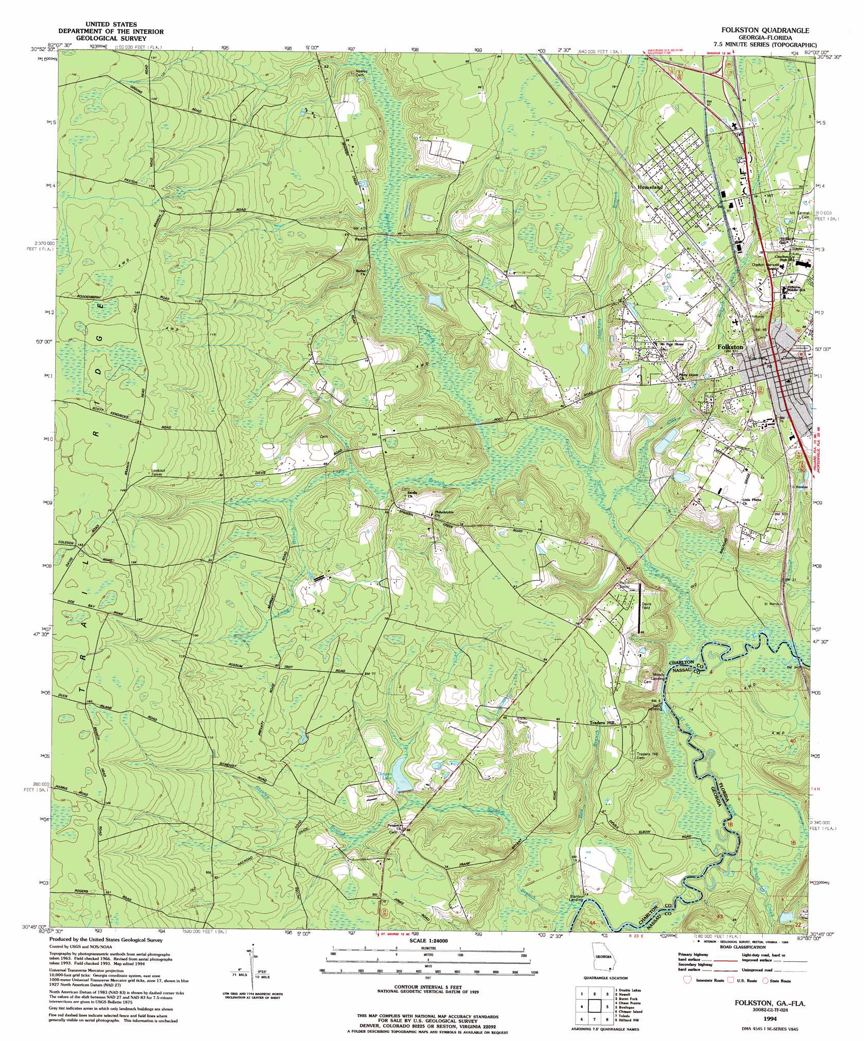
USGS Topo Quad 30082g1 - 1:24,000 scale
| Topo Map Name: | Folkston |
| USGS Topo Quad ID: | 30082g1 |
| Print Size: | ca. 21 1/4" wide x 27" high |
| Southeast Coordinates: | 30.75° N latitude / 82° W longitude |
| Map Center Coordinates: | 30.8125° N latitude / 82.0625° W longitude |
| U.S. States: | GA, FL |
| Filename: | o30082g1.jpg |
| Download Map JPG Image: | Folkston topo map 1:24,000 scale |
| Map Type: | Topographic |
| Topo Series: | 7.5´ |
| Map Scale: | 1:24,000 |
| Source of Map Images: | United States Geological Survey (USGS) |
| Alternate Map Versions: |
Folkston GA 1966, updated 1967 Download PDF Buy paper map Folkston GA 1966, updated 1981 Download PDF Buy paper map Folkston GA 1994, updated 1994 Download PDF Buy paper map Folkston GA 2011 Download PDF Buy paper map Folkston GA 2014 Download PDF Buy paper map |
1:24,000 Topo Quads surrounding Folkston
Waycross Se |
Fort Mudge |
Winokur |
Boons Lake |
Tarboro |
Dinner Pond |
Double Lakes |
Newell |
Burnt Fort |
Jerusalem |
Billys Island |
Chase Prairie |
Folkston |
Boulogne |
Kings Ferry |
Blackjack Island |
Chesser Island |
Toledo |
Hilliard |
Hilliard Ne |
Eddy |
Moniac |
Saint George |
Hilliard Sw |
Callahan |
> Back to 30082e1 at 1:100,000 scale
> Back to 30082a1 at 1:250,000 scale
> Back to U.S. Topo Maps home
Folkston topo map: Gazetteer
Folkston: Airports
Davis Field elevation 20m 65′Folkston: Dams
Charlton County Lake Dam elevation 8m 26′Gowen Lake Dam elevation 14m 45′
Folkston: Parks
Homeland Park elevation 24m 78′Folkston: Populated Places
Ferry Landing elevation 2m 6′Folkston elevation 24m 78′
Homeland elevation 29m 95′
Oakdale elevation 21m 68′
Paxton elevation 12m 39′
Stanley Landing elevation 2m 6′
Traders Hill elevation 23m 75′
Folkston: Reservoirs
Charlton County Lake elevation 8m 26′Gowen Lake elevation 14m 45′
Folkston: Ridges
Trail Ridge elevation 46m 150′Folkston: Streams
Ben Branch elevation 2m 6′Brush Creek elevation 1m 3′
Clay Branch elevation 3m 9′
Hatchers Branch elevation 4m 13′
Little Dunn Creek elevation 2m 6′
Long Branch elevation 6m 19′
Spanish Creek elevation 1m 3′
Stanley Branch elevation 2m 6′
Folkston digital topo map on disk
Buy this Folkston topo map showing relief, roads, GPS coordinates and other geographical features, as a high-resolution digital map file on DVD: