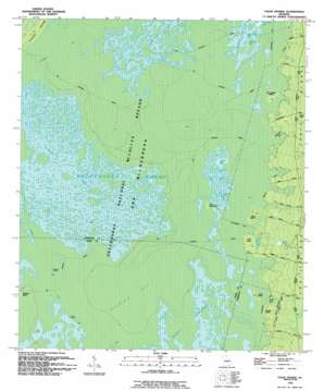
Chase Prairie Topo Map Georgia
To zoom in, hover over the map of Chase Prairie
USGS Topo Quad 30082g2 - 1:24,000 scale
| Topo Map Name: | Chase Prairie |
| USGS Topo Quad ID: | 30082g2 |
| Print Size: | ca. 21 1/4" wide x 27" high |
| Southeast Coordinates: | 30.75° N latitude / 82.125° W longitude |
| Map Center Coordinates: | 30.8125° N latitude / 82.1875° W longitude |
| U.S. State: | GA |
| Filename: | o30082g2.jpg |
| Download Map JPG Image: | Chase Prairie topo map 1:24,000 scale |
| Map Type: | Topographic |
| Topo Series: | 7.5´ |
| Map Scale: | 1:24,000 |
| Source of Map Images: | United States Geological Survey (USGS) |
| Alternate Map Versions: |
Chase Prairie GA 1965, updated 1967 Download PDF Buy paper map Chase Prairie GA 1994, updated 1994 Download PDF Buy paper map Chase Prairie GA 2011 Download PDF Buy paper map Chase Prairie GA 2014 Download PDF Buy paper map |
1:24,000 Topo Quads surrounding Chase Prairie
> Back to 30082e1 at 1:100,000 scale
> Back to 30082a1 at 1:250,000 scale
> Back to U.S. Topo Maps home
Chase Prairie topo map: Gazetteer
Chase Prairie: Canals
Cedar Hammock Canal elevation 36m 118′Suwannee Canal elevation 36m 118′
Chase Prairie: Islands
Cedar Hammock elevation 37m 121′Duck Island elevation 37m 121′
Indian Island elevation 38m 124′
Lloyd Island elevation 38m 124′
McDonald Island elevation 38m 124′
Chase Prairie: Lakes
Big Lake elevation 36m 118′Big Lake elevation 36m 118′
Boggy Lake elevation 37m 121′
Bush Lake elevation 37m 121′
Camphose Lake elevation 37m 121′
Christie Lake elevation 37m 121′
Dan Dunkins Lake elevation 35m 114′
Double Lakes elevation 37m 121′
Eagle Nest Lake elevation 37m 121′
Fishingpole Lake elevation 35m 114′
Galepost Lake elevation 36m 118′
Half Moon Lake elevation 37m 121′
House Lake elevation 37m 121′
Jack Lake elevation 35m 114′
Jack Lake elevation 37m 121′
Little Double Lakes elevation 37m 121′
Long Lake elevation 35m 114′
Long Lake elevation 35m 114′
Mandy Lake elevation 35m 114′
Sometime Hole elevation 35m 114′
Walter Lakes elevation 35m 114′
Chase Prairie: Populated Places
Silver Hill elevation 44m 144′Chase Prairie: Reservoirs
Davis Pond elevation 40m 131′Chase Prairie: Swamps
Chase Prairie elevation 35m 114′Christie Prairie elevation 37m 121′
Double O Bay elevation 36m 118′
Mizell Prairie elevation 36m 118′
Outside Bay elevation 38m 124′
Territory Prairie elevation 38m 124′
Chase Prairie digital topo map on disk
Buy this Chase Prairie topo map showing relief, roads, GPS coordinates and other geographical features, as a high-resolution digital map file on DVD:


