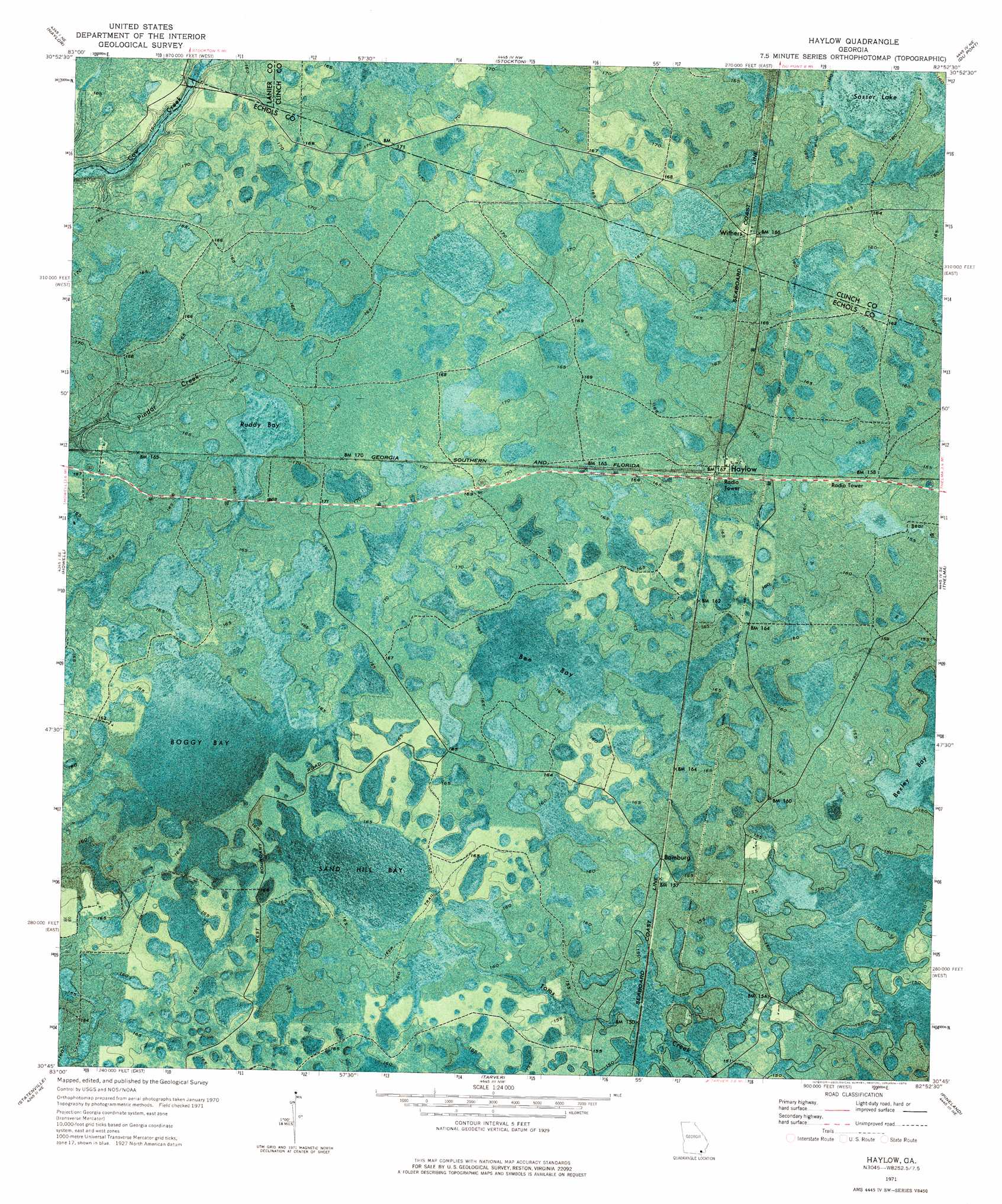
Haylow Topo Map Georgia
To zoom in, hover over the map of Haylow
USGS Topo Quad 30082g8 - 1:24,000 scale
| Topo Map Name: | Haylow |
| USGS Topo Quad ID: | 30082g8 |
| Print Size: | ca. 21 1/4" wide x 27" high |
| Southeast Coordinates: | 30.75° N latitude / 82.875° W longitude |
| Map Center Coordinates: | 30.8125° N latitude / 82.9375° W longitude |
| U.S. State: | GA |
| Filename: | p30082g8.jpg |
| Download Map JPG Image: | Haylow topo map 1:24,000 scale |
| Map Type: | Orthophoto |
| Topo Series: | 7.5´ |
| Map Scale: | 1:24,000 |
| Source of Map Images: | United States Geological Survey (USGS) |
| Alternate Map Versions: |
Haylow GA 1971, updated 1976 Download PDF Buy paper map Haylow GA 2011 Download PDF Buy paper map Haylow GA 2014 Download PDF Buy paper map |
1:24,000 Topo Quads surrounding Haylow
Ray City |
Lakeland |
Sirmans |
Homerville West |
Homerville East |
Bemiss |
Naylor |
Stockton |
Du Pont |
Midway |
Indianola |
Howell |
Haylow |
Thelma |
Headlight |
Lake Park |
Statenville |
Tarver |
Pineland |
Needmore |
Octahatchee |
Jennings |
Jasper |
Cypress Creek |
Fargo Sw |
> Back to 30082e1 at 1:100,000 scale
> Back to 30082a1 at 1:250,000 scale
> Back to U.S. Topo Maps home
Haylow topo map: Gazetteer
Haylow: Lakes
Sasser Lake elevation 48m 157′Haylow: Populated Places
Bamburg elevation 48m 157′Haylow elevation 50m 164′
Withers elevation 50m 164′
Haylow: Swamps
Bee Bay elevation 49m 160′Boggy Bay elevation 49m 160′
Ruddy Bay elevation 50m 164′
Sand Hill Bay elevation 49m 160′
Haylow digital topo map on disk
Buy this Haylow topo map showing relief, roads, GPS coordinates and other geographical features, as a high-resolution digital map file on DVD: