Midway Topo Map Georgia
To zoom in, hover over the map of Midway
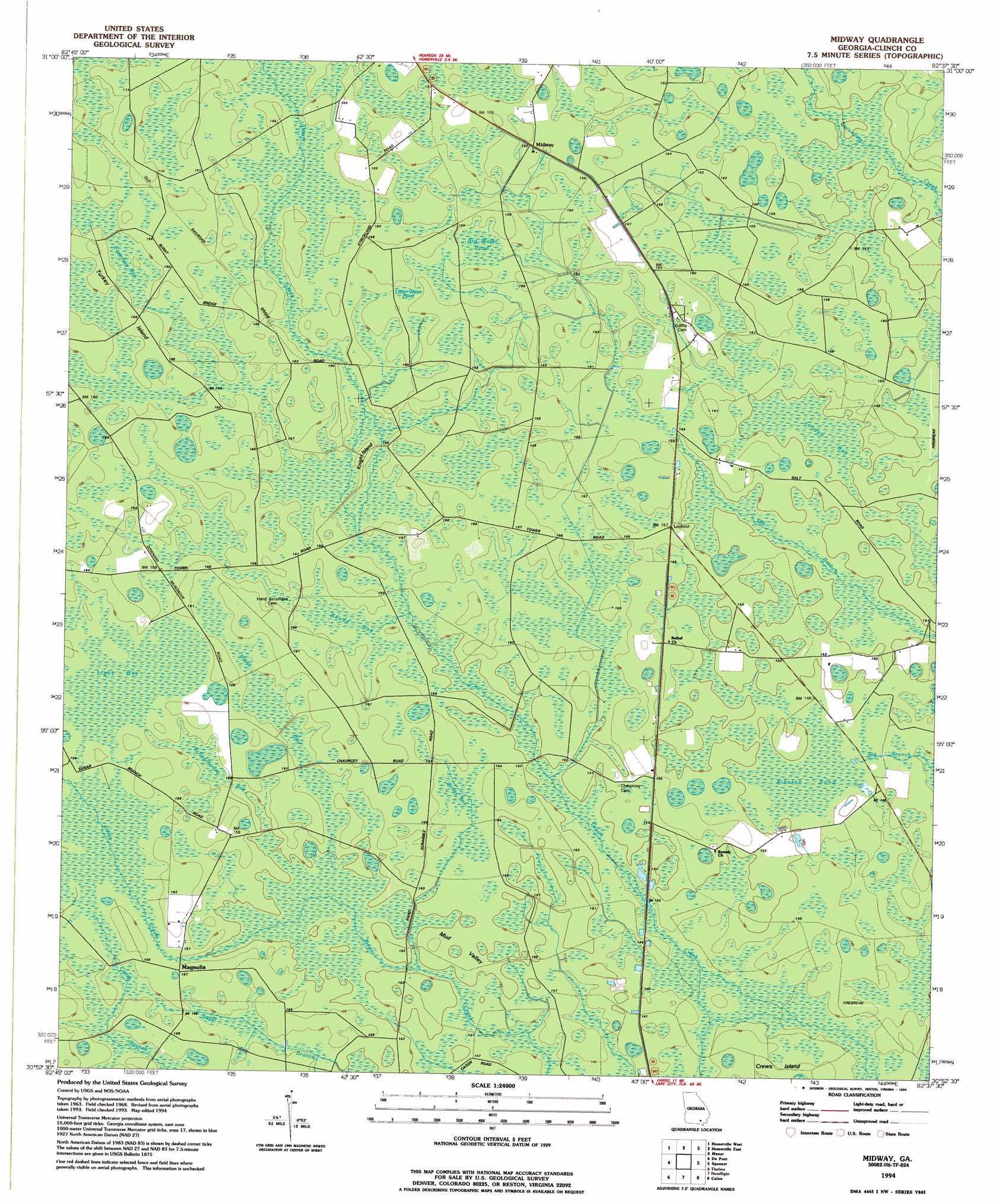
USGS Topo Quad 30082h6 - 1:24,000 scale
| Topo Map Name: | Midway |
| USGS Topo Quad ID: | 30082h6 |
| Print Size: | ca. 21 1/4" wide x 27" high |
| Southeast Coordinates: | 30.875° N latitude / 82.625° W longitude |
| Map Center Coordinates: | 30.9375° N latitude / 82.6875° W longitude |
| U.S. State: | GA |
| Filename: | o30082h6.jpg |
| Download Map JPG Image: | Midway topo map 1:24,000 scale |
| Map Type: | Topographic |
| Topo Series: | 7.5´ |
| Map Scale: | 1:24,000 |
| Source of Map Images: | United States Geological Survey (USGS) |
| Alternate Map Versions: |
Midway GA 1968, updated 1970 Download PDF Buy paper map Midway GA 1994, updated 1994 Download PDF Buy paper map Midway GA 2011 Download PDF Buy paper map Midway GA 2014 Download PDF Buy paper map |
1:24,000 Topo Quads surrounding Midway
Henderson Still |
Sandy Bottom |
Cogdell |
Pine Valley |
Waycross West |
Sirmans |
Homerville West |
Homerville East |
Manor |
Waycross Sw |
Stockton |
Du Pont |
Midway |
Spooner |
Cravens Island |
Haylow |
Thelma |
Headlight |
Colon |
The Pocket |
Tarver |
Pineland |
Needmore |
Fargo |
Strange Island |
> Back to 30082e1 at 1:100,000 scale
> Back to 30082a1 at 1:250,000 scale
> Back to U.S. Topo Maps home
Midway topo map: Gazetteer
Midway: Areas
Mud Valley elevation 45m 147′Midway: Bays
Tower Bay elevation 45m 147′Midway: Islands
Knight Island elevation 47m 154′Turkey Island elevation 50m 164′
Midway: Lakes
Little Water Pond elevation 50m 164′Midway: Populated Places
Chauncey elevation 47m 154′Magnolia elevation 47m 154′
Midway elevation 50m 164′
Midway: Swamps
Beede Bay elevation 46m 150′Big Water Pond elevation 49m 160′
Briary Bay elevation 47m 154′
Foreman Bay elevation 50m 164′
Jordan Bay elevation 45m 147′
Light Bay elevation 48m 157′
Piney Bay elevation 46m 150′
Riberon Pond elevation 45m 147′
Schoolhouse Bay elevation 47m 154′
Midway digital topo map on disk
Buy this Midway topo map showing relief, roads, GPS coordinates and other geographical features, as a high-resolution digital map file on DVD: