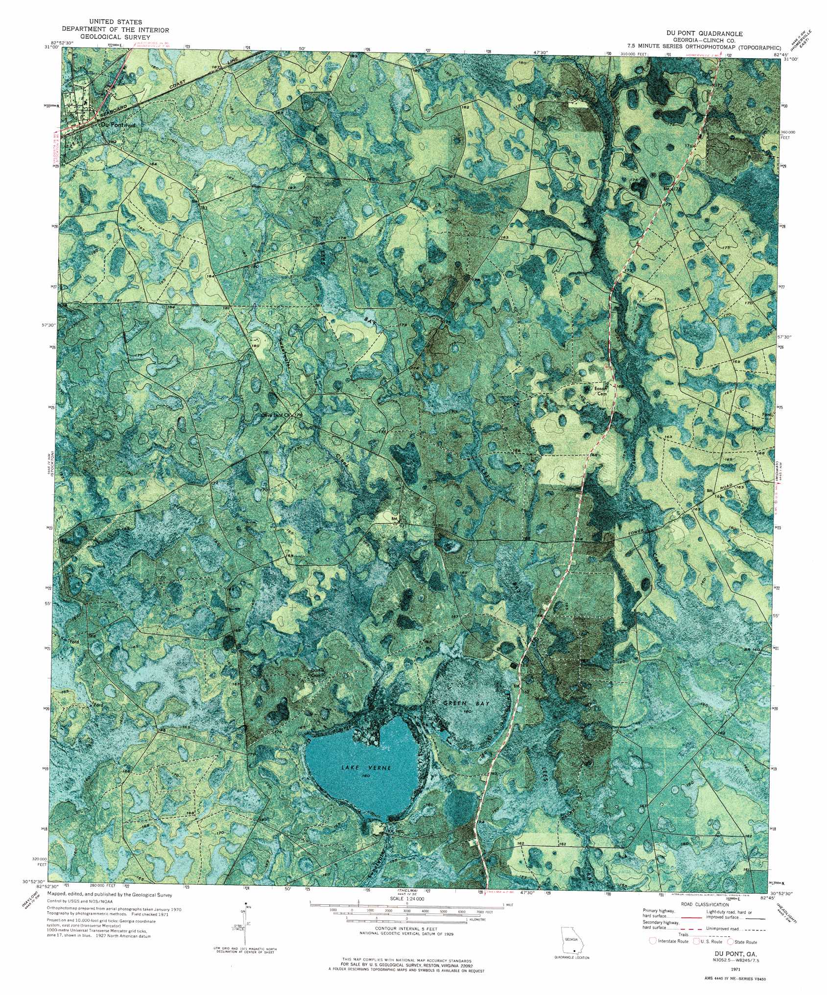
Du Pont Topo Map Georgia
To zoom in, hover over the map of Du Pont
USGS Topo Quad 30082h7 - 1:24,000 scale
| Topo Map Name: | Du Pont |
| USGS Topo Quad ID: | 30082h7 |
| Print Size: | ca. 21 1/4" wide x 27" high |
| Southeast Coordinates: | 30.875° N latitude / 82.75° W longitude |
| Map Center Coordinates: | 30.9375° N latitude / 82.8125° W longitude |
| U.S. State: | GA |
| Filename: | p30082h7.jpg |
| Download Map JPG Image: | Du Pont topo map 1:24,000 scale |
| Map Type: | Orthophoto |
| Topo Series: | 7.5´ |
| Map Scale: | 1:24,000 |
| Source of Map Images: | United States Geological Survey (USGS) |
| Alternate Map Versions: |
Du Pont GA 1971, updated 1976 Download PDF Buy paper map Du Pont GA 2011 Download PDF Buy paper map Du Pont GA 2014 Download PDF Buy paper map |
1:24,000 Topo Quads surrounding Du Pont
Hastings Fish Pond |
Henderson Still |
Sandy Bottom |
Cogdell |
Pine Valley |
Lakeland |
Sirmans |
Homerville West |
Homerville East |
Manor |
Naylor |
Stockton |
Du Pont |
Midway |
Spooner |
Howell |
Haylow |
Thelma |
Headlight |
Colon |
Statenville |
Tarver |
Pineland |
Needmore |
Fargo |
> Back to 30082e1 at 1:100,000 scale
> Back to 30082a1 at 1:250,000 scale
> Back to U.S. Topo Maps home
Du Pont topo map: Gazetteer
Du Pont: Dams
Lake Verne Dam elevation 49m 160′Du Pont: Lakes
Lake Verne elevation 49m 160′Du Pont: Populated Places
Du Pont elevation 56m 183′Du Pont: Reservoirs
Lake Verne elevation 49m 160′Du Pont: Swamps
Green Bay elevation 49m 160′Du Pont digital topo map on disk
Buy this Du Pont topo map showing relief, roads, GPS coordinates and other geographical features, as a high-resolution digital map file on DVD: