Live Oak West Topo Map Florida
To zoom in, hover over the map of Live Oak West
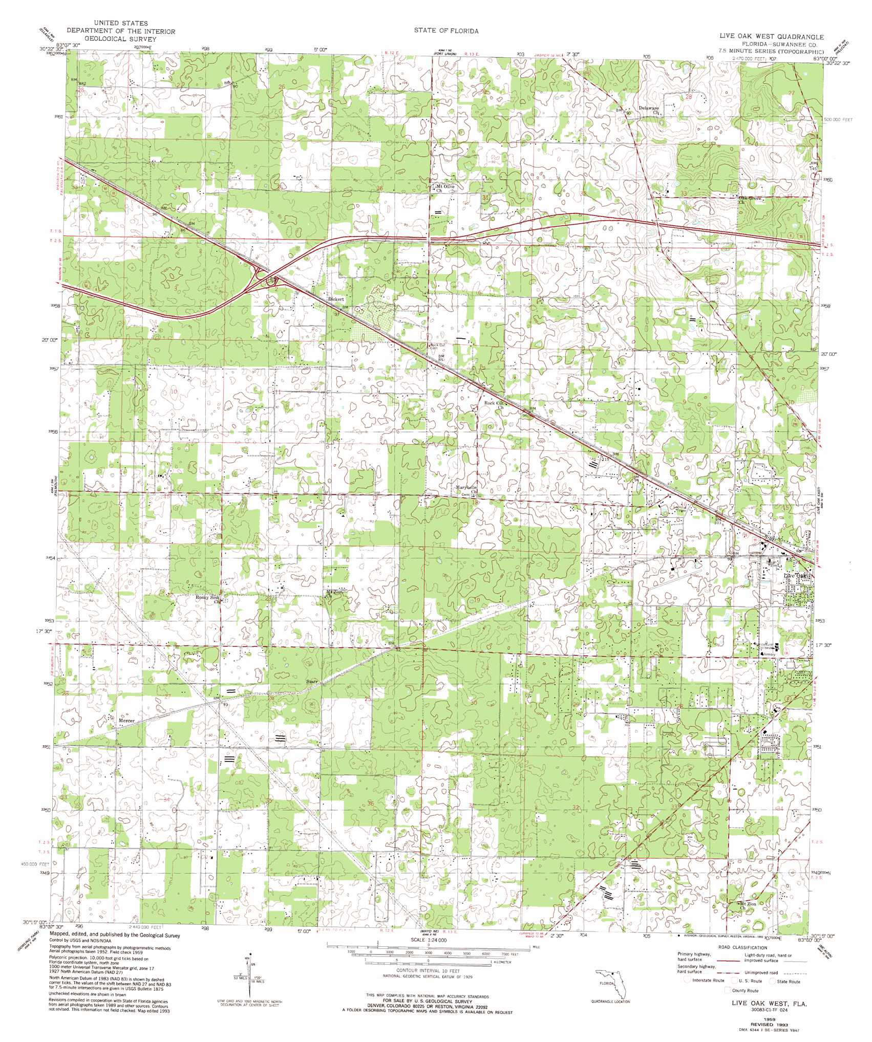
USGS Topo Quad 30083c1 - 1:24,000 scale
| Topo Map Name: | Live Oak West |
| USGS Topo Quad ID: | 30083c1 |
| Print Size: | ca. 21 1/4" wide x 27" high |
| Southeast Coordinates: | 30.25° N latitude / 83° W longitude |
| Map Center Coordinates: | 30.3125° N latitude / 83.0625° W longitude |
| U.S. State: | FL |
| Filename: | O30083C1.jpg |
| Download Map JPG Image: | Live Oak West topo map 1:24,000 scale |
| Map Type: | Topographic |
| Topo Series: | 7.5´ |
| Map Scale: | 1:24,000 |
| Source of Map Images: | United States Geological Survey (USGS) |
| Alternate Map Versions: |
Live Oak West FL 1959, updated 1960 Download PDF Buy paper map Live Oak West FL 1959, updated 1977 Download PDF Buy paper map Live Oak West FL 1959, updated 1993 Download PDF Buy paper map Live Oak West FL 2012 Download PDF Buy paper map Live Oak West FL 2015 Download PDF Buy paper map |
1:24,000 Topo Quads surrounding Live Oak West
Pinetta |
Octahatchee |
Jennings |
Jasper |
Cypress Creek |
Lee |
Ellaville |
Fort Union |
Hillcoat |
Genoa |
Madison Se |
Falmouth |
Live Oak West |
Live Oak East |
White Springs West |
Day |
Dowling Park |
Mayo Ne |
Mcalpin |
Wellborn |
Day Se |
Mayo |
Mayo Se |
O'Brien |
O'Brien Se |
> Back to 30083a1 at 1:100,000 scale
> Back to 30082a1 at 1:250,000 scale
> Back to U.S. Topo Maps home
Live Oak West topo map: Gazetteer
Live Oak West: Airports
Suwannee County Airport elevation 30m 98′Suwannee Hospital Emergency Heliport elevation 28m 91′
Live Oak West: Populated Places
Dickert elevation 28m 91′Mercer elevation 29m 95′
Starr elevation 23m 75′
Wayne Friers Mobile Home Park elevation 30m 98′
Live Oak West digital topo map on disk
Buy this Live Oak West topo map showing relief, roads, GPS coordinates and other geographical features, as a high-resolution digital map file on DVD: