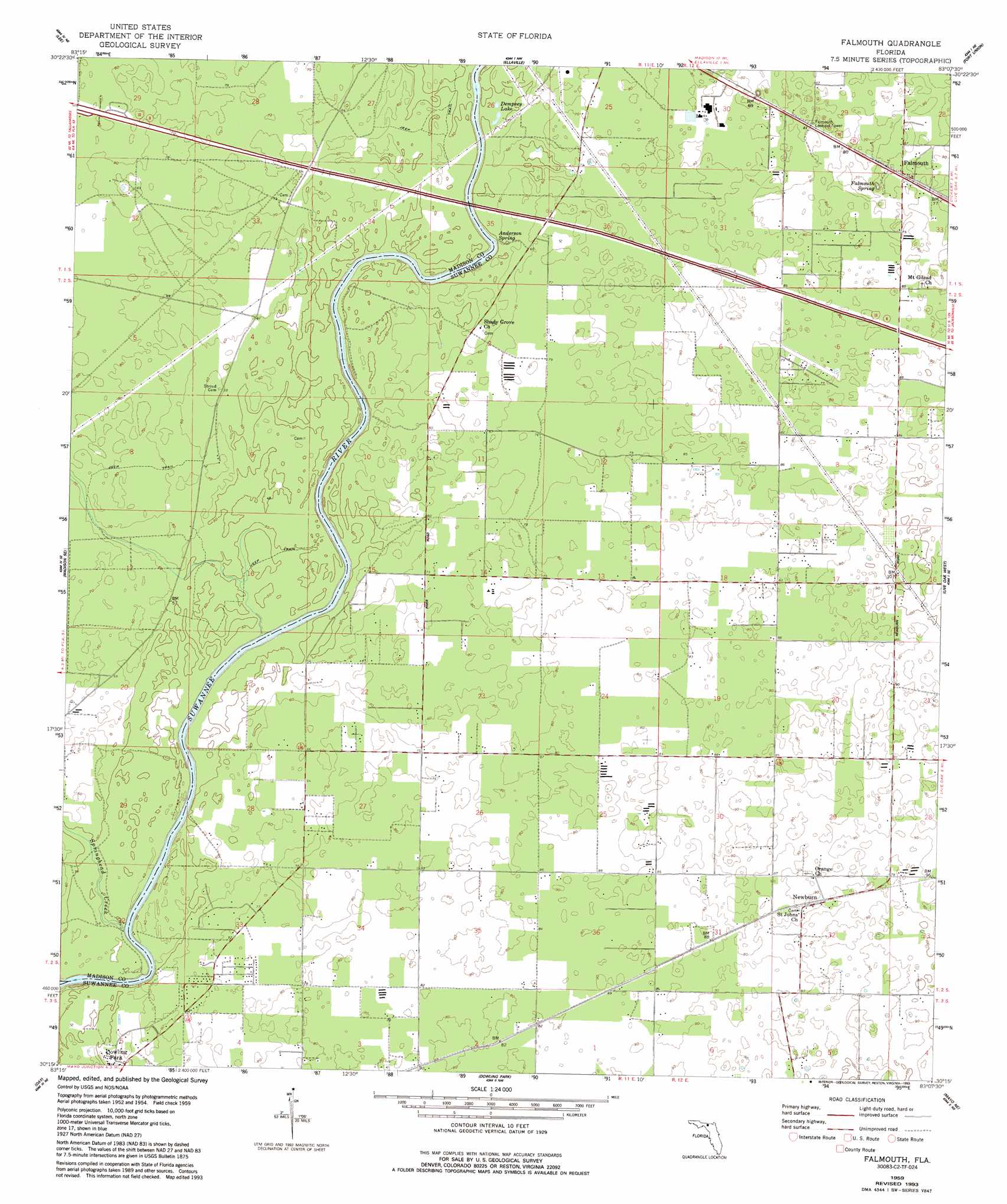
Falmouth Topo Map Florida
To zoom in, hover over the map of Falmouth
USGS Topo Quad 30083c2 - 1:24,000 scale
| Topo Map Name: | Falmouth |
| USGS Topo Quad ID: | 30083c2 |
| Print Size: | ca. 21 1/4" wide x 27" high |
| Southeast Coordinates: | 30.25° N latitude / 83.125° W longitude |
| Map Center Coordinates: | 30.3125° N latitude / 83.1875° W longitude |
| U.S. State: | FL |
| Filename: | O30083C2.jpg |
| Download Map JPG Image: | Falmouth topo map 1:24,000 scale |
| Map Type: | Topographic |
| Topo Series: | 7.5´ |
| Map Scale: | 1:24,000 |
| Source of Map Images: | United States Geological Survey (USGS) |
| Alternate Map Versions: |
Falmouth FL 1959, updated 1960 Download PDF Buy paper map Falmouth FL 1959, updated 1977 Download PDF Buy paper map Falmouth FL 1959, updated 1993 Download PDF Buy paper map Falmouth FL 2012 Download PDF Buy paper map Falmouth FL 2015 Download PDF Buy paper map |
1:24,000 Topo Quads surrounding Falmouth
Cherry Lake |
Pinetta |
Octahatchee |
Jennings |
Jasper |
Madison |
Lee |
Ellaville |
Fort Union |
Hillcoat |
Madison Sw |
Madison Se |
Falmouth |
Live Oak West |
Live Oak East |
Day Nw |
Day |
Dowling Park |
Mayo Ne |
Mcalpin |
Fenholloway |
Day Se |
Mayo |
Mayo Se |
O'Brien |
> Back to 30083a1 at 1:100,000 scale
> Back to 30082a1 at 1:250,000 scale
> Back to U.S. Topo Maps home
Falmouth topo map: Gazetteer
Falmouth: Airports
Kittyhawk Estates Airport elevation 24m 78′Falmouth: Lakes
Dempsey Lake elevation 15m 49′Falmouth: Populated Places
Falmouth elevation 26m 85′Newburn elevation 27m 88′
Falmouth: Springs
Anderson Spring elevation 17m 55′Falmouth Spring elevation 19m 62′
Falmouth: Streams
Springhead Creek elevation 8m 26′Falmouth digital topo map on disk
Buy this Falmouth topo map showing relief, roads, GPS coordinates and other geographical features, as a high-resolution digital map file on DVD: