Fort Union Topo Map Florida
To zoom in, hover over the map of Fort Union
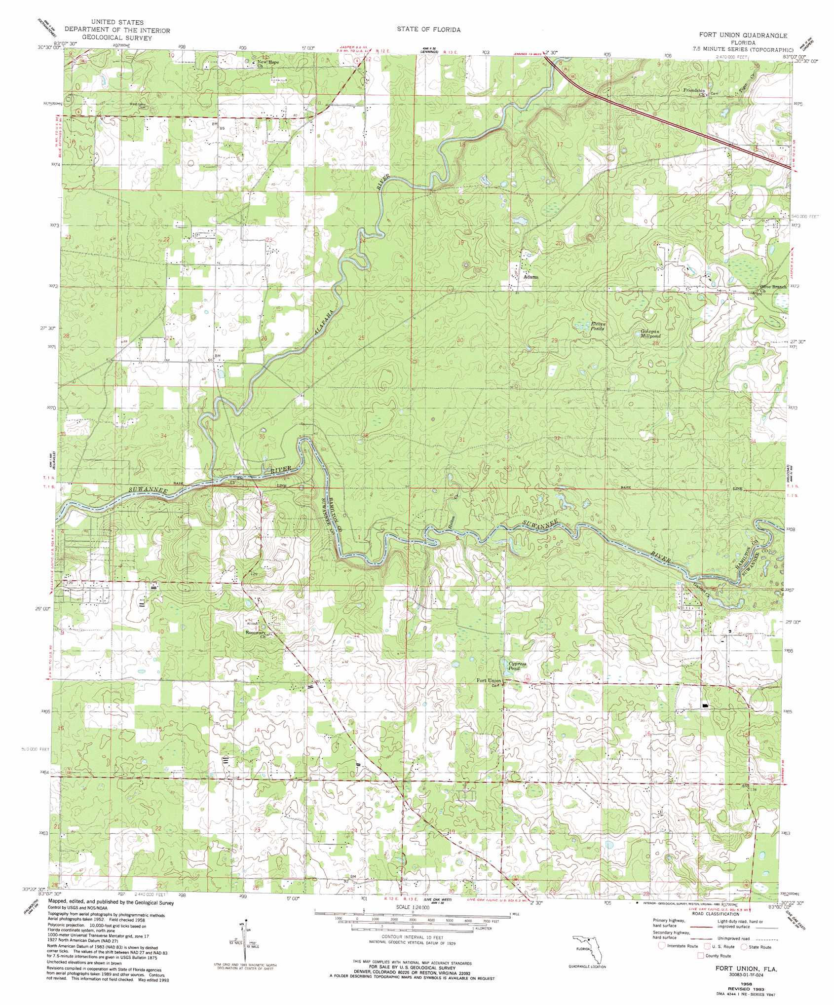
USGS Topo Quad 30083d1 - 1:24,000 scale
| Topo Map Name: | Fort Union |
| USGS Topo Quad ID: | 30083d1 |
| Print Size: | ca. 21 1/4" wide x 27" high |
| Southeast Coordinates: | 30.375° N latitude / 83° W longitude |
| Map Center Coordinates: | 30.4375° N latitude / 83.0625° W longitude |
| U.S. State: | FL |
| Filename: | O30083D1.jpg |
| Download Map JPG Image: | Fort Union topo map 1:24,000 scale |
| Map Type: | Topographic |
| Topo Series: | 7.5´ |
| Map Scale: | 1:24,000 |
| Source of Map Images: | United States Geological Survey (USGS) |
| Alternate Map Versions: |
Fort Union FL 1958, updated 1959 Download PDF Buy paper map Fort Union FL 1958, updated 1977 Download PDF Buy paper map Fort Union FL 1958, updated 1993 Download PDF Buy paper map Fort Union FL 2012 Download PDF Buy paper map Fort Union FL 2015 Download PDF Buy paper map |
1:24,000 Topo Quads surrounding Fort Union
Clyattville |
Lake Park |
Statenville |
Tarver |
Pineland |
Pinetta |
Octahatchee |
Jennings |
Jasper |
Cypress Creek |
Lee |
Ellaville |
Fort Union |
Hillcoat |
Genoa |
Madison Se |
Falmouth |
Live Oak West |
Live Oak East |
White Springs West |
Day |
Dowling Park |
Mayo Ne |
Mcalpin |
Wellborn |
> Back to 30083a1 at 1:100,000 scale
> Back to 30082a1 at 1:250,000 scale
> Back to U.S. Topo Maps home
Fort Union topo map: Gazetteer
Fort Union: Airports
Florida Sheriffs Boys Ranch Airport elevation 26m 85′Pittman Oaks Airport elevation 30m 98′
Fort Union: Lakes
Cypress Pond elevation 33m 108′Eleven Ponds elevation 30m 98′
Gohegan Millpond elevation 30m 98′
Fort Union: Parks
Gibson County Park elevation 15m 49′Fort Union: Populated Places
Adams elevation 25m 82′Fort Union elevation 34m 111′
Fort Union: Streams
Alapaha River elevation 9m 29′Guinea Creek elevation 11m 36′
Holton Creek elevation 9m 29′
Tiger Creek elevation 20m 65′
Fort Union digital topo map on disk
Buy this Fort Union topo map showing relief, roads, GPS coordinates and other geographical features, as a high-resolution digital map file on DVD: