Lee Topo Map Florida
To zoom in, hover over the map of Lee
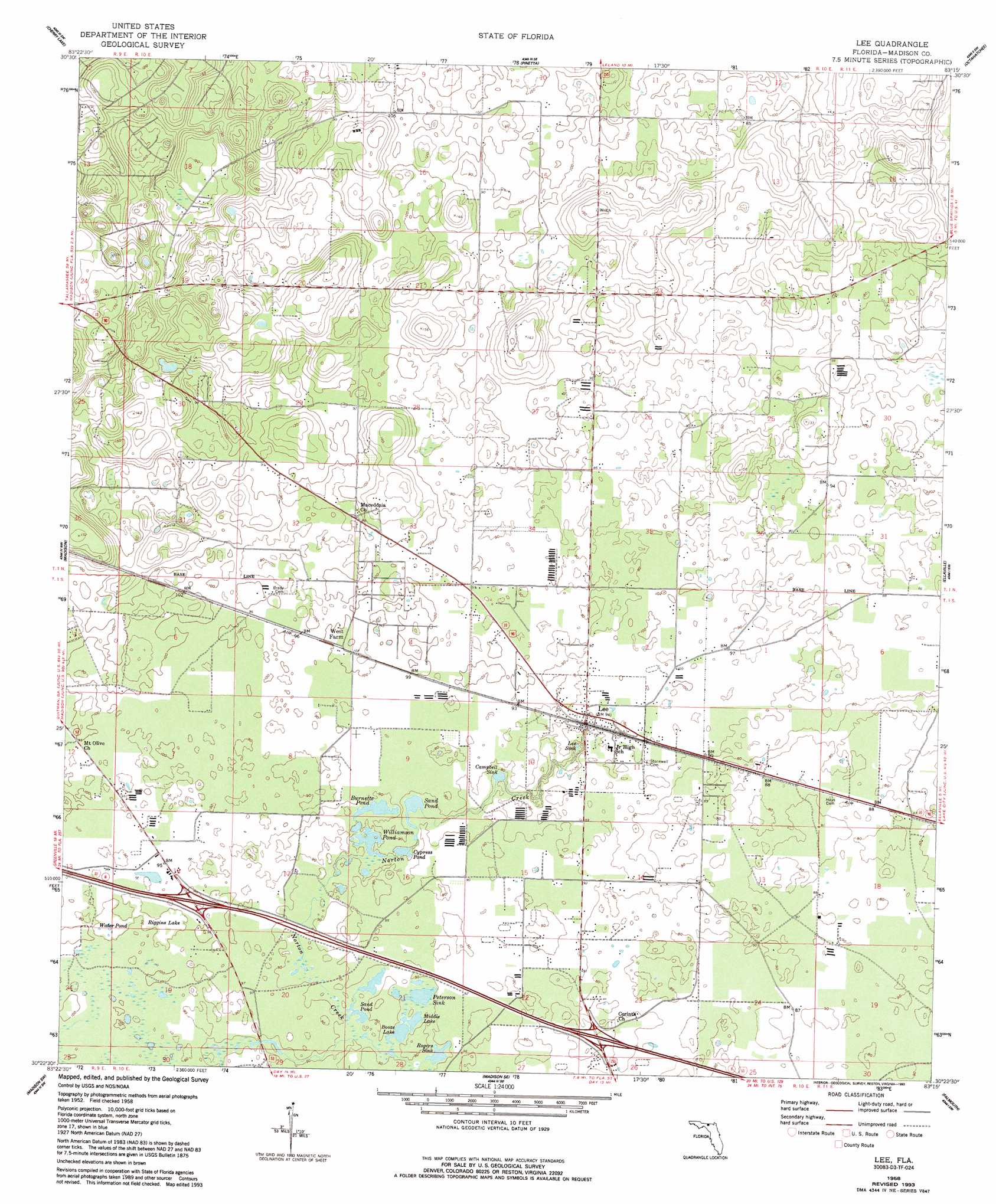
USGS Topo Quad 30083d3 - 1:24,000 scale
| Topo Map Name: | Lee |
| USGS Topo Quad ID: | 30083d3 |
| Print Size: | ca. 21 1/4" wide x 27" high |
| Southeast Coordinates: | 30.375° N latitude / 83.25° W longitude |
| Map Center Coordinates: | 30.4375° N latitude / 83.3125° W longitude |
| U.S. State: | FL |
| Filename: | O30083D3.jpg |
| Download Map JPG Image: | Lee topo map 1:24,000 scale |
| Map Type: | Topographic |
| Topo Series: | 7.5´ |
| Map Scale: | 1:24,000 |
| Source of Map Images: | United States Geological Survey (USGS) |
| Alternate Map Versions: |
Lee FL 1958, updated 1960 Download PDF Buy paper map Lee FL 1958, updated 1971 Download PDF Buy paper map Lee FL 1958, updated 1993 Download PDF Buy paper map Lee FL 2012 Download PDF Buy paper map Lee FL 2015 Download PDF Buy paper map |
1:24,000 Topo Quads surrounding Lee
Baden |
Nankin |
Clyattville |
Lake Park |
Statenville |
Hamburg |
Cherry Lake |
Pinetta |
Octahatchee |
Jennings |
Greenville Ne |
Madison |
Lee |
Ellaville |
Fort Union |
Greenville Se |
Madison Sw |
Madison Se |
Falmouth |
Live Oak West |
Boyd |
Day Nw |
Day |
Dowling Park |
Mayo Ne |
> Back to 30083a1 at 1:100,000 scale
> Back to 30082a1 at 1:250,000 scale
> Back to U.S. Topo Maps home
Lee topo map: Gazetteer
Lee: Airports
Flying G Ranch Stolport elevation 27m 88′Madison County Airport elevation 27m 88′
Lee: Basins
Campbell Sink elevation 24m 78′Lee Sink elevation 16m 52′
Peterson Sink elevation 26m 85′
Rogers Sink elevation 26m 85′
Lee: Lakes
Booze Lake elevation 26m 85′Burnette Pond elevation 24m 78′
Cypress Pond elevation 24m 78′
Middle Lake elevation 26m 85′
Peterson Sink Pond elevation 26m 85′
Riggins Lake elevation 27m 88′
Sand Pond elevation 26m 85′
Sand Pond elevation 26m 85′
Water Pond elevation 27m 88′
Williamson Pond elevation 23m 75′
Lee: Populated Places
Lee elevation 27m 88′Lee: Streams
Norton Creek elevation 16m 52′Lee digital topo map on disk
Buy this Lee topo map showing relief, roads, GPS coordinates and other geographical features, as a high-resolution digital map file on DVD: