Lamont Topo Map Florida
To zoom in, hover over the map of Lamont
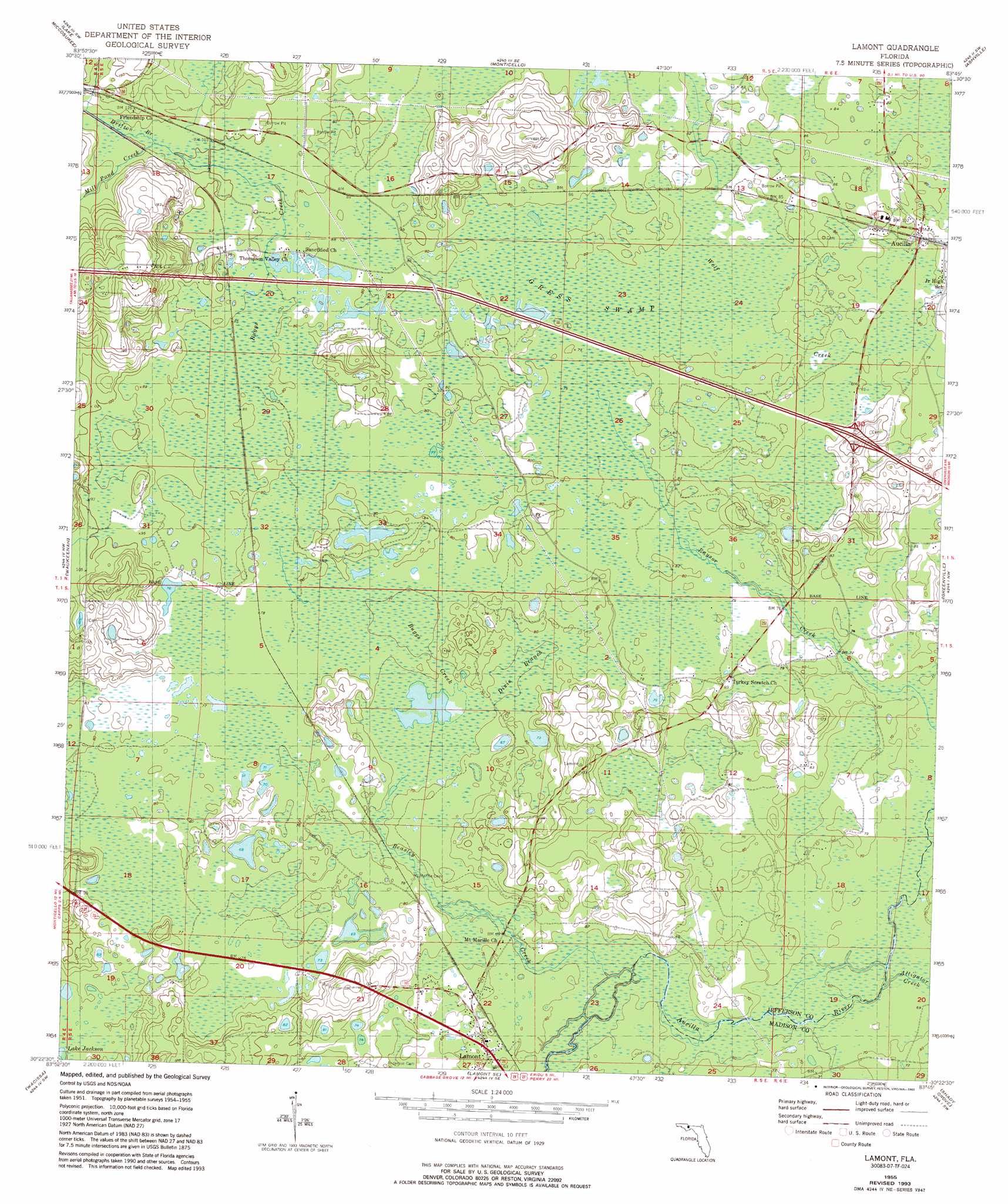
USGS Topo Quad 30083d7 - 1:24,000 scale
| Topo Map Name: | Lamont |
| USGS Topo Quad ID: | 30083d7 |
| Print Size: | ca. 21 1/4" wide x 27" high |
| Southeast Coordinates: | 30.375° N latitude / 83.75° W longitude |
| Map Center Coordinates: | 30.4375° N latitude / 83.8125° W longitude |
| U.S. State: | FL |
| Filename: | O30083D7.jpg |
| Download Map JPG Image: | Lamont topo map 1:24,000 scale |
| Map Type: | Topographic |
| Topo Series: | 7.5´ |
| Map Scale: | 1:24,000 |
| Source of Map Images: | United States Geological Survey (USGS) |
| Alternate Map Versions: |
Lamont FL 1955, updated 1956 Download PDF Buy paper map Lamont FL 1955, updated 1975 Download PDF Buy paper map Lamont FL 1955, updated 1993 Download PDF Buy paper map Lamont FL 2012 Download PDF Buy paper map Lamont FL 2015 Download PDF Buy paper map |
1:24,000 Topo Quads surrounding Lamont
Miccosukee Ne |
Metcalf |
Monticello Ne |
Grooverville |
Baden |
Miccosukee |
Lake Miccosukee |
Monticello |
Ashville |
Hamburg |
Lloyd |
Waukeenah |
Lamont |
Greenville |
Greenville Ne |
Cody |
Wacissa |
Lamont Se |
Shady Grove |
Greenville Se |
Saint Marks Ne |
Nutall Rise |
Johnson Hammock |
Secotan |
Boyd |
> Back to 30083a1 at 1:100,000 scale
> Back to 30082a1 at 1:250,000 scale
> Back to U.S. Topo Maps home
Lamont topo map: Gazetteer
Lamont: Lakes
Lake Jackson elevation 21m 68′Lamont: Populated Places
Aucilla elevation 24m 78′Aucilla (historical) elevation 24m 78′
Lamont elevation 20m 65′
Lamont: Streams
Alligator Creek elevation 18m 59′Beasley Creek elevation 15m 49′
Buggs Creek elevation 21m 68′
Dixie Branch elevation 21m 68′
Drifton Branch elevation 33m 108′
Mill Pond Creek elevation 33m 108′
Lamont: Swamps
Gress Swamp elevation 24m 78′Lamont digital topo map on disk
Buy this Lamont topo map showing relief, roads, GPS coordinates and other geographical features, as a high-resolution digital map file on DVD: